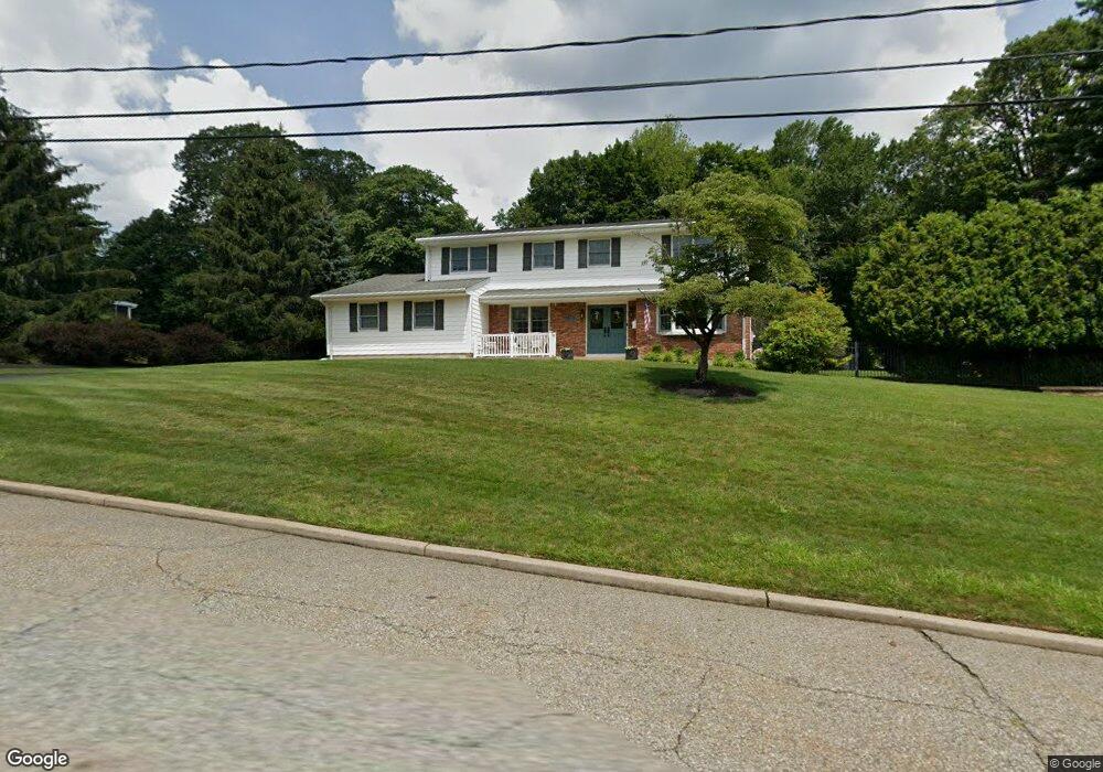
23 Mouacdie Dr Pearl River, NY 10965
Estimated Value: $575,112 - $957,000
5
Beds
3
Baths
2,984
Sq Ft
$279/Sq Ft
Est. Value
About This Home
This home is located at 23 Mouacdie Dr, Pearl River, NY 10965 and is currently estimated at $833,528, approximately $279 per square foot. 23 Mouacdie Dr is a home located in Rockland County with nearby schools including Fleetwood Elementary School, Chestnut Ridge Middle School, and Spring Valley High School.
Ownership History
Date
Name
Owned For
Owner Type
Purchase Details
Closed on
Jul 7, 2016
Sold by
Kendall Jeffrey and Kendall Theresa
Bought by
Shaut Anthony and Mccormick Kathleen
Current Estimated Value
Home Financials for this Owner
Home Financials are based on the most recent Mortgage that was taken out on this home.
Original Mortgage
$495,000
Outstanding Balance
$395,414
Interest Rate
3.6%
Mortgage Type
New Conventional
Estimated Equity
$438,114
Create a Home Valuation Report for This Property
The Home Valuation Report is an in-depth analysis detailing your home's value as well as a comparison with similar homes in the area
Home Values in the Area
Average Home Value in this Area
Purchase History
| Date | Buyer | Sale Price | Title Company |
|---|---|---|---|
| Shaut Anthony | $550,000 | Attorney |
Source: Public Records
Mortgage History
| Date | Status | Borrower | Loan Amount |
|---|---|---|---|
| Open | Shaut Anthony | $495,000 |
Source: Public Records
Tax History Compared to Growth
Tax History
| Year | Tax Paid | Tax Assessment Tax Assessment Total Assessment is a certain percentage of the fair market value that is determined by local assessors to be the total taxable value of land and additions on the property. | Land | Improvement |
|---|---|---|---|---|
| 2024 | $16,386 | $67,900 | $16,900 | $51,000 |
| 2023 | $16,386 | $67,900 | $16,900 | $51,000 |
| 2022 | $15,235 | $67,900 | $16,900 | $51,000 |
| 2021 | $15,160 | $67,900 | $16,900 | $51,000 |
| 2020 | $16,212 | $67,900 | $16,900 | $51,000 |
| 2019 | $16,299 | $67,900 | $16,900 | $51,000 |
| 2018 | $16,299 | $67,900 | $16,900 | $51,000 |
| 2017 | $16,117 | $67,900 | $16,900 | $51,000 |
| 2016 | $14,980 | $67,900 | $16,900 | $51,000 |
| 2015 | -- | $67,900 | $16,900 | $51,000 |
| 2014 | -- | $67,900 | $16,900 | $51,000 |
Source: Public Records
Map
Nearby Homes
- 160 Pascack Rd
- 168 N Lincoln St
- 85 Lieutenant Cox Dr
- 19 Paul Ct
- 96 Old Pascack Rd
- 39 Graney Ct
- 217 W Washington Ave
- 38 Van Buren St
- 60 Van Buren St
- 8 Ronwood Rd
- 13 Lomond Ave
- 73 Bogert Ave
- 49 North Ave
- 6 Fairmont Ave
- 86 Braunsdorf Rd
- 74 S William St
- 85 Grand Ave
- 165 Forest Ave
- 460 E Crooked Hill Rd Unit 460
- 4 Nicole Way
- 15 Mouacdie Dr
- 31 Mouacdie Dr
- 276 W Crooked Hill Rd
- 14 Pella Ct
- 38 Pella Ct
- 39 Mouacdie Dr
- 175 S Highland Ave
- 239 Center St
- 34 Mouacdie Dr
- 247 Center St
- 280 W Crooked Hill Rd
- 270 W Crooked Hill Rd
- 225 Center St
- 30 Pella Ct
- 255 Center St
- 22 Pella Ct
- 181 S Highland Ave
- 217 Center St
- 262 W Crooked Hill Rd
- 157 S Highland Ave