Estimated Value: $93,000 - $334,000
3
Beds
1
Bath
1,056
Sq Ft
$243/Sq Ft
Est. Value
About This Home
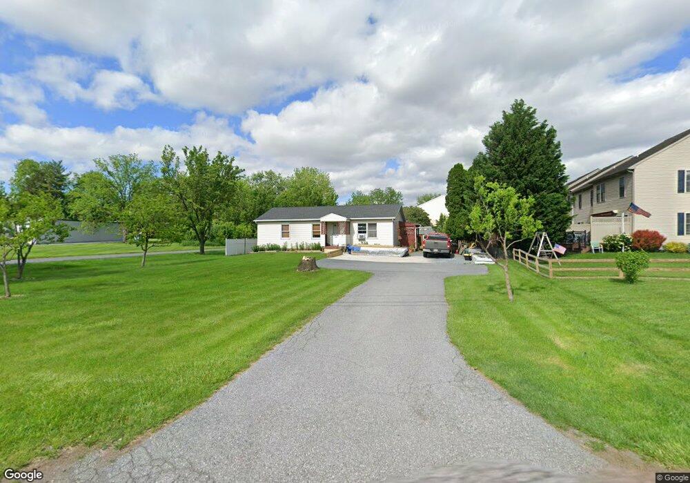
This home is located at 23 Newport Rd, Leola, PA 17540 and is currently estimated at $256,590, approximately $242 per square foot. 23 Newport Rd is a home located in Lancaster County with nearby schools including Leola Elementary School, Gerald G. Huesken Middle School, and Conestoga Valley High School.
Ownership History
Date
Name
Owned For
Owner Type
Purchase Details
Closed on
Mar 19, 2008
Sold by
Hoover John E and Hoover Sothea V
Bought by
Vong Sotheavy
Current Estimated Value
Home Financials for this Owner
Home Financials are based on the most recent Mortgage that was taken out on this home.
Original Mortgage
$157,731
Outstanding Balance
$98,317
Interest Rate
5.75%
Mortgage Type
Purchase Money Mortgage
Estimated Equity
$158,273
Purchase Details
Closed on
Aug 19, 1998
Sold by
Mumma James L and Mcnamara Susan E
Bought by
Hoover John E and Hoover Sothea V
Home Financials for this Owner
Home Financials are based on the most recent Mortgage that was taken out on this home.
Original Mortgage
$97,934
Interest Rate
6.86%
Mortgage Type
FHA
Create a Home Valuation Report for This Property
The Home Valuation Report is an in-depth analysis detailing your home's value as well as a comparison with similar homes in the area
Home Values in the Area
Average Home Value in this Area
Purchase History
| Date | Buyer | Sale Price | Title Company |
|---|---|---|---|
| Vong Sotheavy | $159,000 | None Available | |
| Hoover John E | $98,500 | -- |
Source: Public Records
Mortgage History
| Date | Status | Borrower | Loan Amount |
|---|---|---|---|
| Open | Vong Sotheavy | $157,731 | |
| Closed | Hoover John E | $97,934 |
Source: Public Records
Tax History Compared to Growth
Tax History
| Year | Tax Paid | Tax Assessment Tax Assessment Total Assessment is a certain percentage of the fair market value that is determined by local assessors to be the total taxable value of land and additions on the property. | Land | Improvement |
|---|---|---|---|---|
| 2025 | $2,144 | $107,300 | $55,900 | $51,400 |
| 2024 | $2,144 | $107,300 | $55,900 | $51,400 |
| 2023 | $2,100 | $107,300 | $55,900 | $51,400 |
| 2022 | $2,047 | $107,300 | $55,900 | $51,400 |
| 2021 | $1,974 | $107,300 | $55,900 | $51,400 |
| 2020 | $1,974 | $107,300 | $55,900 | $51,400 |
| 2019 | $1,931 | $107,300 | $55,900 | $51,400 |
| 2018 | $2,682 | $107,300 | $55,900 | $51,400 |
| 2017 | $2,266 | $104,600 | $41,400 | $63,200 |
| 2016 | $2,234 | $104,600 | $41,400 | $63,200 |
| 2015 | $569 | $104,600 | $41,400 | $63,200 |
| 2014 | $1,456 | $104,600 | $41,400 | $63,200 |
Source: Public Records
Map
Nearby Homes
- 68 Horseshoe Rd
- 39 N Maple Ave
- 71 Apricot Ave
- 259 Raspberry Rd
- 70 Hellers Church Rd
- 130 Snapdragon Dr
- 248 E Main St
- 425 Mill Creek Rd
- 2234 Coach Light Ln
- 466 E Main St
- 103 Fairhill Dr
- 456 Brendon Dr
- 2221 Brentford St
- 205 E Main St
- Charleston Plan at Devon Creek - Terraces
- Wyndham Plan at Devon Creek - Cottages
- Preston Plan at Devon Creek - Cottages
- Livingston Plan at Devon Creek - Cottages
- 50 Allen Rd
- 70 Millstone Dr