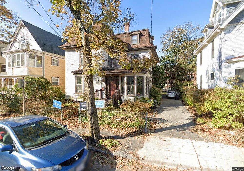
23 Norris St Cambridge, MA 02140
North Cambridge NeighborhoodEstimated Value: $1,878,000 - $3,391,000
6
Beds
4
Baths
3,358
Sq Ft
$793/Sq Ft
Est. Value
About This Home
This home is located at 23 Norris St, Cambridge, MA 02140 and is currently estimated at $2,662,434, approximately $792 per square foot. 23 Norris St is a home located in Middlesex County with nearby schools including Benjamin Banneker Charter Public School, International School of Boston, and Cambridge Friends School.
Ownership History
Date
Name
Owned For
Owner Type
Purchase Details
Closed on
Jul 1, 1987
Sold by
Rst Daniel Cherneff
Bought by
Bass David H
Current Estimated Value
Home Financials for this Owner
Home Financials are based on the most recent Mortgage that was taken out on this home.
Original Mortgage
$264,750
Interest Rate
10.76%
Mortgage Type
Purchase Money Mortgage
Create a Home Valuation Report for This Property
The Home Valuation Report is an in-depth analysis detailing your home's value as well as a comparison with similar homes in the area
Home Values in the Area
Average Home Value in this Area
Purchase History
| Date | Buyer | Sale Price | Title Company |
|---|---|---|---|
| Bass David H | $353,000 | -- |
Source: Public Records
Mortgage History
| Date | Status | Borrower | Loan Amount |
|---|---|---|---|
| Open | Bass David H | $330,000 | |
| Closed | Bass David H | $202,000 | |
| Closed | Bass David H | $264,750 |
Source: Public Records
Tax History
| Year | Tax Paid | Tax Assessment Tax Assessment Total Assessment is a certain percentage of the fair market value that is determined by local assessors to be the total taxable value of land and additions on the property. | Land | Improvement |
|---|---|---|---|---|
| 2025 | $16,057 | $2,528,700 | $754,400 | $1,774,300 |
| 2024 | $14,719 | $2,486,400 | $788,100 | $1,698,300 |
| 2023 | $13,305 | $2,270,400 | $802,500 | $1,467,900 |
| 2022 | $12,166 | $2,055,000 | $756,400 | $1,298,600 |
| 2021 | $11,393 | $1,947,600 | $741,000 | $1,206,600 |
| 2020 | $10,738 | $1,867,400 | $724,600 | $1,142,800 |
| 2019 | $9,843 | $1,657,000 | $602,400 | $1,054,600 |
| 2018 | $9,517 | $1,513,000 | $507,300 | $1,005,700 |
| 2017 | $8,381 | $1,291,300 | $475,600 | $815,700 |
| 2016 | $8,155 | $1,166,700 | $412,200 | $754,500 |
| 2015 | $8,102 | $1,036,100 | $362,400 | $673,700 |
| 2014 | $8,225 | $981,500 | $317,000 | $664,500 |
Source: Public Records
Map
Nearby Homes
- 69 Harvey St Unit 1
- 97 Elmwood St Unit 313
- 97 Elmwood St Unit 110
- 97 Elmwood St Unit 310
- 9-11 Edmunds St
- 2 Gold Star Ct
- 5 Glendale Ave Unit 5
- 127 Harvey St
- 108 Clay St
- 38 Brookford St Unit 2
- 34 Elmwood St Unit 2
- 124 Jackson St
- 49 Clifton St
- 17 Holland St Unit 301
- 151 Sherman St
- 151 Sherman St Unit 151
- 3 Warwick Park Unit 2
- 30 Clarendon Ave
- 7 Russell St Unit 1
- 11 Cogswell Ave Unit 15
- 27 Norris St
- 27 Norris St Unit 5
- 29 Norris St Unit 29
- 17 Norris St
- 33 Norris St
- 33 Norris St Unit 2
- 13 Norris St
- 35 Norris St
- 35 Norris St Unit 2
- 39 Cedar Square Unit 1
- 20 Dudley St
- 20 Dudley St Unit 3
- 22 Dudley St
- 22 Dudley St Unit 3
- 22 Dudley St Unit 2
- 18 Dudley St
- 18 Dudley St Unit 3
- 18 Dudley St Unit 2
- 18 Dudley St Unit 1
- 18 Dudley St
Your Personal Tour Guide
Ask me questions while you tour the home.