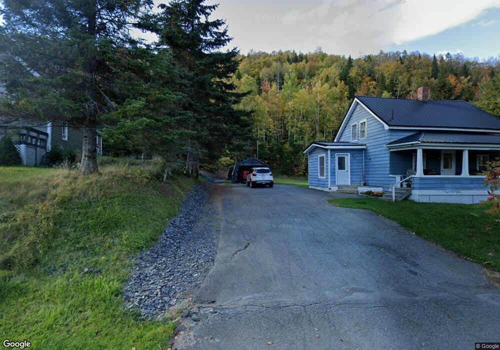
23 Paradis Cir Fort Kent, ME 04743
Estimated Value: $119,375 - $167,000
--
Bed
--
Bath
--
Sq Ft
--
Built
About This Home
This home is located at 23 Paradis Cir, Fort Kent, ME 04743 and is currently estimated at $144,458. 23 Paradis Cir is a home with nearby schools including Fort Kent Elementary School and Valley Rivers Middle School.
Ownership History
Date
Name
Owned For
Owner Type
Purchase Details
Closed on
Jun 17, 2022
Sold by
Beaulieu Daniel
Bought by
Brann Austin and Pinette Kayle
Current Estimated Value
Home Financials for this Owner
Home Financials are based on the most recent Mortgage that was taken out on this home.
Original Mortgage
$99,000
Outstanding Balance
$94,199
Interest Rate
5.27%
Mortgage Type
Purchase Money Mortgage
Estimated Equity
$50,259
Purchase Details
Closed on
Jul 17, 2015
Sold by
Sylvain Reno J
Bought by
Beaulieu Daniel
Home Financials for this Owner
Home Financials are based on the most recent Mortgage that was taken out on this home.
Original Mortgage
$81,600
Interest Rate
4%
Mortgage Type
Commercial
Create a Home Valuation Report for This Property
The Home Valuation Report is an in-depth analysis detailing your home's value as well as a comparison with similar homes in the area
Home Values in the Area
Average Home Value in this Area
Purchase History
| Date | Buyer | Sale Price | Title Company |
|---|---|---|---|
| Brann Austin | -- | None Available | |
| Beaulieu Daniel | -- | -- |
Source: Public Records
Mortgage History
| Date | Status | Borrower | Loan Amount |
|---|---|---|---|
| Open | Brann Austin | $99,000 | |
| Previous Owner | Beaulieu Daniel | $81,600 |
Source: Public Records
Tax History Compared to Growth
Tax History
| Year | Tax Paid | Tax Assessment Tax Assessment Total Assessment is a certain percentage of the fair market value that is determined by local assessors to be the total taxable value of land and additions on the property. | Land | Improvement |
|---|---|---|---|---|
| 2024 | $1,558 | $67,900 | $12,400 | $55,500 |
| 2023 | $1,426 | $67,900 | $12,400 | $55,500 |
| 2022 | $1,334 | $63,500 | $11,600 | $51,900 |
| 2021 | $1,339 | $63,500 | $11,600 | $51,900 |
| 2020 | $1,322 | $57,800 | $10,600 | $47,200 |
| 2019 | $1,292 | $57,800 | $10,600 | $47,200 |
| 2018 | $1,179 | $57,800 | $10,600 | $47,200 |
| 2017 | $1,063 | $57,800 | $10,600 | $47,200 |
| 2016 | $1,040 | $57,800 | $10,600 | $47,200 |
| 2013 | $1,003 | $57,800 | $10,600 | $47,200 |
Source: Public Records
Map
Nearby Homes
- 5 Paradis Cir
- 0 Clover Ave Unit 1591925
- 120 Bradbury Rd
- 175 Bradbury Rd
- 145 Village Rd
- 26 S Perley Brook Rd
- 176 Market St
- 97 Third Ave
- 68 Second Ave
- 72 Third Ave
- 41 1st
- 188 S Perley Brook Rd
- 73 N Perley Brook Rd
- 10 Dow St
- 116 S Perley Brook Rd
- 30 Elm St
- 315 W Main St
- 217 S South Perley Brook Rd
- 57 Market St
- 21 Market St
- 19 Paradis Cir
- 21 Paradis Cir
- 15 Paradis Cir
- 331 Aroostook Rd
- 34 Paradis Cir
- 342 Aroostook Rd
- 332 Aroostook Rd
- 364 Aroostook Rd
- 51 Paradis Cir
- 1 Map1lot149 Rd
- Map2c Lot111c
- 370 Aroostook Rd
- 0 Clover Ave Unit 1559755
- 0 Clover Ave Unit 1425641
- 0 Clover Ave Unit 1528870
- 0 Clover Ave Unit 1482140
- 372 Aroostook Rd
- 376 Aroostook Rd
- 379 Aroostook Rd
- 384 Aroostook Rd