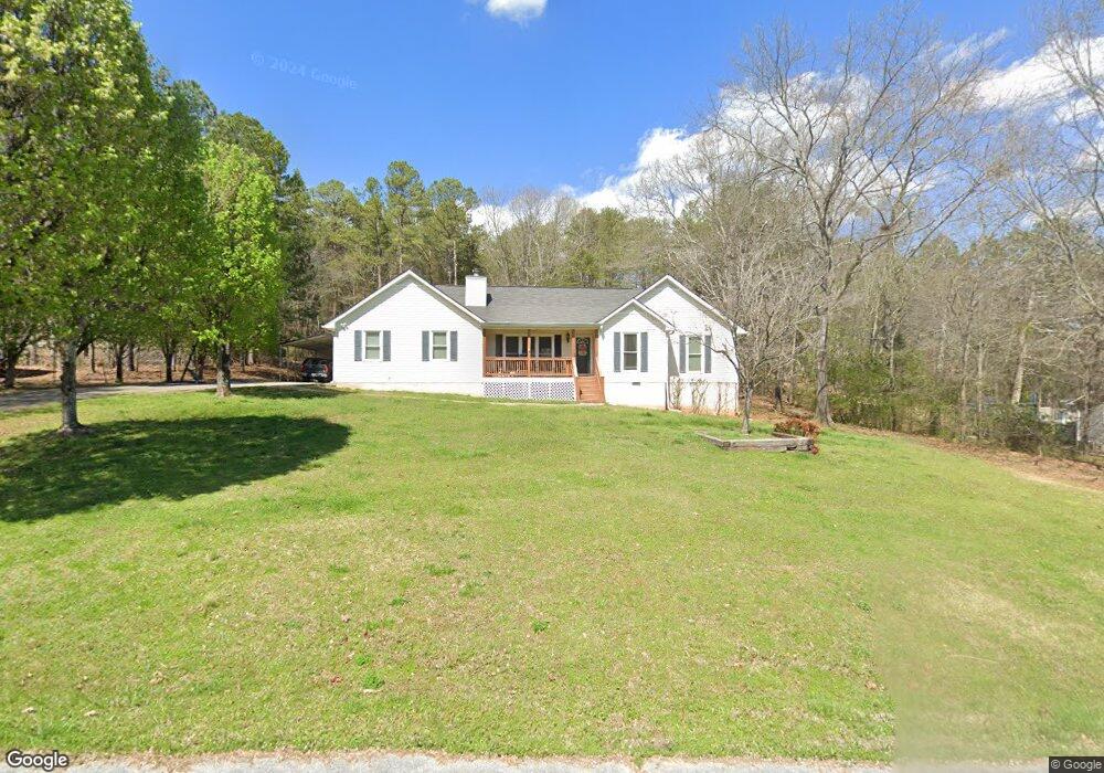
23 Paula Ct Cedartown, GA 30125
Estimated Value: $272,000 - $298,000
3
Beds
2
Baths
1,526
Sq Ft
$183/Sq Ft
Est. Value
About This Home
This home is located at 23 Paula Ct, Cedartown, GA 30125 and is currently estimated at $279,548, approximately $183 per square foot. 23 Paula Ct is a home located in Polk County.
Ownership History
Date
Name
Owned For
Owner Type
Purchase Details
Closed on
Nov 24, 2004
Sold by
Garner Joey D
Bought by
Tracy Jimmy T and Diane L*
Current Estimated Value
Purchase Details
Closed on
Oct 19, 2001
Sold by
Rice Linda Marie
Bought by
Rice Michael Edward A and Rice K
Purchase Details
Closed on
Oct 17, 2001
Sold by
Smith Michael
Bought by
Garner Joey D
Purchase Details
Closed on
May 17, 1997
Sold by
Montgomery Thomas L
Bought by
Rice Michael E and Rice Linda M
Purchase Details
Closed on
Jan 31, 1997
Sold by
Liverant Jacob
Bought by
Montgomery Thomas L
Purchase Details
Closed on
Apr 14, 1995
Sold by
Igel Stanley
Bought by
Igel Stanley Living Trust (Stanley Igel
Purchase Details
Closed on
Oct 30, 1973
Sold by
Adams Charles W
Bought by
Igel Stanley
Create a Home Valuation Report for This Property
The Home Valuation Report is an in-depth analysis detailing your home's value as well as a comparison with similar homes in the area
Purchase History
| Date | Buyer | Sale Price | Title Company |
|---|---|---|---|
| Tracy Jimmy T | $105,000 | -- | |
| Rice Michael Edward A | -- | -- | |
| Garner Joey D | $98,200 | -- | |
| Rice Michael E | $11,500 | -- | |
| Montgomery Thomas L | $6,300 | -- | |
| Igel Stanley Living Trust (Stanley Igel | -- | -- | |
| Igel Stanley | -- | -- |
Source: Public Records
Tax History
| Year | Tax Paid | Tax Assessment Tax Assessment Total Assessment is a certain percentage of the fair market value that is determined by local assessors to be the total taxable value of land and additions on the property. | Land | Improvement |
|---|---|---|---|---|
| 2025 | $2,365 | $107,114 | $15,200 | $91,914 |
| 2024 | $2,214 | $107,914 | $16,000 | $91,914 |
| 2023 | $1,751 | $75,786 | $16,000 | $59,786 |
| 2022 | $1,275 | $55,722 | $4,000 | $51,722 |
| 2021 | $1,291 | $55,722 | $4,000 | $51,722 |
| 2020 | $1,294 | $55,722 | $4,000 | $51,722 |
| 2019 | $1,300 | $50,412 | $4,000 | $46,412 |
| 2018 | $1,262 | $47,791 | $4,000 | $43,791 |
| 2017 | $1,246 | $47,791 | $4,000 | $43,791 |
| 2016 | $1,246 | $47,791 | $4,000 | $43,791 |
| 2015 | $1,257 | $48,046 | $4,000 | $44,046 |
| 2014 | $1,194 | $45,434 | $4,022 | $41,412 |
Source: Public Records
Map
Nearby Homes
- 612 Michael Blvd
- 354 Michael Blvd
- 387 Michael Blvd
- 425 Chubbtown Rd
- 914 Chubbtown Rd
- 0 Cave Spring Rd Unit 10631588
- 0 Cave Spring Rd Unit 7671027
- 0 Santa Claus Rd Unit 7706526
- 0 Santa Claus Rd Unit 10676218
- 75 Weaver Rd
- 727 Cherokee Rd
- 217 Cherokee Cir
- 39 Summerwind Dr
- 8 Stonegate Dr
- LOT 21 Cherokee Cir
- 8 Sequoyah Ct
- 621 N College Dr
- 620 N College Dr
- 616 N College Dr
- 413 N College Dr
- 41 Paula Ct
- 21 Paula Ct
- 519 Michael Blvd
- 24 Paula Ct
- 491 Michael Blvd
- 40 Paula Ct
- 403 Michael Blvd
- 591 Michael Blvd
- 401 Michael Blvd
- 421 Michael Blvd
- 391 Michael Blvd
- 480 Michael Blvd
- 476 Michael Blvd
- 0 Michael Blvd
- 0 Michael Blvd Unit 7554775
- 0 Michael Blvd Unit 7452611
- 0 Michael Blvd Unit 8667105
- 522 Michael Blvd
- 412 Michael Blvd
- 623 Michael Blvd
Your Personal Tour Guide
Ask me questions while you tour the home.