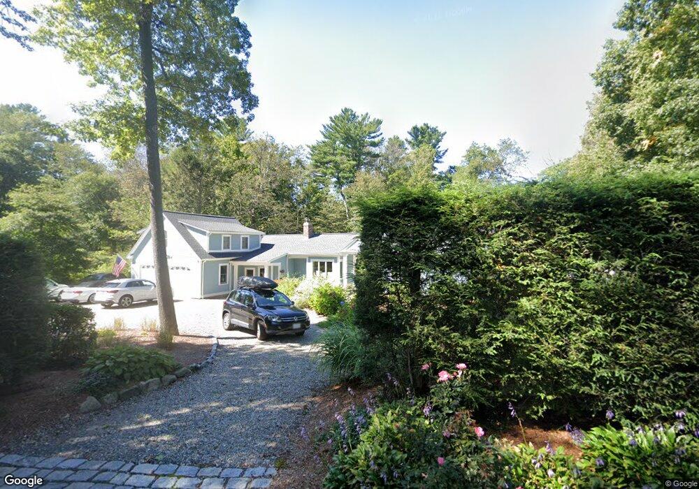
23 Schofield Rd Cohasset, MA 02025
Estimated Value: $1,175,000 - $1,636,000
4
Beds
3
Baths
3,483
Sq Ft
$392/Sq Ft
Est. Value
About This Home
This home is located at 23 Schofield Rd, Cohasset, MA 02025 and is currently estimated at $1,366,068, approximately $392 per square foot. 23 Schofield Rd is a home located in Norfolk County with nearby schools including Joseph Osgood School, Deer Hill School, and Cohasset Middle School.
Ownership History
Date
Name
Owned For
Owner Type
Purchase Details
Closed on
Sep 25, 2020
Sold by
Dunn Maura and Dunn John T
Bought by
Maura Dunn T and Maura Dunn
Current Estimated Value
Purchase Details
Closed on
Apr 12, 1989
Sold by
Anderson Peter
Bought by
Dunn John T
Create a Home Valuation Report for This Property
The Home Valuation Report is an in-depth analysis detailing your home's value as well as a comparison with similar homes in the area
Home Values in the Area
Average Home Value in this Area
Purchase History
| Date | Buyer | Sale Price | Title Company |
|---|---|---|---|
| Maura Dunn T | -- | None Available | |
| Maura Dunn T | -- | None Available | |
| Dunn John T | $215,000 | -- | |
| Dunn John T | $215,000 | -- |
Source: Public Records
Mortgage History
| Date | Status | Borrower | Loan Amount |
|---|---|---|---|
| Previous Owner | Dunn John T | $417,000 | |
| Previous Owner | Dunn John T | $159,000 | |
| Previous Owner | Dunn John T | $171,513 |
Source: Public Records
Tax History Compared to Growth
Tax History
| Year | Tax Paid | Tax Assessment Tax Assessment Total Assessment is a certain percentage of the fair market value that is determined by local assessors to be the total taxable value of land and additions on the property. | Land | Improvement |
|---|---|---|---|---|
| 2025 | $10,021 | $865,400 | $350,000 | $515,400 |
| 2024 | $9,955 | $818,000 | $291,600 | $526,400 |
| 2023 | $9,310 | $789,000 | $280,400 | $508,600 |
| 2022 | $9,431 | $750,900 | $280,400 | $470,500 |
| 2021 | $8,985 | $689,000 | $221,500 | $467,500 |
| 2020 | $8,936 | $689,000 | $221,500 | $467,500 |
| 2019 | $8,442 | $654,400 | $221,500 | $432,900 |
| 2018 | $8,370 | $654,400 | $221,500 | $432,900 |
| 2017 | $8,200 | $627,900 | $201,300 | $426,600 |
| 2016 | $8,087 | $627,900 | $201,300 | $426,600 |
| 2015 | $7,981 | $627,900 | $201,300 | $426,600 |
| 2014 | $7,874 | $627,900 | $201,300 | $426,600 |
Source: Public Records
Map
Nearby Homes
- 46 Pond St
- 100 Pond St Unit 10
- 40 Brewster Rd
- 73 Pond St
- 40 Pond St
- 78 Old Pasture Rd
- 309 S Main St
- 26 Ash St
- 119 Pleasant St
- 31 Chittenden Ln Unit 31
- 392 S Main St
- 212 S Main St
- 15 Cushing Rd
- 817 Country Way
- 99 Doane St
- 98 Black Horse Ln
- 68 Black Horse Ln
- 89 Ripley Rd
- 70 Black Horse Ln
- 508 Beechwood St
- 31 Schofield Rd
- 11 Schofield Rd
- 20 Schofield Rd
- 440 King St
- 30 Schofield Rd
- 12 Schofield Rd
- 35 Schofield Rd
- 6 Schofield Rd
- 671 Chief Justice Cushing Hwy
- 5 Schofield Rd
- 36 Schofield Rd
- 450 King St
- 434 King St
- 8 Kendall Village
- 444 King St
- 7 Kendall Village
- 682 Chief Justice Cushing Hwy
- 430 King St
- 474 King St Unit 474
- 470 King St