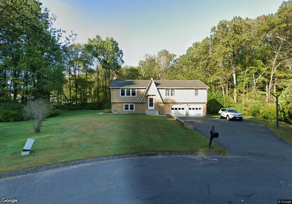
23 Shamrock Cir Windsor, CT 06095
Hayden NeighborhoodEstimated Value: $361,000 - $414,000
3
Beds
3
Baths
1,294
Sq Ft
$300/Sq Ft
Est. Value
About This Home
This home is located at 23 Shamrock Cir, Windsor, CT 06095 and is currently estimated at $388,658, approximately $300 per square foot. 23 Shamrock Cir is a home located in Hartford County with nearby schools including Oliver Ellsworth School, John F. Kennedy School, and Sage Park Middle School.
Ownership History
Date
Name
Owned For
Owner Type
Purchase Details
Closed on
Sep 18, 2007
Sold by
Tasillo Gregory and Jones Alison
Bought by
Farley Kevin and Farley Shaundra
Current Estimated Value
Purchase Details
Closed on
Feb 19, 1993
Sold by
Oliver Arthur and Oliver Alma
Bought by
Tasillo Gregory and Jones Alison
Create a Home Valuation Report for This Property
The Home Valuation Report is an in-depth analysis detailing your home's value as well as a comparison with similar homes in the area
Home Values in the Area
Average Home Value in this Area
Purchase History
| Date | Buyer | Sale Price | Title Company |
|---|---|---|---|
| Farley Kevin | $222,500 | -- | |
| Tasillo Gregory | $141,450 | -- |
Source: Public Records
Mortgage History
| Date | Status | Borrower | Loan Amount |
|---|---|---|---|
| Open | Tasillo Gregory | $219,000 | |
| Closed | Tasillo Gregory | $226,000 | |
| Closed | Tasillo Gregory | $225,000 |
Source: Public Records
Tax History
| Year | Tax Paid | Tax Assessment Tax Assessment Total Assessment is a certain percentage of the fair market value that is determined by local assessors to be the total taxable value of land and additions on the property. | Land | Improvement |
|---|---|---|---|---|
| 2025 | $6,524 | $229,320 | $67,480 | $161,840 |
| 2024 | $6,953 | $229,320 | $67,480 | $161,840 |
| 2023 | $5,069 | $150,850 | $52,220 | $98,630 |
| 2022 | $5,019 | $150,850 | $52,220 | $98,630 |
| 2021 | $5,019 | $150,850 | $52,220 | $98,630 |
| 2020 | $4,995 | $150,850 | $52,220 | $98,630 |
| 2019 | $4,885 | $150,850 | $52,220 | $98,630 |
| 2018 | $4,861 | $147,490 | $52,220 | $95,270 |
| 2017 | $4,786 | $147,490 | $52,220 | $95,270 |
| 2016 | $4,649 | $147,490 | $52,220 | $95,270 |
| 2015 | $4,560 | $147,490 | $52,220 | $95,270 |
| 2014 | $4,494 | $147,490 | $52,220 | $95,270 |
Source: Public Records
Map
Nearby Homes
- 211 MacKtown Rd
- 957 Palisado Ave
- 1333 Palisado Ave
- 216 Hayden Station Rd
- 268 High Path Rd Unit 268
- 943 High Path Rd Unit 943
- 136 High Path Rd
- 98 High Path Rd
- 58 High Path Rd Unit 58
- 118 High Path Rd Unit 118
- 122 S Main St
- 9 Milo Peck Ln
- 294 S Main St Unit LOT 2
- 485 River St
- 22 Apple Tree Ln
- 16 Cornfield Rd
- 0 Abbe Rd
- 94 Raymond Rd
- 13 Riverview Dr Unit F
- 22 Eastview Dr
- 22 Shamrock Cir
- 17 Shamrock Cir
- 93 Winthrop Rd
- 97 Winthrop Rd
- 16 Shamrock Cir
- 89 Winthrop Rd
- 11 Shamrock Cir
- 101 Winthrop Rd
- 10 Shamrock Cir
- 209 MacKtown Rd
- 105 Winthrop Rd
- 94 Winthrop Rd
- 85 Winthrop Rd
- 167 MacKtown Rd
- 109 Winthrop Rd
- 84 Winthrop Rd
- 202 MacKtown Rd
- 123 Basswood Rd
- 81 Winthrop Rd
- 215 MacKtown Rd
Your Personal Tour Guide
Ask me questions while you tour the home.