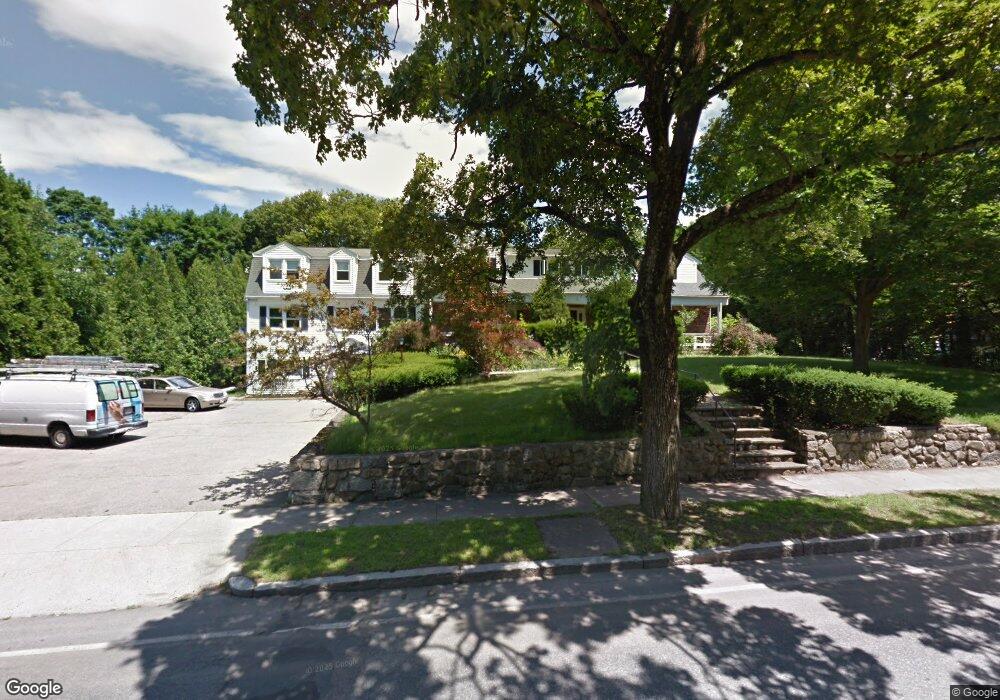
23 Short St Unit 1 East Walpole, MA 02032
Estimated Value: $554,660 - $693,000
3
Beds
2
Baths
2,045
Sq Ft
$295/Sq Ft
Est. Value
About This Home
This home is located at 23 Short St Unit 1, East Walpole, MA 02032 and is currently estimated at $602,915, approximately $294 per square foot. 23 Short St Unit 1 is a home located in Norfolk County with nearby schools including Old Post Road School, Walpole Middle School, and Walpole High School.
Ownership History
Date
Name
Owned For
Owner Type
Purchase Details
Closed on
Mar 24, 2020
Sold by
Mcneil Jimmy
Bought by
Mcneil Jimmy and Winder Mika
Current Estimated Value
Home Financials for this Owner
Home Financials are based on the most recent Mortgage that was taken out on this home.
Original Mortgage
$234,000
Interest Rate
3.6%
Mortgage Type
New Conventional
Purchase Details
Closed on
Feb 11, 2020
Sold by
Mcneil Jimmy C and Winder Mika
Bought by
Mcneil Jimmy C
Home Financials for this Owner
Home Financials are based on the most recent Mortgage that was taken out on this home.
Original Mortgage
$234,000
Interest Rate
3.6%
Mortgage Type
New Conventional
Purchase Details
Closed on
Aug 1, 2014
Sold by
Mcneil Jimmy C
Bought by
Mcneil Jimmy C and Winder Mika
Purchase Details
Closed on
Oct 23, 2013
Sold by
Barber Jean C M Est and Mcneil
Bought by
Mcneil Jimmy C
Home Financials for this Owner
Home Financials are based on the most recent Mortgage that was taken out on this home.
Original Mortgage
$140,000
Interest Rate
4.56%
Mortgage Type
New Conventional
Purchase Details
Closed on
Oct 27, 2006
Sold by
Driscoll Rosanne
Bought by
Mcneil Ann L and Barber Jean
Home Financials for this Owner
Home Financials are based on the most recent Mortgage that was taken out on this home.
Original Mortgage
$290,000
Interest Rate
6.48%
Mortgage Type
Purchase Money Mortgage
Purchase Details
Closed on
Nov 17, 2004
Sold by
Lacombe Carolyn and Driscoll Rosanne
Bought by
Driscoll Rosanne
Purchase Details
Closed on
Aug 31, 2001
Sold by
Rose Melissa E
Bought by
Driscoll Rosanne
Purchase Details
Closed on
Jun 30, 1994
Sold by
Lijoi Joseph R and Lijoi Shawn M
Bought by
Rose Melissa W
Purchase Details
Closed on
May 18, 1990
Sold by
Thomsen Leif
Bought by
Lijoi Joseph R
Purchase Details
Closed on
Jan 18, 1989
Sold by
Petrozzi Est Louis
Bought by
Dedham Coop Bank
Create a Home Valuation Report for This Property
The Home Valuation Report is an in-depth analysis detailing your home's value as well as a comparison with similar homes in the area
Home Values in the Area
Average Home Value in this Area
Purchase History
| Date | Buyer | Sale Price | Title Company |
|---|---|---|---|
| Mcneil Jimmy | -- | None Available | |
| Mcneil Jimmy C | -- | None Available | |
| Mcneil Jimmy C | -- | -- | |
| Mcneil Jimmy C | -- | -- | |
| Mcneil Jimmy C | $140,000 | -- | |
| Mcneil Jimmy C | $140,000 | -- | |
| Mcneil Jimmy C | $140,000 | -- | |
| Mcneil Ann L | $275,000 | -- | |
| Mcneil Ann L | $275,000 | -- | |
| Driscoll Rosanne | $50,000 | -- | |
| Driscoll Rosanne | $50,000 | -- | |
| Driscoll Rosanne | $250,000 | -- | |
| Driscoll Rosanne | $250,000 | -- | |
| Rose Melissa W | $129,000 | -- | |
| Lijoi Joseph R | $135,000 | -- | |
| Lijoi Joseph R | $135,000 | -- | |
| Dedham Coop Bank | $133,400 | -- | |
| Dedham Coop Bank | $133,400 | -- |
Source: Public Records
Mortgage History
| Date | Status | Borrower | Loan Amount |
|---|---|---|---|
| Previous Owner | Mcneil Jimmy C | $234,000 | |
| Previous Owner | Mcneil Jimmy C | $140,000 | |
| Previous Owner | Mcneil Ann L | $290,000 |
Source: Public Records
Tax History Compared to Growth
Tax History
| Year | Tax Paid | Tax Assessment Tax Assessment Total Assessment is a certain percentage of the fair market value that is determined by local assessors to be the total taxable value of land and additions on the property. | Land | Improvement |
|---|---|---|---|---|
| 2025 | $5,661 | $441,200 | $0 | $441,200 |
| 2024 | $5,451 | $412,300 | $0 | $412,300 |
| 2023 | $5,255 | $378,300 | $0 | $378,300 |
| 2022 | $4,973 | $343,900 | $0 | $343,900 |
| 2021 | $4,673 | $314,900 | $0 | $314,900 |
| 2020 | $4,236 | $282,600 | $0 | $282,600 |
| 2019 | $4,143 | $274,400 | $0 | $274,400 |
| 2018 | $3,953 | $258,900 | $0 | $258,900 |
| 2017 | $3,852 | $251,300 | $0 | $251,300 |
| 2016 | $3,834 | $246,400 | $0 | $246,400 |
| 2015 | $3,719 | $236,900 | $0 | $236,900 |
| 2014 | $3,661 | $232,300 | $0 | $232,300 |
Source: Public Records
Map
Nearby Homes
- 363 - 367 Washington St
- 7 Washington Green
- 486 Washington St
- 2 Alexandra Way
- 11 Park Ln
- Unit 11 Powder House Ln Unit 11
- 8 Powder House Ln Unit 2
- Unit 12 Powder House Ln Unit 12
- Unit 3 Powder House Ln Unit 3
- 22 Coolidge Rd
- 270 Moosehill Rd
- 291 Plimpton St
- 0 Charlotte Rd
- 20 Rockhill St
- 20 Rockhill St
- 4403 Pennington Dr Unit 4403
- 52 Baker St
- 66 Gould St
- 8 Rainbow Pond Dr Unit 8
- 1 Palace Ct