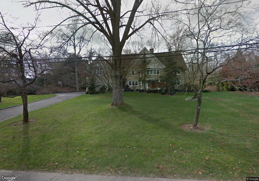
23 Sturges Commons Westport, CT 06880
Staples NeighborhoodEstimated Value: $2,957,000 - $4,308,000
5
Beds
6
Baths
6,333
Sq Ft
$573/Sq Ft
Est. Value
About This Home
This home is located at 23 Sturges Commons, Westport, CT 06880 and is currently estimated at $3,628,675, approximately $572 per square foot. 23 Sturges Commons is a home located in Fairfield County with nearby schools including Long Lots School, Bedford Middle School, and Staples High School.
Ownership History
Date
Name
Owned For
Owner Type
Purchase Details
Closed on
Jun 8, 2015
Sold by
Dana Ann Griffin Ret and Griffin
Bought by
Foushee Scott and Foushee Susan N
Current Estimated Value
Home Financials for this Owner
Home Financials are based on the most recent Mortgage that was taken out on this home.
Original Mortgage
$1,250,000
Outstanding Balance
$946,777
Interest Rate
3.62%
Mortgage Type
Purchase Money Mortgage
Estimated Equity
$2,681,898
Purchase Details
Closed on
Jun 10, 2005
Sold by
Axis Pt Grp Holdings L
Bought by
Griffin Dana
Purchase Details
Closed on
Jul 20, 2004
Sold by
Ward Michael
Bought by
Axis Point Grp Holding
Purchase Details
Closed on
Mar 10, 1998
Sold by
Gardiner Robinson Est and Gardiner
Bought by
Ward Michael
Purchase Details
Closed on
Jul 16, 1996
Sold by
Powell Ed and Vetter Muriel
Bought by
Keenan Thomas
Create a Home Valuation Report for This Property
The Home Valuation Report is an in-depth analysis detailing your home's value as well as a comparison with similar homes in the area
Home Values in the Area
Average Home Value in this Area
Purchase History
| Date | Buyer | Sale Price | Title Company |
|---|---|---|---|
| Foushee Scott | $2,250,000 | -- | |
| Foushee Scott | $2,250,000 | -- | |
| Griffin Dana | $2,715,000 | -- | |
| Griffin Dana Ann | $2,715,000 | -- | |
| Axis Point Grp Holding | $1,050,000 | -- | |
| Axis Point Grp Holding | $1,050,000 | -- | |
| Ward Michael | $560,000 | -- | |
| Ward Michael | $560,000 | -- | |
| Keenan Thomas | $313,000 | -- | |
| Keenan Thomas | $313,000 | -- |
Source: Public Records
Mortgage History
| Date | Status | Borrower | Loan Amount |
|---|---|---|---|
| Open | Foushee Scott | $1,250,000 | |
| Closed | Foushee Scott | $1,250,000 | |
| Previous Owner | Keenan Thomas | $1,800,000 | |
| Previous Owner | Keenan Thomas | $150,000 |
Source: Public Records
Tax History
| Year | Tax Paid | Tax Assessment Tax Assessment Total Assessment is a certain percentage of the fair market value that is determined by local assessors to be the total taxable value of land and additions on the property. | Land | Improvement |
|---|---|---|---|---|
| 2025 | $27,941 | $1,481,500 | $504,000 | $977,500 |
| 2024 | $27,586 | $1,481,500 | $504,000 | $977,500 |
| 2023 | $27,186 | $1,481,500 | $504,000 | $977,500 |
| 2022 | $26,771 | $1,481,500 | $504,000 | $977,500 |
| 2021 | $26,771 | $1,481,500 | $504,000 | $977,500 |
| 2020 | $26,398 | $1,579,800 | $532,000 | $1,047,800 |
| 2019 | $26,635 | $1,579,800 | $532,000 | $1,047,800 |
| 2018 | $6,839 | $1,579,800 | $532,000 | $1,047,800 |
| 2017 | $26,635 | $1,579,800 | $532,000 | $1,047,800 |
| 2016 | $26,635 | $1,579,800 | $532,000 | $1,047,800 |
| 2015 | $30,046 | $1,660,900 | $483,600 | $1,177,300 |
| 2014 | -- | $1,660,900 | $483,600 | $1,177,300 |
Source: Public Records
Map
Nearby Homes
- 21 Sturges Commons
- 10 Mary Jane Ln
- 10 Debra Ln
- 1 Angora Rd
- 1 Sturges Hwy Unit 2
- 35 Woody Ln
- 40 Maple Ave N
- 107 Old Rd
- 13 Terhune Dr
- 1 Coastal Ct
- 16 Burr School Rd
- 688 Hulls Farm Rd
- 14 Burr School Rd
- 32 Bauer Place Extension
- 36 Bauer Place
- 28 Turkey Hill Rd N
- 3 Bowling Ln
- 25 Old Rd
- 4 Burr Farms Rd
- 21 Turkey Hill Rd N
- 23 Sturges Commons
- 22 Sturges Commons
- 22 Sturges Commons
- 24 Sturges Commons
- 21 Sturges Commons
- 20 Sturges Commons
- 24 Sturges Commons
- 25 Sturges Commons
- 25 Sturges Commons
- 19 Sturges Commons
- 19 Sturges Commons
- 12 Sycamore Dr
- 28 Sturges Common
- 28 Sturges Common
- 34 Sturges Commons
- 34 Sturges Commons
- 18 Sturges Commons
- 18 Sturges Commons
- 26 Sturges Commons
- 39 Sturges Commons
Your Personal Tour Guide
Ask me questions while you tour the home.