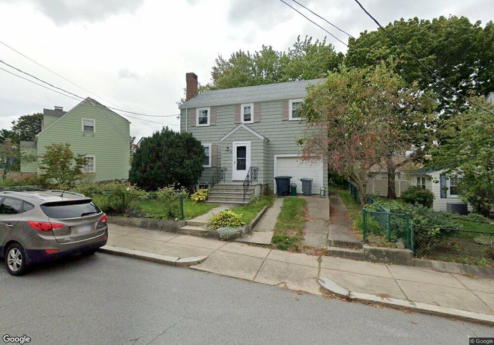
23 Wayburn Rd Jamaica Plain, MA 02130
Jamaica Plain NeighborhoodEstimated Value: $640,000 - $800,000
3
Beds
2
Baths
1,332
Sq Ft
$556/Sq Ft
Est. Value
About This Home
This home is located at 23 Wayburn Rd, Jamaica Plain, MA 02130 and is currently estimated at $740,101, approximately $555 per square foot. 23 Wayburn Rd is a home located in Suffolk County with nearby schools including Brooke Charter School Roslindale, The Croft School - Jamaica Plain, and St. Clare High School.
Ownership History
Date
Name
Owned For
Owner Type
Purchase Details
Closed on
Aug 12, 1998
Sold by
Mildred E Queenan Lt
Bought by
Matthew Oconnor Mary C and Matthew Robert
Current Estimated Value
Home Financials for this Owner
Home Financials are based on the most recent Mortgage that was taken out on this home.
Original Mortgage
$128,000
Outstanding Balance
$26,750
Interest Rate
6.94%
Mortgage Type
Purchase Money Mortgage
Estimated Equity
$713,351
Create a Home Valuation Report for This Property
The Home Valuation Report is an in-depth analysis detailing your home's value as well as a comparison with similar homes in the area
Home Values in the Area
Average Home Value in this Area
Purchase History
| Date | Buyer | Sale Price | Title Company |
|---|---|---|---|
| Matthew Oconnor Mary C | $160,000 | -- |
Source: Public Records
Mortgage History
| Date | Status | Borrower | Loan Amount |
|---|---|---|---|
| Open | Matthew Oconnor Mary C | $128,000 |
Source: Public Records
Tax History Compared to Growth
Tax History
| Year | Tax Paid | Tax Assessment Tax Assessment Total Assessment is a certain percentage of the fair market value that is determined by local assessors to be the total taxable value of land and additions on the property. | Land | Improvement |
|---|---|---|---|---|
| 2025 | $7,590 | $655,400 | $190,800 | $464,600 |
| 2024 | $6,810 | $624,800 | $199,900 | $424,900 |
| 2023 | $6,270 | $583,800 | $186,800 | $397,000 |
| 2022 | $5,825 | $535,400 | $171,300 | $364,100 |
| 2021 | $5,546 | $519,800 | $166,300 | $353,500 |
| 2020 | $5,083 | $481,300 | $163,300 | $318,000 |
| 2019 | $4,833 | $458,500 | $133,500 | $325,000 |
| 2018 | $4,289 | $409,300 | $133,500 | $275,800 |
| 2017 | $4,251 | $401,400 | $133,500 | $267,900 |
| 2016 | $4,330 | $393,600 | $133,500 | $260,100 |
| 2015 | $4,425 | $365,400 | $140,100 | $225,300 |
| 2014 | $4,026 | $320,000 | $140,100 | $179,900 |
Source: Public Records
Map
Nearby Homes
- 50 Southbourne Rd
- 31 Rodman St Unit 2
- 31 Rodman St Unit 1
- 24 Waterman Rd
- 18-20 Northbourne Rd Unit 18
- 602 Canterbury St Unit 14
- 602 Canterbury St Unit 4
- 602 Canterbury St Unit 5
- 602 Canterbury St Unit 2
- 602 Canterbury St Unit 9
- 105 Neponset Ave Unit 105
- 348-350 Hyde Park Ave Unit 2
- 71 Wyvern St
- 103 Neponset Ave Unit 103A
- 103-105 Neponset Ave
- 158 Wachusett St Unit 3
- 140 Wachusett St
- 36 Neponset Ave Unit 1
- 579 American Legion Hwy
- 577-579 American Legion Hwy