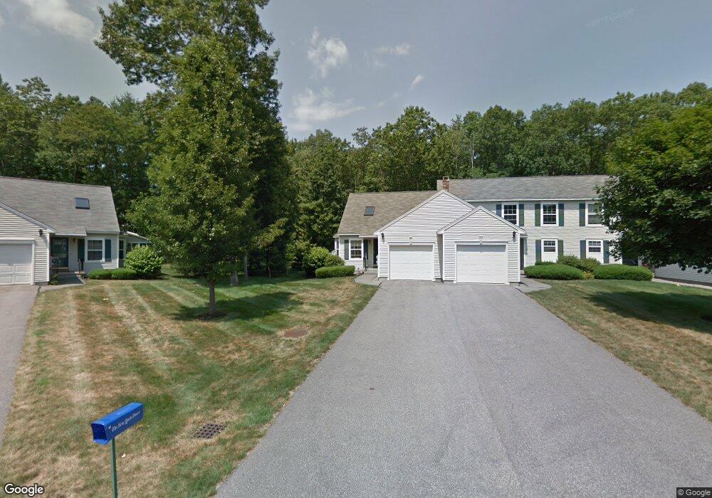
23 Windsor Commons Dr Unit 11 Kennebunk, ME 04043
Estimated Value: $484,000 - $522,000
2
Beds
2
Baths
1,455
Sq Ft
$345/Sq Ft
Est. Value
About This Home
This home is located at 23 Windsor Commons Dr Unit 11, Kennebunk, ME 04043 and is currently estimated at $502,304, approximately $345 per square foot. 23 Windsor Commons Dr Unit 11 is a home located in York County with nearby schools including Kennebunk High School and The New School.
Ownership History
Date
Name
Owned For
Owner Type
Purchase Details
Closed on
Apr 29, 2023
Sold by
Rector Patricia M
Bought by
Becker Carol
Current Estimated Value
Purchase Details
Closed on
Jul 6, 2005
Sold by
Doherty Barbara W
Bought by
Challinor Virginia D
Create a Home Valuation Report for This Property
The Home Valuation Report is an in-depth analysis detailing your home's value as well as a comparison with similar homes in the area
Home Values in the Area
Average Home Value in this Area
Purchase History
| Date | Buyer | Sale Price | Title Company |
|---|---|---|---|
| Becker Carol | $470,000 | None Available | |
| Challinor Virginia D | -- | -- |
Source: Public Records
Tax History
| Year | Tax Paid | Tax Assessment Tax Assessment Total Assessment is a certain percentage of the fair market value that is determined by local assessors to be the total taxable value of land and additions on the property. | Land | Improvement |
|---|---|---|---|---|
| 2024 | $4,893 | $288,700 | $74,700 | $214,000 |
| 2023 | $4,634 | $288,700 | $74,700 | $214,000 |
| 2022 | $4,215 | $288,700 | $74,700 | $214,000 |
| 2021 | $4,114 | $288,700 | $74,700 | $214,000 |
| 2020 | $4,085 | $288,700 | $74,700 | $214,000 |
| 2019 | $3,970 | $288,700 | $74,700 | $214,000 |
| 2018 | $3,789 | $216,500 | $56,000 | $160,500 |
| 2017 | $3,583 | $216,500 | $56,000 | $160,500 |
| 2016 | $3,442 | $216,500 | $56,000 | $160,500 |
| 2015 | $3,312 | $216,500 | $56,000 | $160,500 |
| 2014 | $3,226 | $216,500 | $56,000 | $160,500 |
Source: Public Records
Map
Nearby Homes
- 2 Lexington Dr Unit 2
- 7 Windsor Commons Dr Unit 7
- 3 Kensington Dr
- 14 Hampton Glen Dr Unit 51
- 15 Casey Ln
- 29 Hampton Glen Dr Unit 10
- 9 Hampton Glen Dr Unit 3
- 3 Hardwood Ln
- 17 Hampton Glen Dr Unit 5
- 115 Fletcher St
- 61 Fletcher St
- 24 Cat Mousam Rd
- 23 Lilac Ln
- 22 Oakwood Ln
- 2 Cross St
- 30 York St Unit 1
- 11 Greenwich Way Unit 43
- 93 Main St Unit A
- 23 Cascade Cir Unit 22
- 1 Hall St
- 23 Windsor Commons Dr
- 23 Windsor Commons Dr Unit 23
- 143 Cat Mousam Rd
- 145 Cat Mousam Rd Unit 1
- 145 Cat Mousam Rd Unit 2
- 142 Cat Mousam Rd
- 148 Cat Mousam Rd
- 2 Lexington Dr Unit 5
- 6 Lexington Dr Unit 7
- 6 Lexington Dr Unit 6
- 153 Cat Mousam Rd
- 146 Cat Mousam Rd
- 140 Cat Mousam Rd
- 134 Cat Mousam Rd
- 14 Lexington Dr Unit 11
- 14 Lexington Dr Unit 14
- 10 Lexington Dr Unit 9
- 152 Cat Mousam Rd
- 16 Lexington Dr Unit 12
- 16 Lexington Dr Unit 16
Your Personal Tour Guide
Ask me questions while you tour the home.