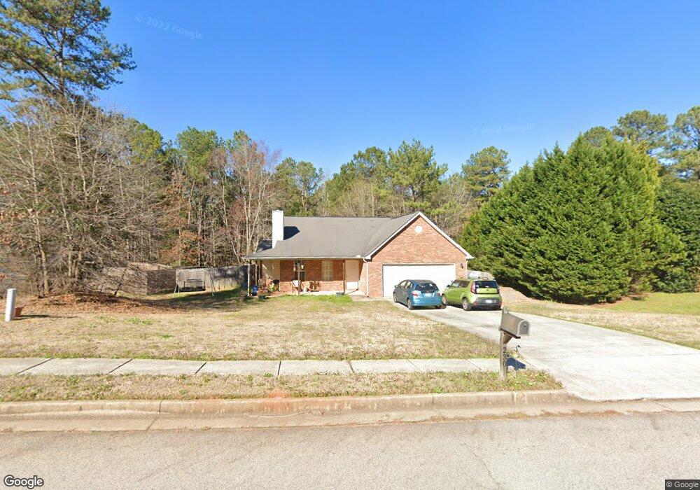
230 Creekside Trail Covington, GA 30016
Estimated Value: $253,127 - $295,000
--
Bed
2
Baths
1,509
Sq Ft
$180/Sq Ft
Est. Value
About This Home
This home is located at 230 Creekside Trail, Covington, GA 30016 and is currently estimated at $271,782, approximately $180 per square foot. 230 Creekside Trail is a home located in Newton County with nearby schools including South Salem Elementary School, Liberty Middle School, and Alcovy High School.
Ownership History
Date
Name
Owned For
Owner Type
Purchase Details
Closed on
Jun 25, 2003
Sold by
The Den-Ric Corp
Bought by
Lamothe Martha
Current Estimated Value
Purchase Details
Closed on
Jul 29, 2002
Sold by
Den-Ric Corp
Bought by
Lamothe Martha
Home Financials for this Owner
Home Financials are based on the most recent Mortgage that was taken out on this home.
Original Mortgage
$102,900
Interest Rate
6.53%
Mortgage Type
New Conventional
Create a Home Valuation Report for This Property
The Home Valuation Report is an in-depth analysis detailing your home's value as well as a comparison with similar homes in the area
Home Values in the Area
Average Home Value in this Area
Purchase History
| Date | Buyer | Sale Price | Title Company |
|---|---|---|---|
| Lamothe Martha | -- | -- | |
| The Den-Ric Corp | -- | -- | |
| Lamothe Martha | $114,900 | -- |
Source: Public Records
Mortgage History
| Date | Status | Borrower | Loan Amount |
|---|---|---|---|
| Previous Owner | Lamothe Martha | $102,900 |
Source: Public Records
Tax History Compared to Growth
Tax History
| Year | Tax Paid | Tax Assessment Tax Assessment Total Assessment is a certain percentage of the fair market value that is determined by local assessors to be the total taxable value of land and additions on the property. | Land | Improvement |
|---|---|---|---|---|
| 2024 | $2,401 | $111,560 | $17,600 | $93,960 |
| 2023 | $2,276 | $100,880 | $7,200 | $93,680 |
| 2022 | $2,068 | $77,720 | $7,200 | $70,520 |
| 2021 | $1,964 | $66,560 | $7,200 | $59,360 |
| 2020 | $1,843 | $56,920 | $7,200 | $49,720 |
| 2019 | $1,596 | $48,880 | $5,600 | $43,280 |
| 2018 | $1,549 | $47,200 | $5,600 | $41,600 |
| 2017 | $1,391 | $42,600 | $5,600 | $37,000 |
| 2016 | $1,186 | $36,640 | $4,000 | $32,640 |
| 2015 | $1,121 | $34,760 | $4,000 | $30,760 |
| 2014 | $1,046 | $32,640 | $0 | $0 |
Source: Public Records
Map
Nearby Homes
- 145 Wynfield Way
- 400 Oak Hill Dr
- 75 Oak Hill Dr
- 265 Lazy Hollow Ln
- 145 Mill Chase
- 205 Woodcrest Dr
- 135 Woodcrest Dr
- 255 Countryside Ln
- 165 Countryside Ln
- 25 Woodcrest Dr
- 70 Countryside Ln
- 445 Brickstone Way
- 410 Brickstone Way
- 70 Cowan Ridge
- 85 Lakeside Dr
- 115 Branchwood Dr
- 40 Brickstone Pkwy
- 25 Castlehill Ct
- 40 Belmont Cir Unit 2
- 472 Oak Hill Rd
- 220 Creekside Trail
- 240 Creekside Trail
- 195 Creekside Trail
- 244 Creekside Trail
- 210 Creekside Trail
- 200 Creekside Trail
- 185 Creekside Trail
- 250 Creekside Trail
- 180 Creekside Trail
- 190 Creekside Trail
- 175 Creekside Trail
- 260 Creekside Trail
- 285 Creekside Trail
- 170 Creekside Trail
- 295 Creekside Trail
- 165 Creekside Trail
- 160 Creekside Trail Unit 1
- 270 Creekside Trail
- 305 Creekside Trail
- 150 Creekside Trail