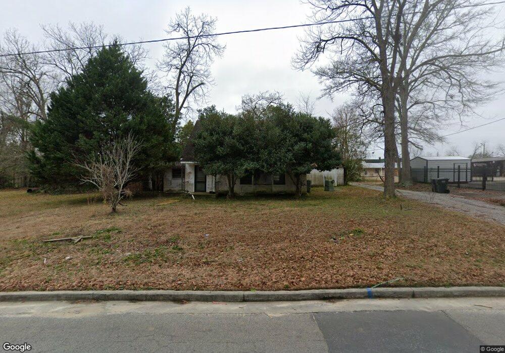
230 E Lillian St Metter, GA 30439
Estimated Value: $64,793 - $198,000
--
Bed
2
Baths
1,174
Sq Ft
$108/Sq Ft
Est. Value
About This Home
This home is located at 230 E Lillian St, Metter, GA 30439 and is currently estimated at $126,448, approximately $107 per square foot. 230 E Lillian St is a home located in Candler County with nearby schools including Metter Elementary School, Metter Intermediate School, and Metter Middle School.
Ownership History
Date
Name
Owned For
Owner Type
Purchase Details
Closed on
Aug 23, 2022
Sold by
Lanier George Brant
Bought by
Scott Herman and Scott Mary
Current Estimated Value
Purchase Details
Closed on
May 30, 2013
Sold by
Cutten Rita H
Bought by
Lanier George Brant
Purchase Details
Closed on
Nov 19, 2008
Sold by
Lanier George Brant
Bought by
Cutten Rita H
Purchase Details
Closed on
Oct 11, 2005
Sold by
Olliff Jim F
Bought by
Lanier George Brant
Purchase Details
Closed on
Mar 18, 1996
Sold by
Faircloth Bobby
Bought by
Olliff Jim F
Purchase Details
Closed on
Dec 28, 1994
Bought by
Faircloth Bobby
Purchase Details
Closed on
Oct 1, 1948
Sold by
Olliff F H
Bought by
Olliff Jim F
Create a Home Valuation Report for This Property
The Home Valuation Report is an in-depth analysis detailing your home's value as well as a comparison with similar homes in the area
Home Values in the Area
Average Home Value in this Area
Purchase History
| Date | Buyer | Sale Price | Title Company |
|---|---|---|---|
| Scott Herman | $25,000 | -- | |
| Lanier George Brant | -- | -- | |
| Lanier George Brant | -- | -- | |
| Cutten Rita H | -- | -- | |
| Lanier George Brant | $34,900 | -- | |
| Olliff Jim F | -- | -- | |
| Faircloth Bobby | $27,500 | -- | |
| Olliff Jim F | -- | -- |
Source: Public Records
Tax History Compared to Growth
Tax History
| Year | Tax Paid | Tax Assessment Tax Assessment Total Assessment is a certain percentage of the fair market value that is determined by local assessors to be the total taxable value of land and additions on the property. | Land | Improvement |
|---|---|---|---|---|
| 2024 | $611 | $9,986 | $1,280 | $8,706 |
| 2023 | $611 | $9,764 | $1,280 | $8,484 |
| 2022 | $834 | $20,717 | $1,280 | $19,437 |
| 2021 | $690 | $17,495 | $1,280 | $16,215 |
| 2020 | $691 | $17,495 | $1,280 | $16,215 |
| 2019 | $478 | $11,948 | $1,152 | $10,796 |
| 2018 | $429 | $10,771 | $1,152 | $9,619 |
| 2017 | $365 | $10,899 | $1,280 | $9,619 |
| 2016 | $655 | $10,899 | $1,280 | $9,619 |
| 2015 | $536 | $11,100 | $1,280 | $9,820 |
| 2014 | $536 | $11,100 | $1,280 | $9,820 |
Source: Public Records
Map
Nearby Homes
- 250 S Lewis St
- 40 Hickory St
- 295 S Lewis St
- 365 S Leroy St
- 405 S Leroy St
- 450 S Rountree St
- 465 Cedar St
- 405 Preston St
- 550 S Rountree St
- 150 W Willow Lake Dr
- 0 Central Ave Unit 10628403
- 4515 Harper Rd
- 1449 Hulsey Dr
- 286 Webb Cir
- 0 Oak Tree Rd Unit (31.62 AC) 10490874
- 743 Ann's Ln
- 0 Indigo Rd Unit 10425491
- 6424 Collins Rd
- 26844 Georgia 46
- 527 Windmill Rd
- 235 N Leroy St
- 235 N Leroy St
- 239 E Lillian St
- 235 E Lillian St
- 215 N Leroy St
- 225 E Lillian St
- 260 N Leroy St
- 310 N Lewis St
- 205 E Lee St
- 205 N Leroy St
- 320 N Lewis St
- 250 N Leroy St
- 318 E Lillian St
- 203 E Lee St
- 337 E Lee St
- 330 N Lewis St
- 210 N Lewis St
- 0 Raynell Cir Unit 7593304
- 0 Raynell Cir Unit 294964
- 341 E Lee St