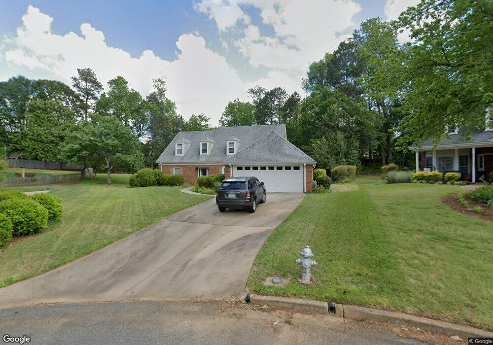
230 Farm Grove Trace Unit 11 Alpharetta, GA 30004
Estimated Value: $717,000 - $785,000
3
Beds
3
Baths
3,133
Sq Ft
$239/Sq Ft
Est. Value
About This Home
This home is located at 230 Farm Grove Trace Unit 11, Alpharetta, GA 30004 and is currently estimated at $749,020, approximately $239 per square foot. 230 Farm Grove Trace Unit 11 is a home located in Fulton County with nearby schools including Crabapple Crossing Elementary School, Northwestern Middle School, and Milton High School.
Ownership History
Date
Name
Owned For
Owner Type
Purchase Details
Closed on
Apr 25, 2019
Sold by
Shetlar Thomas J
Bought by
Stapleton Timothy
Current Estimated Value
Home Financials for this Owner
Home Financials are based on the most recent Mortgage that was taken out on this home.
Original Mortgage
$364,500
Outstanding Balance
$318,484
Interest Rate
4%
Mortgage Type
New Conventional
Estimated Equity
$430,536
Purchase Details
Closed on
Dec 30, 2004
Sold by
Pankopp Alfred & Alice E Trust
Bought by
Shetlar Thomas J and Shetlar Gloria
Home Financials for this Owner
Home Financials are based on the most recent Mortgage that was taken out on this home.
Original Mortgage
$175,000
Interest Rate
5.71%
Mortgage Type
New Conventional
Create a Home Valuation Report for This Property
The Home Valuation Report is an in-depth analysis detailing your home's value as well as a comparison with similar homes in the area
Home Values in the Area
Average Home Value in this Area
Purchase History
| Date | Buyer | Sale Price | Title Company |
|---|---|---|---|
| Stapleton Timothy | $429,000 | -- | |
| Shetlar Thomas J | $275,000 | -- |
Source: Public Records
Mortgage History
| Date | Status | Borrower | Loan Amount |
|---|---|---|---|
| Open | Stapleton Timothy | $364,500 | |
| Previous Owner | Shetlar Thomas J | $175,000 |
Source: Public Records
Tax History Compared to Growth
Tax History
| Year | Tax Paid | Tax Assessment Tax Assessment Total Assessment is a certain percentage of the fair market value that is determined by local assessors to be the total taxable value of land and additions on the property. | Land | Improvement |
|---|---|---|---|---|
| 2025 | $799 | $229,680 | $60,600 | $169,080 |
| 2023 | $6,623 | $234,640 | $78,880 | $155,760 |
| 2022 | $3,914 | $180,600 | $49,760 | $130,840 |
| 2021 | $4,574 | $158,160 | $42,400 | $115,760 |
| 2020 | $4,601 | $156,320 | $41,920 | $114,400 |
| 2019 | $512 | $153,520 | $41,160 | $112,360 |
| 2018 | $3,332 | $133,320 | $33,320 | $100,000 |
| 2017 | $2,917 | $111,920 | $31,280 | $80,640 |
| 2016 | $2,916 | $111,920 | $31,280 | $80,640 |
| 2015 | $3,371 | $111,920 | $31,280 | $80,640 |
| 2014 | $3,040 | $111,920 | $31,280 | $80,640 |
Source: Public Records
Map
Nearby Homes
- 290 Rucker Rd
- 285 N Farm Dr
- 640 Mae Ln
- 1040 Jordan Ln
- 406 Sweet Apple Cir
- 4404 Orchard Trace
- 530 Camber Woods Dr
- 2230 Ashton Dr
- 1115 Primrose Dr
- 565 Camber Woods Dr
- 666 Abbey Ct
- 12440 Brookhill Crossing Ln
- 1565 Parkside Dr
- 216 Lask Ln
- 233 Lask Ln
- 237 Lask Ln
- 13125 Morningpark Cir
- 245 Lask Ln
- 580 Stillhouse Ln Unit 2
- 200 Welford Trace
- 230 Farm Grove Trace
- 220 Farm Grove Trace Unit 1
- 225 Mamie Ct
- 225 Farm Grove Trace
- 210 Mamie Ct
- 12206 Limeridge Ct
- 12202 Limeridge Ct
- 210 Farm Grove Trace
- 215 Mamie Ct
- 200 Mamie Ct
- 200 Mamie Ct Unit 9
- 12207 Limeridge Ct
- 215 Farm Grove Trace
- 12198 Limeridge Ct
- 675 Mae Ln
- 245 N Farm Dr Unit 1
- 645 Mae Ln
- 12203 Limeridge Ct
- 200 Farm Grove Trace Unit 1
- 235 N Farm Dr