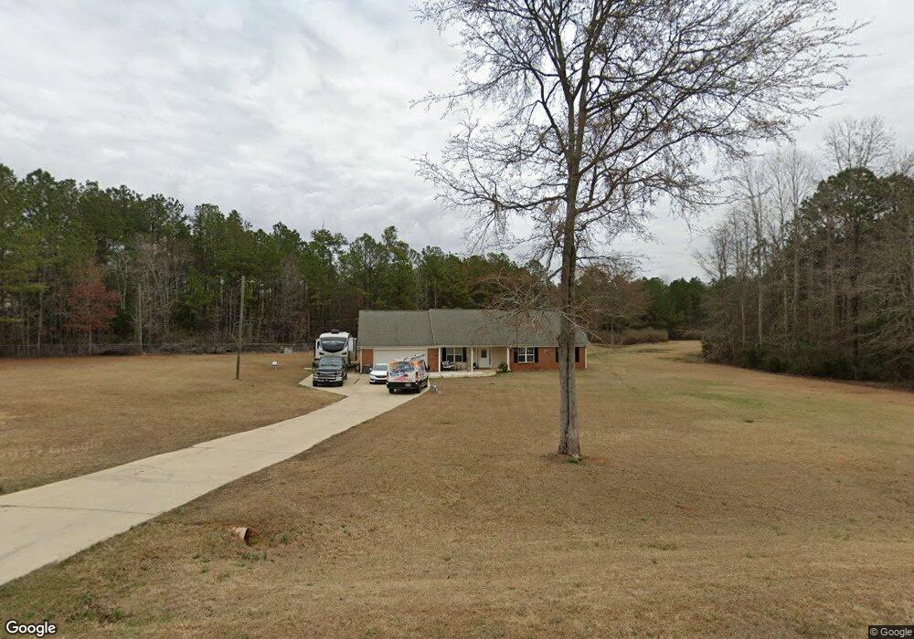
230 Gordon Rd Forsyth, GA 31029
Estimated Value: $259,506 - $300,000
--
Bed
2
Baths
1,816
Sq Ft
$154/Sq Ft
Est. Value
About This Home
This home is located at 230 Gordon Rd, Forsyth, GA 31029 and is currently estimated at $280,127, approximately $154 per square foot. 230 Gordon Rd is a home located in Monroe County with nearby schools including Katherine B. Sutton Elementary School and Mary Persons High School.
Ownership History
Date
Name
Owned For
Owner Type
Purchase Details
Closed on
May 18, 2005
Sold by
Btb Homes Inc
Bought by
Mullis Bobby Lee and Mullis Joyce Marie
Current Estimated Value
Home Financials for this Owner
Home Financials are based on the most recent Mortgage that was taken out on this home.
Original Mortgage
$103,900
Outstanding Balance
$58,583
Interest Rate
7.13%
Mortgage Type
New Conventional
Estimated Equity
$221,544
Create a Home Valuation Report for This Property
The Home Valuation Report is an in-depth analysis detailing your home's value as well as a comparison with similar homes in the area
Home Values in the Area
Average Home Value in this Area
Purchase History
| Date | Buyer | Sale Price | Title Company |
|---|---|---|---|
| Mullis Bobby Lee | $129,900 | -- |
Source: Public Records
Mortgage History
| Date | Status | Borrower | Loan Amount |
|---|---|---|---|
| Open | Mullis Bobby Lee | $103,900 | |
| Closed | Mullis Bobby Lee | $25,950 |
Source: Public Records
Tax History Compared to Growth
Tax History
| Year | Tax Paid | Tax Assessment Tax Assessment Total Assessment is a certain percentage of the fair market value that is determined by local assessors to be the total taxable value of land and additions on the property. | Land | Improvement |
|---|---|---|---|---|
| 2024 | $1,329 | $61,200 | $12,960 | $48,240 |
| 2023 | $1,329 | $53,160 | $12,960 | $40,200 |
| 2022 | $1,114 | $53,160 | $12,960 | $40,200 |
| 2021 | $1,154 | $53,160 | $12,960 | $40,200 |
| 2020 | $1,108 | $50,560 | $10,360 | $40,200 |
| 2019 | $1,117 | $50,560 | $10,360 | $40,200 |
| 2018 | $1,120 | $50,560 | $10,360 | $40,200 |
| 2017 | $1,470 | $50,560 | $10,360 | $40,200 |
| 2016 | $1,065 | $50,560 | $10,360 | $40,200 |
| 2015 | $1,079 | $53,160 | $12,960 | $40,200 |
| 2014 | $1,041 | $53,160 | $12,960 | $40,200 |
Source: Public Records
Map
Nearby Homes
- 6418 Georgia 42
- 49 Homestead Cir Unit LOT 49A
- 160 Aaron Ct
- 120 Homestead Cir
- 40 Timber Dr
- 381 Homestead Cir
- 1538 Freeman Rd
- 788 Teagle Rd
- 3528 Highway 42 S
- 120 Torbet Rd
- 674 Stokes Store Rd
- 1649 Stokes Store Rd
- 1649 Stokes Store Rd Unit 52
- 1659 Stokes Store Rd
- 0 Garr Rd Unit 10439858
- 739 Westbrooks Rd
- 343 Torbet Dr
- 1653 Stokes Store Rd Unit 51
- Magnolia Plan at Providence Ridge
- Oakwood Plan at Providence Ridge
- 202 Gordon Rd
- 225 Gordon Rd
- 103 Craig Rd
- 215 Gordon Rd
- 215 Gordon Rd Unit Phase 2
- 445 Gordon Rd
- 201 Gordon Rd
- 153 Craig Rd
- 465 Gordon Rd Unit 6
- 465 Gordon Rd
- 101 Gordon Rd
- 466 Gordon Rd
- 473 Gordon Rd
- 48 Craig Rd
- 6589 Ga Highway 42 N
- 0 Hwy 42 and Craig Rd Unit PARCEL 1 8259966
- 0 Hwy 42 and Craig Rd Unit 1 7527778
- 0 Hwy 42 and Craig Rd Unit 2&3 7527771
- 0 Hwy 42 and Craig Rd Unit PARCEL 1 7527750
- 0 Gordon Rd Unit 8453383