Estimated Value: $270,000 - $362,000
3
Beds
3
Baths
1,948
Sq Ft
$166/Sq Ft
Est. Value
About This Home
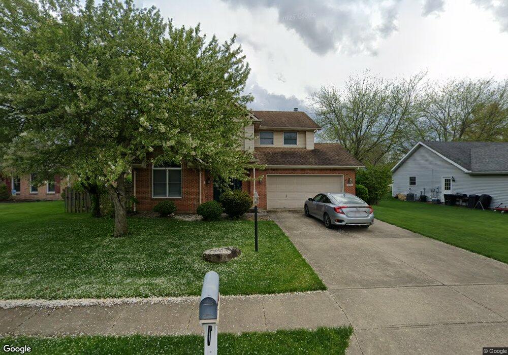
This home is located at 230 Locust View Way, Troy, OH 45373 and is currently estimated at $323,182, approximately $165 per square foot. 230 Locust View Way is a home located in Miami County with nearby schools including Concord Elementary School, Van Cleve Elementary School, and Troy Junior High School.
Ownership History
Date
Name
Owned For
Owner Type
Purchase Details
Closed on
Jul 25, 2019
Sold by
Northridge Group Llc
Bought by
Sycamore Ltd
Current Estimated Value
Purchase Details
Closed on
May 17, 2016
Sold by
Rectenwald John W
Bought by
North Rige Group Llc
Purchase Details
Closed on
Apr 27, 2016
Sold by
Rectenwald John W
Bought by
North Ridge Group Llc
Purchase Details
Closed on
Dec 7, 1994
Sold by
Kegley Glennis
Bought by
Rectenwald John W and Rectenwald Nancy J
Create a Home Valuation Report for This Property
The Home Valuation Report is an in-depth analysis detailing your home's value as well as a comparison with similar homes in the area
Home Values in the Area
Average Home Value in this Area
Purchase History
| Date | Buyer | Sale Price | Title Company |
|---|---|---|---|
| Sycamore Ltd | -- | None Available | |
| North Rige Group Llc | $119,451 | None Available | |
| North Ridge Group Llc | $119,451 | Attorney | |
| Rectenwald John W | $149,900 | -- |
Source: Public Records
Mortgage History
| Date | Status | Borrower | Loan Amount |
|---|---|---|---|
| Closed | Rectenwald John W | -- |
Source: Public Records
Tax History Compared to Growth
Tax History
| Year | Tax Paid | Tax Assessment Tax Assessment Total Assessment is a certain percentage of the fair market value that is determined by local assessors to be the total taxable value of land and additions on the property. | Land | Improvement |
|---|---|---|---|---|
| 2024 | $3,149 | $79,320 | $12,360 | $66,960 |
| 2023 | $3,149 | $79,320 | $12,360 | $66,960 |
| 2022 | $2,650 | $79,320 | $12,360 | $66,960 |
| 2021 | $2,351 | $66,080 | $10,290 | $55,790 |
| 2020 | $2,354 | $66,080 | $10,290 | $55,790 |
| 2019 | $2,375 | $66,080 | $10,290 | $55,790 |
| 2018 | $2,121 | $56,140 | $11,130 | $45,010 |
| 2017 | $2,140 | $56,140 | $11,130 | $45,010 |
| 2016 | $1,735 | $56,140 | $11,130 | $45,010 |
| 2015 | $1,645 | $51,980 | $10,290 | $41,690 |
| 2014 | $1,645 | $51,980 | $10,290 | $41,690 |
| 2013 | $1,656 | $51,980 | $10,290 | $41,690 |
Source: Public Records
Map
Nearby Homes
- 2765 Silver Maple Ct
- 445 Wisteria Dr
- 660 Wisteria Dr
- 203 Boone Dr
- 0 Lincolnshire Unit 939331
- 1701 Chevington Chase
- 2215 Merrimont Dr
- 1117 Honeydew Dr
- 1216 Wind Rock Ct
- 2065 S Co Road 25a
- 768 Stonehenge Dr
- Spruce Plan at Summit Landing
- Norway Plan at Summit Landing
- Chestnut Plan at Summit Landing
- Juniper Plan at Summit Landing
- Palmetto Plan at Summit Landing
- Ashton Plan at Summit Landing
- Empress Plan at Summit Landing
- Ironwood Plan at Summit Landing
- Aspen II Plan at Summit Landing
- 216 Locust View Way
- 240 Locust View Way
- 231 Green Oak Dr
- 202 Locust View Way
- 2965 Walnut Ridge Dr
- 215 Green Oak Dr
- 229 Locust View Way
- 2905 Walnut Ridge Dr
- 2912 Red Oak Cir
- 190 Locust View Way
- 199 Green Oak Dr
- 270 Locust View Way
- 275 Green Oak Dr
- 2896 Red Oak Cir
- 185 Locust View Way
- 2900 Walnut Ridge Dr
- 176 Locust View Way
- 2897 Walnut Ridge Dr
- 228 Green Oak Dr
- 181 Green Oak Dr