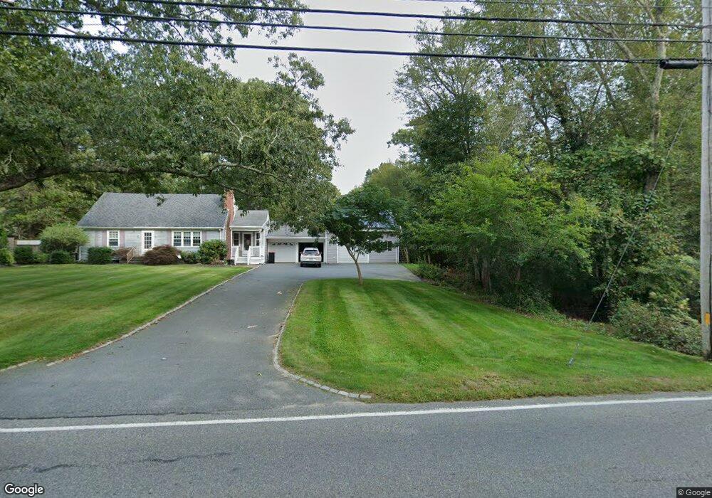
230 Main Rd Westport, MA 02790
Brownell/Giffords Corner NeighborhoodEstimated Value: $504,000 - $782,000
4
Beds
--
Bath
2,440
Sq Ft
$258/Sq Ft
Est. Value
About This Home
This home is located at 230 Main Rd, Westport, MA 02790 and is currently estimated at $629,854, approximately $258 per square foot. 230 Main Rd is a home located in Bristol County with nearby schools including Alice A. Macomber Primary School, Westport Elementary School, and Westport Middle-High School.
Ownership History
Date
Name
Owned For
Owner Type
Purchase Details
Closed on
Jul 27, 1998
Sold by
Dietzel George E
Bought by
Cinquini Wayne and Cinquini Ann
Current Estimated Value
Create a Home Valuation Report for This Property
The Home Valuation Report is an in-depth analysis detailing your home's value as well as a comparison with similar homes in the area
Home Values in the Area
Average Home Value in this Area
Purchase History
| Date | Buyer | Sale Price | Title Company |
|---|---|---|---|
| Cinquini Wayne | $125,000 | -- |
Source: Public Records
Mortgage History
| Date | Status | Borrower | Loan Amount |
|---|---|---|---|
| Open | Cinquini Wayne | $212,850 | |
| Closed | Cinquini Wayne | $60,000 | |
| Closed | Cinquini Wayne | $177,000 |
Source: Public Records
Tax History Compared to Growth
Tax History
| Year | Tax Paid | Tax Assessment Tax Assessment Total Assessment is a certain percentage of the fair market value that is determined by local assessors to be the total taxable value of land and additions on the property. | Land | Improvement |
|---|---|---|---|---|
| 2025 | $3,530 | $473,800 | $170,700 | $303,100 |
| 2024 | $3,464 | $448,100 | $151,300 | $296,800 |
| 2023 | $3,353 | $410,900 | $131,000 | $279,900 |
| 2022 | $2,859 | $351,000 | $131,000 | $220,000 |
| 2021 | $2,859 | $331,700 | $113,100 | $218,600 |
| 2020 | $2,710 | $321,500 | $102,900 | $218,600 |
| 2019 | $2,588 | $312,900 | $102,900 | $210,000 |
| 2018 | $2,484 | $304,100 | $114,300 | $189,800 |
| 2017 | $2,418 | $303,400 | $110,600 | $192,800 |
| 2016 | $2,265 | $286,300 | $107,000 | $179,300 |
| 2015 | $2,220 | $279,900 | $109,400 | $170,500 |
Source: Public Records
Map
Nearby Homes
- 994 State
- 0 Hidden Glen Ln
- 118 Charlotte White Rd Extension
- 118 Charlotte White Rd
- 4 Main Rd
- 47 Fallon Dr
- 8 Strawberry Ln
- 6 Angel Ct
- 978 Sodom Rd
- 27 Dias Ave
- 15 Village Way
- 7 Village Way
- 8 Village Way
- 380 Gifford Rd
- 218 American Legion Hwy
- 2 Magnolia Ln
- 771 Sanford Rd
- 96 Forge Rd
- 47 Devol Ave
- 29 Union Ave
- 224 Main Rd
- 1 Benjamin Tripp Rd
- 250 Main Rd
- 213 Main Rd
- 00 Rte 195 Frontage Way
- 0 Running Brook Vineyard Unit 71726758
- Lots 2 & 4 Walters Way
- Lot 6 - 26 Charlotte White Rd
- Lot 9 Mya Way
- 0 Oceanfront Unit 1
- 0 Oceanfront Unit 1 72050739
- 0 Blue Acres Way & Horseneck Rd Unit 71971103
- 0 Address Withheld Unit 1071767
- Lot 24 Devolavenue
- 0 Address Withheld Unit 72437701
- 204 Main Rd
- 204 Main Rd
- 11 Benjamin Tripp Rd
- 205 Main Rd
- 2 Benjamin Tripp Rd