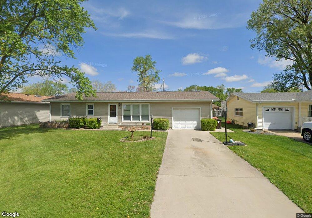
230 Mayfair Dr Lincoln, IL 62656
Estimated Value: $138,000 - $214,000
4
Beds
--
Bath
1,632
Sq Ft
$104/Sq Ft
Est. Value
About This Home
This home is located at 230 Mayfair Dr, Lincoln, IL 62656 and is currently estimated at $169,214, approximately $103 per square foot. 230 Mayfair Dr is a home located in Logan County with nearby schools including Washington-Monroe Elementary School, Adams Elementary School, and Lincoln Junior High School.
Ownership History
Date
Name
Owned For
Owner Type
Purchase Details
Closed on
Sep 13, 2018
Sold by
Wells Fargo Bank
Bought by
Meador Michael Charles
Current Estimated Value
Purchase Details
Closed on
Jul 24, 2018
Sold by
Logan County Sheriff
Bought by
Wells Fargo Bank
Purchase Details
Closed on
Dec 30, 2011
Sold by
Deilkes Andrew and Deilkes Megan
Bought by
Merreighn Joshua L
Home Financials for this Owner
Home Financials are based on the most recent Mortgage that was taken out on this home.
Original Mortgage
$116,251
Interest Rate
4.37%
Mortgage Type
FHA
Create a Home Valuation Report for This Property
The Home Valuation Report is an in-depth analysis detailing your home's value as well as a comparison with similar homes in the area
Home Values in the Area
Average Home Value in this Area
Purchase History
| Date | Buyer | Sale Price | Title Company |
|---|---|---|---|
| Meador Michael Charles | $78,000 | None Available | |
| Wells Fargo Bank | -- | None Available | |
| Merreighn Joshua L | -- | -- |
Source: Public Records
Mortgage History
| Date | Status | Borrower | Loan Amount |
|---|---|---|---|
| Previous Owner | Merreighn Joshua L | $116,251 |
Source: Public Records
Tax History
| Year | Tax Paid | Tax Assessment Tax Assessment Total Assessment is a certain percentage of the fair market value that is determined by local assessors to be the total taxable value of land and additions on the property. | Land | Improvement |
|---|---|---|---|---|
| 2024 | $3,151 | $34,370 | $8,360 | $26,010 |
| 2023 | $3,009 | $31,820 | $7,740 | $24,080 |
| 2022 | $2,934 | $29,730 | $7,230 | $22,500 |
| 2021 | $2,826 | $28,540 | $6,940 | $21,600 |
| 2020 | $2,790 | $28,120 | $6,840 | $21,280 |
| 2019 | $2,731 | $27,570 | $6,710 | $20,860 |
| 2018 | $3,352 | $39,430 | $6,580 | $32,850 |
| 2017 | $3,332 | $39,430 | $6,580 | $32,850 |
| 2016 | $3,245 | $39,390 | $6,570 | $32,820 |
| 2015 | $2,967 | $36,540 | $6,350 | $30,190 |
| 2014 | $2,967 | $36,540 | $6,350 | $30,190 |
| 2013 | $2,967 | $34,690 | $6,030 | $28,660 |
| 2012 | $2,967 | $35,320 | $6,140 | $29,180 |
Source: Public Records
Map
Nearby Homes
- 180 Regent St
- 130 Half Moon St
- 1208 N Kankakee St
- 1431 N Ottawa St
- 1708 Rutledge Dr
- 1109 N Logan St
- 2294 Railsplitter Ave
- 2344 Railsplitter Ave
- 906 Peoria St
- 620 Tremont St
- 1214 Pekin St
- 113 N Kickapoo St
- 310 Pekin St
- 703 N Union St
- 1412 N Union St
- 417 N Union St
- 435 N Union St
- 123 20th St
- 218 18th St
- 1311 Broadway St
- 220 Mayfair Dr
- 240 Mayfair Dr
- 250 Mayfair Dr
- 210 Mayfair Dr
- 155 Southgate St
- 235 Mayfair Dr
- 165 Southgate St
- 245 Mayfair Dr
- 225 Mayfair Dr
- 200 Mayfair Dr
- 215 Mayfair Dr
- 255 Mayfair Dr
- 260 Mayfair Dr
- 175 Southgate St
- 135 Southgate St
- 265 Mayfair Dr
- 205 Mayfair Dr
- 180 Mayfair Dr
- 150 Southgate St
- 270 Mayfair Dr
Your Personal Tour Guide
Ask me questions while you tour the home.