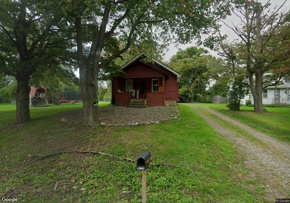
230 Pershing Ave Jackson, MI 49203
Estimated Value: $89,000 - $151,000
Studio
--
Bath
709
Sq Ft
$174/Sq Ft
Est. Value
About This Home
This home is located at 230 Pershing Ave, Jackson, MI 49203 and is currently estimated at $123,233, approximately $173 per square foot. 230 Pershing Ave is a home located in Jackson County with nearby schools including Western High School, Paragon Charter Academy, and Westchester Christian School.
Ownership History
Date
Name
Owned For
Owner Type
Purchase Details
Closed on
Sep 28, 2001
Sold by
Ladd Robert W and Ladd Kenya N
Bought by
Benn Carl L and Larose Rachel A
Current Estimated Value
Home Financials for this Owner
Home Financials are based on the most recent Mortgage that was taken out on this home.
Original Mortgage
$91,464
Outstanding Balance
$36,064
Interest Rate
6.99%
Mortgage Type
FHA
Estimated Equity
$87,169
Purchase Details
Closed on
Jul 27, 1999
Sold by
Chapin Douglas E and Ladd Gregg A
Bought by
Ladd Ii Robert W
Home Financials for this Owner
Home Financials are based on the most recent Mortgage that was taken out on this home.
Original Mortgage
$7,600
Interest Rate
7.68%
Create a Home Valuation Report for This Property
The Home Valuation Report is an in-depth analysis detailing your home's value as well as a comparison with similar homes in the area
Home Values in the Area
Average Home Value in this Area
Purchase History
| Date | Buyer | Sale Price | Title Company |
|---|---|---|---|
| Benn Carl L | $92,900 | -- | |
| Ladd Ii Robert W | $73,900 | -- | |
| Ladd Ii Robert W | $9,500 | -- |
Source: Public Records
Mortgage History
| Date | Status | Borrower | Loan Amount |
|---|---|---|---|
| Open | Benn Carl L | $91,464 | |
| Previous Owner | Ladd Ii Robert W | $7,600 | |
| Previous Owner | Ladd Ii Robert W | $73,800 |
Source: Public Records
Tax History
| Year | Tax Paid | Tax Assessment Tax Assessment Total Assessment is a certain percentage of the fair market value that is determined by local assessors to be the total taxable value of land and additions on the property. | Land | Improvement |
|---|---|---|---|---|
| 2025 | $1,662 | $50,050 | $0 | $0 |
| 2024 | $8 | $47,350 | $0 | $0 |
| 2023 | $791 | $40,600 | $0 | $0 |
| 2022 | $1,428 | $38,100 | $0 | $0 |
| 2021 | $1,407 | $34,200 | $0 | $0 |
| 2020 | $1,195 | $33,100 | $0 | $0 |
| 2019 | $1,212 | $32,600 | $0 | $0 |
| 2018 | $1,063 | $32,500 | $0 | $0 |
| 2017 | $1,007 | $32,900 | $0 | $0 |
| 2016 | $672 | $32,415 | $32,415 | $0 |
| 2015 | $970 | $29,239 | $29,239 | $0 |
| 2014 | $970 | $27,600 | $27,600 | $0 |
| 2013 | -- | $27,600 | $27,600 | $0 |
Source: Public Records
Map
Nearby Homes
- 0 Evelyn St
- 242 Kenneth St
- 3844 Westchester Blvd
- 2924 Sheridan Cirlce Unit 57
- 4116 Mulberry Cir Unit 31
- 0 Cummings Rd
- 4009 Magnolia Pkwy
- 3250 Carlton Blvd
- 0 Laurence Ave Unit 25062864
- 4070 Magnolia Pkwy
- VL Laurence Ave
- 0 VL Laurence Ave
- 693 Leo Rd
- 534 Barrett Ave
- 745 W Barrington Cir Unit 92
- 778 W Barrington Cir Unit 75
- 800 Obrien Rd
- 783 W Barrington Cir Unit 45
- 4650 Suffolk Ln Unit 31
- 760 Woodbine Blvd
- 226 Pershing Ave
- 221 Pershing Ave
- 210 Pershing Ave
- 248 Pershing Ave
- 245 Pershing Ave
- 249 Pershing Ave
- 150 Pershing Ave
- 314 Pershing Ave
- 149 Pershing Ave
- 136 Pershing Ave
- 237 Woodland Ave
- 315 Pershing Ave
- 241 Woodland Ave
- 324 Pershing Ave
- 133 Pershing Ave
- 3968 Catherine St
- 215 Woodland Ave
- 207 Woodland Ave
- 330 Pershing Ave
- 149 Woodland Ave
Your Personal Tour Guide
Ask me questions while you tour the home.