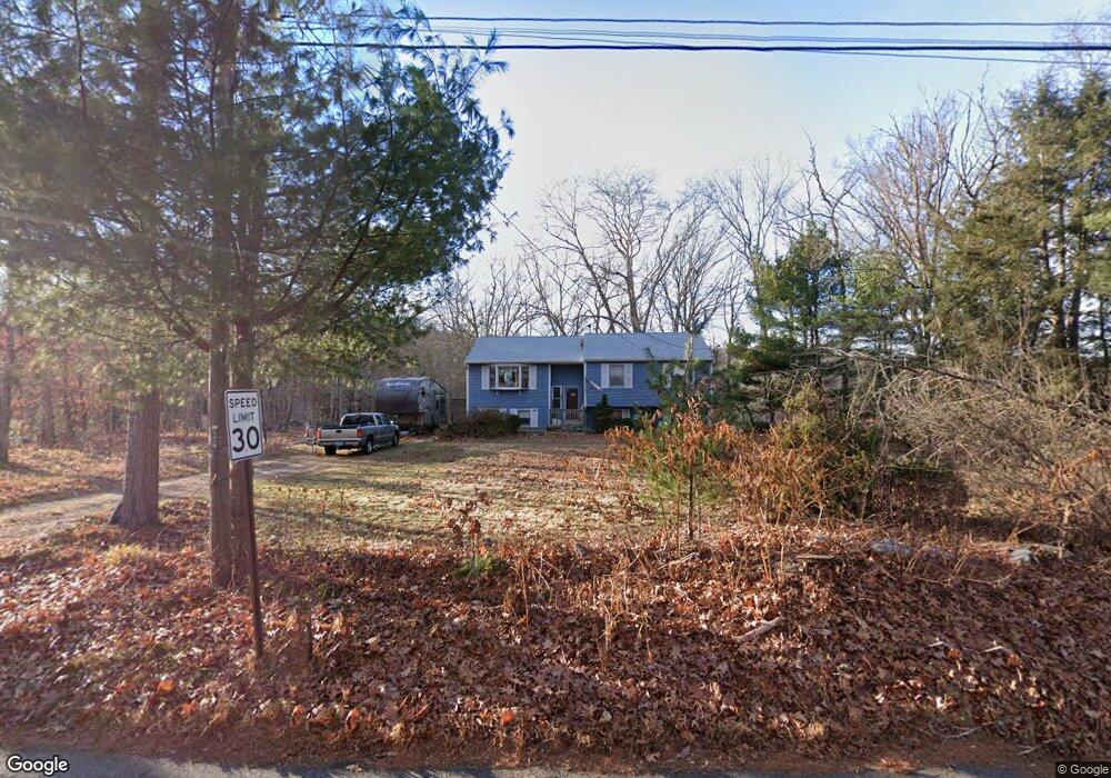
230 Plains Rd Coventry, CT 06238
Estimated Value: $368,000 - $423,000
3
Beds
3
Baths
1,274
Sq Ft
$313/Sq Ft
Est. Value
About This Home
This home is located at 230 Plains Rd, Coventry, CT 06238 and is currently estimated at $398,431, approximately $312 per square foot. 230 Plains Rd is a home located in Tolland County with nearby schools including George Hersey Robertson School, Coventry Grammar School, and Capt. Nathan Hale School.
Ownership History
Date
Name
Owned For
Owner Type
Purchase Details
Closed on
May 5, 1998
Sold by
Mcgetrick Jack and Mcgetrick Lysa
Bought by
Sentivany Karl and Sentivany Janice
Current Estimated Value
Home Financials for this Owner
Home Financials are based on the most recent Mortgage that was taken out on this home.
Original Mortgage
$100,000
Interest Rate
7.04%
Mortgage Type
Purchase Money Mortgage
Create a Home Valuation Report for This Property
The Home Valuation Report is an in-depth analysis detailing your home's value as well as a comparison with similar homes in the area
Home Values in the Area
Average Home Value in this Area
Purchase History
| Date | Buyer | Sale Price | Title Company |
|---|---|---|---|
| Sentivany Karl | $126,500 | -- | |
| Sentivany Karl | $126,500 | -- |
Source: Public Records
Mortgage History
| Date | Status | Borrower | Loan Amount |
|---|---|---|---|
| Open | Sentivany Karl | $110,000 | |
| Closed | Sentivany Karl | $100,500 | |
| Closed | Sentivany Karl | $100,000 |
Source: Public Records
Tax History
| Year | Tax Paid | Tax Assessment Tax Assessment Total Assessment is a certain percentage of the fair market value that is determined by local assessors to be the total taxable value of land and additions on the property. | Land | Improvement |
|---|---|---|---|---|
| 2025 | $5,978 | $251,600 | $51,000 | $200,600 |
| 2024 | $5,146 | $154,500 | $44,300 | $110,200 |
| 2023 | $4,904 | $154,500 | $44,300 | $110,200 |
| 2022 | $4,813 | $154,500 | $44,300 | $110,200 |
| 2021 | $4,813 | $154,500 | $44,300 | $110,200 |
| 2020 | $4,816 | $154,500 | $44,300 | $110,200 |
| 2019 | $4,975 | $154,500 | $44,300 | $110,200 |
| 2018 | $5,078 | $157,700 | $44,300 | $113,400 |
| 2017 | $5,046 | $157,700 | $44,300 | $113,400 |
| 2016 | $4,920 | $157,700 | $44,300 | $113,400 |
| 2015 | $4,920 | $157,700 | $44,300 | $113,400 |
| 2014 | $4,686 | $164,600 | $54,900 | $109,700 |
Source: Public Records
Map
Nearby Homes
- 106 S Street Extension
- 103 S Street Extension
- 457 Stafford Rd
- 550 High St
- 58 Candide Ln
- 97 Armstrong Rd
- 811 Pucker St
- 35 Wyllys Farm Rd
- 33 Oak Dr
- 30 Wyllys Farm Rd
- 60 Highland Rd
- 37 Wyllys Farm Rd
- 31 Wyllys Farm Rd
- 198 Forest Rd
- 0 Mansfield City Rd Unit LOT 2
- 0 Woodland Rd
- 55 Whites Hill Rd
- 498 Root Rd
- 127 U S 6
- 23 Thompson Hill Rd
- 232 Plains Rd
- 0 Plains Rd
- 261 Plains Rd
- 225 Plains Rd
- 277 Plains Rd
- 203 Plains Rd
- 273 Plains Rd
- 143 Plains Rd
- 150 Plains Rd
- 148 Plains Rd
- 139 S Street Extension
- 0 South St Unit G566467
- 0 South St Unit G582934
- 0 South St Unit G587706
- 0 South St Unit E270328
- 0 S Street Extension Unit G10231659
- 00 S Street Extension
- 000 South St
- 0 South St Unit 24134981
- 311 Plains Rd
Your Personal Tour Guide
Ask me questions while you tour the home.