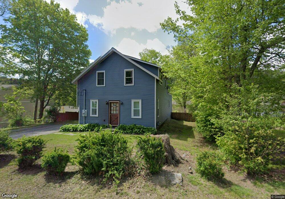
230 Reynolds Bridge Rd Thomaston, CT 06787
Estimated Value: $285,000 - $408,000
3
Beds
2
Baths
1,425
Sq Ft
$241/Sq Ft
Est. Value
About This Home
This home is located at 230 Reynolds Bridge Rd, Thomaston, CT 06787 and is currently estimated at $343,682, approximately $241 per square foot. 230 Reynolds Bridge Rd is a home located in Litchfield County with nearby schools including Black Rock School, Thomaston Center School, and Thomaston High School.
Ownership History
Date
Name
Owned For
Owner Type
Purchase Details
Closed on
Jul 16, 2021
Sold by
Lahey Keith and Lahey Bethany
Bought by
Monterio Margaret
Current Estimated Value
Home Financials for this Owner
Home Financials are based on the most recent Mortgage that was taken out on this home.
Original Mortgage
$216,997
Outstanding Balance
$196,891
Interest Rate
2.9%
Mortgage Type
FHA
Estimated Equity
$146,791
Purchase Details
Closed on
Dec 19, 2013
Sold by
Lahey Keith
Bought by
Lahey Keith and Lahey Bethany
Home Financials for this Owner
Home Financials are based on the most recent Mortgage that was taken out on this home.
Original Mortgage
$140,000
Interest Rate
4.15%
Purchase Details
Closed on
Aug 1, 2005
Sold by
Johnson Gary and Johnson Carmen
Bought by
Lahey Keith
Home Financials for this Owner
Home Financials are based on the most recent Mortgage that was taken out on this home.
Original Mortgage
$140,000
Interest Rate
5.67%
Create a Home Valuation Report for This Property
The Home Valuation Report is an in-depth analysis detailing your home's value as well as a comparison with similar homes in the area
Home Values in the Area
Average Home Value in this Area
Purchase History
| Date | Buyer | Sale Price | Title Company |
|---|---|---|---|
| Monterio Margaret | $221,000 | None Available | |
| Lahey Keith | -- | -- | |
| Lahey Keith | $175,000 | -- |
Source: Public Records
Mortgage History
| Date | Status | Borrower | Loan Amount |
|---|---|---|---|
| Open | Monterio Margaret | $216,997 | |
| Previous Owner | Lahey Keith | $140,000 | |
| Previous Owner | Lahey Keith | $140,000 |
Source: Public Records
Tax History Compared to Growth
Tax History
| Year | Tax Paid | Tax Assessment Tax Assessment Total Assessment is a certain percentage of the fair market value that is determined by local assessors to be the total taxable value of land and additions on the property. | Land | Improvement |
|---|---|---|---|---|
| 2025 | $5,046 | $140,910 | $44,870 | $96,040 |
| 2024 | $4,842 | $140,910 | $44,870 | $96,040 |
| 2023 | $4,739 | $140,910 | $44,870 | $96,040 |
| 2022 | $4,525 | $140,910 | $44,870 | $96,040 |
| 2021 | $4,163 | $115,220 | $44,870 | $70,350 |
| 2020 | $4,163 | $115,220 | $44,870 | $70,350 |
| 2019 | $4,209 | $115,220 | $44,870 | $70,350 |
| 2018 | $4,124 | $115,220 | $44,870 | $70,350 |
| 2017 | $4,038 | $115,220 | $44,870 | $70,350 |
| 2016 | $3,806 | $111,720 | $42,770 | $68,950 |
| 2015 | $3,696 | $109,900 | $42,770 | $67,130 |
| 2014 | $3,696 | $109,900 | $42,770 | $67,130 |
Source: Public Records
Map
Nearby Homes
- 228 Reynolds Bridge Rd
- 197 Pine Hill Rd Unit 2D
- 143 Pine Hill Rd Unit 20C
- 143 Pine Hill Rd Unit 15F
- 43 Pine Hill Rd
- 2 Branch Rd Unit 3G
- 2 Branch Rd Unit 6F
- 34 Warner Ln
- 203 Branch Rd Unit 5C
- 100 Pleasant View Rd
- 212 Branch Rd
- 147 Cedar Mountain Rd
- 194 Carter Rd
- 42 Litchfield St
- 58 Litchfield St
- 1045 Thomaston Rd
- 96 Elm St
- 239 Old Farms Rd
- 1402 Waterbury Rd Unit 1
- 60 Watch Tower Rd
- 218 Reynolds Bridge Rd
- 200 Reynolds Bridge Rd
- 212 Reynolds Bridge Rd
- 239 Reynolds Bridge Rd
- 245 Reynolds Bridge Rd
- 233 Reynolds Bridge Rd
- 211 Reynolds Bridge Rd
- 251 Reynolds Bridge Rd
- 192 Reynolds Bridge Rd
- 257 Reynolds Bridge Rd
- 182 Reynolds Bridge Rd
- 265 Reynolds Bridge Rd
- 176 Reynolds Bridge Rd
- 267 Reynolds Bridge Rd
- 167 Reynolds Bridge Rd
- 170 Reynolds Bridge Rd
- 168 Reynolds Bridge Rd
- 166 Reynolds Bridge Rd
- 165 Reynolds Bridge Rd