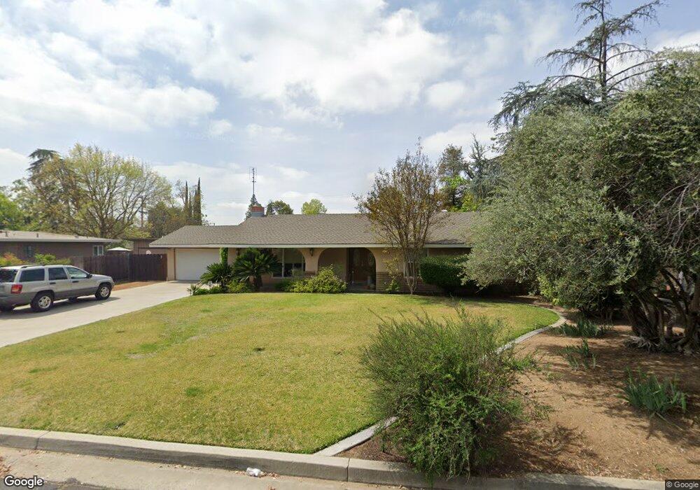
230 S Caesar Ave Fresno, CA 93727
Sunnyside NeighborhoodEstimated Value: $378,033 - $416,000
3
Beds
2
Baths
1,704
Sq Ft
$235/Sq Ft
Est. Value
About This Home
This home is located at 230 S Caesar Ave, Fresno, CA 93727 and is currently estimated at $400,008, approximately $234 per square foot. 230 S Caesar Ave is a home located in Fresno County with nearby schools including Easterby Elementary School, Kings Canyon Middle School, and Sunnyside High School.
Ownership History
Date
Name
Owned For
Owner Type
Purchase Details
Closed on
Jun 22, 2007
Sold by
Mcpherson Mary L
Bought by
Mcpherson Gerald B and Mcpherson Mary L
Current Estimated Value
Home Financials for this Owner
Home Financials are based on the most recent Mortgage that was taken out on this home.
Original Mortgage
$60,000
Interest Rate
6.04%
Mortgage Type
Purchase Money Mortgage
Purchase Details
Closed on
Dec 18, 1995
Sold by
Mcpherson Gerald B
Bought by
Mcpherson Mary L
Home Financials for this Owner
Home Financials are based on the most recent Mortgage that was taken out on this home.
Original Mortgage
$81,925
Interest Rate
7.38%
Create a Home Valuation Report for This Property
The Home Valuation Report is an in-depth analysis detailing your home's value as well as a comparison with similar homes in the area
Home Values in the Area
Average Home Value in this Area
Purchase History
| Date | Buyer | Sale Price | Title Company |
|---|---|---|---|
| Mcpherson Gerald B | -- | Financial Title Company | |
| Mcpherson Mary L | -- | Stewart Title |
Source: Public Records
Mortgage History
| Date | Status | Borrower | Loan Amount |
|---|---|---|---|
| Closed | Mcpherson Gerald B | $60,000 | |
| Closed | Mcpherson Mary L | $81,925 |
Source: Public Records
Tax History
| Year | Tax Paid | Tax Assessment Tax Assessment Total Assessment is a certain percentage of the fair market value that is determined by local assessors to be the total taxable value of land and additions on the property. | Land | Improvement |
|---|---|---|---|---|
| 2025 | $2,064 | $168,847 | $30,002 | $138,845 |
| 2023 | $1,944 | $162,292 | $28,838 | $133,454 |
| 2022 | $1,916 | $159,111 | $28,273 | $130,838 |
| 2021 | $1,861 | $155,992 | $27,719 | $128,273 |
| 2020 | $1,853 | $154,393 | $27,435 | $126,958 |
| 2019 | $1,779 | $151,367 | $26,898 | $124,469 |
| 2018 | $1,739 | $148,400 | $26,371 | $122,029 |
| 2017 | $1,708 | $145,491 | $25,854 | $119,637 |
| 2016 | $1,650 | $142,640 | $25,348 | $117,292 |
| 2015 | $1,623 | $140,499 | $24,968 | $115,531 |
| 2014 | $1,602 | $137,747 | $24,479 | $113,268 |
Source: Public Records
Map
Nearby Homes
- 5167 E Balch Ave
- 240 S Bailey Ave
- 5407 E Tulare St
- 5458 E Tulare St
- 5446 E Mono St
- 5132 E Washington Ave
- 5145 E Lane Ave Unit 252
- 1062 S de Sante Ave
- 5225 E Belmont Ave
- 5017 E Washington Ave
- 5064 E Belmont Ave
- 4935 E Kerckhoff Ave
- 5545 E Washington Ave
- 4907 E Platt Ave
- 907 S Rogers Ln
- 4984 E Belmont Ave
- 1521 S Bush Ave
- 5576 E Belmont Ave
- 4877 E Illinois Ave
- 5478 E Butler Ave
- 220 S Caesar Ave
- 240 S Caesar Ave
- 237 S Bush Ave
- 221 S Bush Ave
- 243 S Bush Ave
- 316 S Caesar Ave
- 245 S Caesar Ave
- 215 S Caesar Ave
- 331 S Bush Ave
- 209 S Bush Ave
- 326 S Caesar Ave
- 162 S Villa Ave
- 5268 E Platt Ave
- 5258 E Platt Ave
- 345 S Bush Ave
- 336 S Caesar Ave
- 312 S Bush Ave
- 346 S Caesar Ave
- 330 S Bush Ave
- 160 S Bush Ave
Your Personal Tour Guide
Ask me questions while you tour the home.