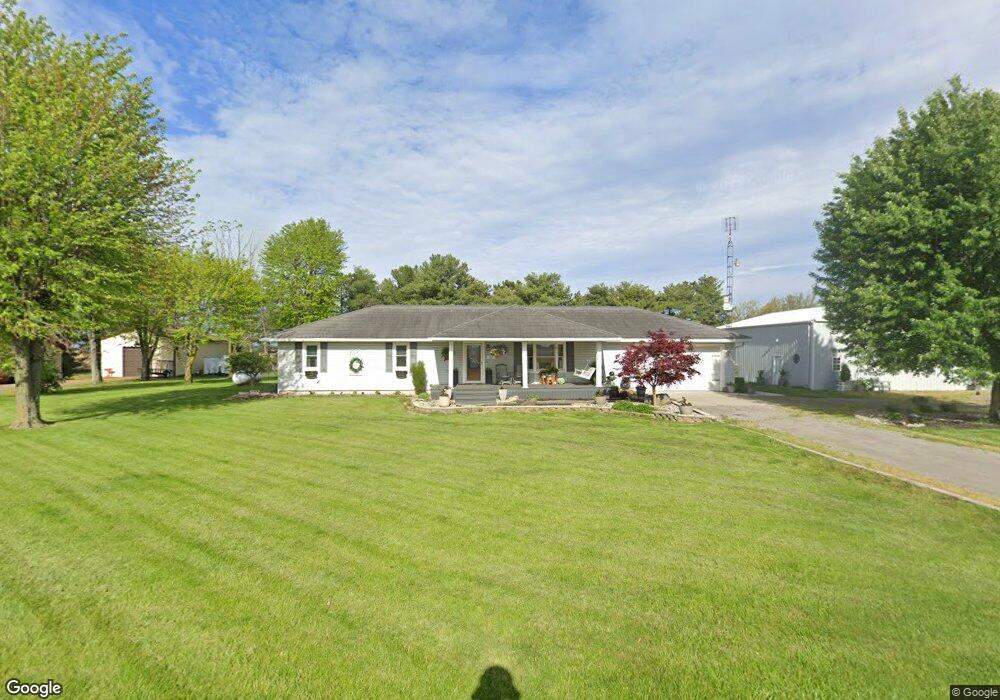
230 S Kill Rd Spencerville, OH 45887
Estimated Value: $162,000 - $258,274
3
Beds
2
Baths
1,554
Sq Ft
$142/Sq Ft
Est. Value
About This Home
This home is located at 230 S Kill Rd, Spencerville, OH 45887 and is currently estimated at $220,569, approximately $141 per square foot. 230 S Kill Rd is a home located in Allen County with nearby schools including Spencerville Elementary School, Spencerville Middle School, and Spencerville High School.
Ownership History
Date
Name
Owned For
Owner Type
Purchase Details
Closed on
Dec 19, 2008
Sold by
Kill Kevin G and Kill Brian J
Bought by
Kill Jeffrey A and Kill Penny A
Current Estimated Value
Purchase Details
Closed on
Aug 4, 1986
Bought by
Kill Jeffrey A
Create a Home Valuation Report for This Property
The Home Valuation Report is an in-depth analysis detailing your home's value as well as a comparison with similar homes in the area
Purchase History
| Date | Buyer | Sale Price | Title Company |
|---|---|---|---|
| Kill Jeffrey A | -- | Attorney | |
| Kill Jeffrey A | -- | -- |
Source: Public Records
Tax History
| Year | Tax Paid | Tax Assessment Tax Assessment Total Assessment is a certain percentage of the fair market value that is determined by local assessors to be the total taxable value of land and additions on the property. | Land | Improvement |
|---|---|---|---|---|
| 2024 | $2,335 | $83,340 | $12,040 | $71,300 |
| 2023 | $1,647 | $57,480 | $8,300 | $49,180 |
| 2022 | $1,776 | $58,420 | $8,300 | $50,120 |
| 2021 | $1,773 | $58,420 | $8,300 | $50,120 |
| 2020 | $1,488 | $49,250 | $7,630 | $41,620 |
| 2019 | $1,488 | $49,250 | $7,630 | $41,620 |
| 2018 | $1,514 | $49,250 | $7,630 | $41,620 |
| 2017 | $1,311 | $44,590 | $7,630 | $36,960 |
| 2016 | $1,279 | $44,590 | $7,630 | $36,960 |
| 2015 | $1,442 | $44,590 | $7,630 | $36,960 |
| 2014 | $1,442 | $48,900 | $7,630 | $41,270 |
| 2013 | $1,456 | $48,900 | $7,630 | $41,270 |
Source: Public Records
Map
Nearby Homes
- 14101 Allentown Rd
- 21302 Masters Rd
- 433 W 4th St
- 421 W 4th St
- 417 W 4th St
- 408 N Mulberry St
- 714 Briggs Ave Unit 1
- 313 S Broadway St
- 305 N Broadway St
- 510 S Broadway St
- 522 S Broadway St
- 00 Kleinoeder Rd
- 21183 Ohio 116
- 19059 Wittington St
- 15044 Main St
- 18906 Bebb St
- 594 N Conant Rd
- 19195 State Rd
- 8240 Spencerville Rd
- 241 King St
Your Personal Tour Guide
Ask me questions while you tour the home.