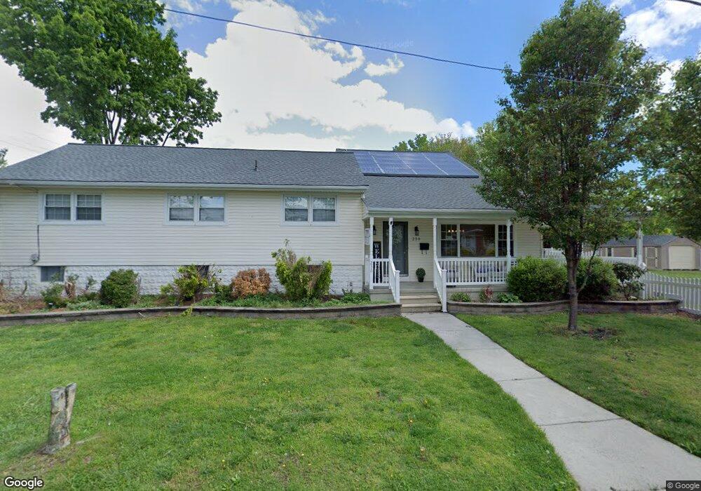
230 Walnut St West Deptford, NJ 08096
West Deptford Township NeighborhoodEstimated Value: $439,000 - $513,000
5
Beds
2
Baths
2,512
Sq Ft
$187/Sq Ft
Est. Value
About This Home
This home is located at 230 Walnut St, West Deptford, NJ 08096 and is currently estimated at $469,643, approximately $186 per square foot. 230 Walnut St is a home located in Gloucester County with nearby schools including Oakview Elementary School, Red Bank Elementary School, and Green-Fields Elementary School.
Ownership History
Date
Name
Owned For
Owner Type
Purchase Details
Closed on
May 24, 2022
Sold by
Patricia Murray
Bought by
Hoolahan Suzanne F and Hoolahan David K
Current Estimated Value
Purchase Details
Closed on
Nov 19, 2020
Sold by
Murray Patricia C
Bought by
Murray Patricia C and Nelson Suzanne F
Purchase Details
Closed on
Sep 6, 2013
Sold by
Fasola Frank W
Bought by
Vespucci Patricia C
Purchase Details
Closed on
Mar 17, 2009
Sold by
Pilla Matthew R and Pilla Michelle
Bought by
Fasola Frank W
Home Financials for this Owner
Home Financials are based on the most recent Mortgage that was taken out on this home.
Original Mortgage
$240,562
Interest Rate
5.25%
Mortgage Type
FHA
Purchase Details
Closed on
Dec 22, 2005
Sold by
Fasola Frank W and Fasola Mary Ellen
Bought by
Pilla Matthew R and Pilla Michelle
Purchase Details
Closed on
Nov 3, 2000
Sold by
Huesser Stephen and Mullen Catherine
Bought by
Fasola Frank W and Fasola Mary Ellen
Home Financials for this Owner
Home Financials are based on the most recent Mortgage that was taken out on this home.
Original Mortgage
$124,000
Interest Rate
7.78%
Purchase Details
Closed on
Sep 9, 2000
Sold by
Huesser Stephen and Mullen Catherine
Bought by
Huesser Stephen and Mullen Catherine
Home Financials for this Owner
Home Financials are based on the most recent Mortgage that was taken out on this home.
Original Mortgage
$124,000
Interest Rate
7.78%
Purchase Details
Closed on
Dec 31, 1996
Sold by
Huesser Margaret Ann
Bought by
Huesser Stephen and Mullen Catherine
Create a Home Valuation Report for This Property
The Home Valuation Report is an in-depth analysis detailing your home's value as well as a comparison with similar homes in the area
Home Values in the Area
Average Home Value in this Area
Purchase History
| Date | Buyer | Sale Price | Title Company |
|---|---|---|---|
| Hoolahan Suzanne F | -- | -- | |
| Hoolahan Suzanne F | -- | None Listed On Document | |
| Murray Patricia C | -- | None Available | |
| Vespucci Patricia C | $260,000 | -- | |
| Fasola Frank W | $245,000 | Ctl Title Ins Agency Inc | |
| Pilla Matthew R | $312,500 | Precision Title Agency | |
| Fasola Frank W | -- | Freedom Title & Abstract | |
| Huesser Stephen | -- | -- | |
| Huesser Stephen | $125,000 | -- |
Source: Public Records
Mortgage History
| Date | Status | Borrower | Loan Amount |
|---|---|---|---|
| Previous Owner | Fasola Frank W | $240,562 | |
| Previous Owner | Fasola Frank W | $124,000 |
Source: Public Records
Tax History Compared to Growth
Tax History
| Year | Tax Paid | Tax Assessment Tax Assessment Total Assessment is a certain percentage of the fair market value that is determined by local assessors to be the total taxable value of land and additions on the property. | Land | Improvement |
|---|---|---|---|---|
| 2025 | $8,786 | $251,600 | $70,000 | $181,600 |
| 2024 | $8,673 | $251,600 | $70,000 | $181,600 |
| 2023 | $8,673 | $251,600 | $70,000 | $181,600 |
| 2022 | $8,632 | $251,600 | $70,000 | $181,600 |
| 2021 | $8,134 | $251,600 | $70,000 | $181,600 |
| 2020 | $8,582 | $251,600 | $70,000 | $181,600 |
| 2019 | $8,343 | $251,600 | $70,000 | $181,600 |
| 2018 | $8,117 | $251,600 | $70,000 | $181,600 |
| 2017 | $7,928 | $251,600 | $70,000 | $181,600 |
| 2016 | $7,707 | $251,600 | $70,000 | $181,600 |
| 2015 | $7,342 | $251,600 | $70,000 | $181,600 |
| 2014 | $6,977 | $251,600 | $70,000 | $181,600 |
Source: Public Records
Map
Nearby Homes
- 193 Dubois Ave
- 654 Frances Ave
- 210 Lawnton Ave
- 302 W Red Bank Ave
- 815 Harker Ave
- 131 Watkins Ave
- 7 Victorian Way
- 3 Victorian Way
- 2 Victorian Way
- 46 Lynn Dr
- 121 Crescent Ave
- 83 Lynn Dr
- 70 Crescent Ave
- 1029 Tatum St
- 120 Progress Ave
- 38 Watkins Ave
- 112 Progress Ave
- 41 Crescent Ave
- 17 Watkins Ave
- 1174 Harker Ave
- 672 Carter Ave
- 231 Walnut St
- 680 Carter Ave
- 206 Walnut St
- 655 Carter Ave
- 667 Shields Ave
- 673 Shields Ave
- 622 Carter Ave
- 690 Carter Ave
- 207 Walnut St
- 673 Carter Ave
- 681 Shields Ave
- 629 Carter Ave
- 252 Walnut St
- 681 Carter Ave
- 612 Carter Ave
- 623 Shields Ave
- 641 Carter Ave
- 691 Shields Ave
- 700 Carter Ave