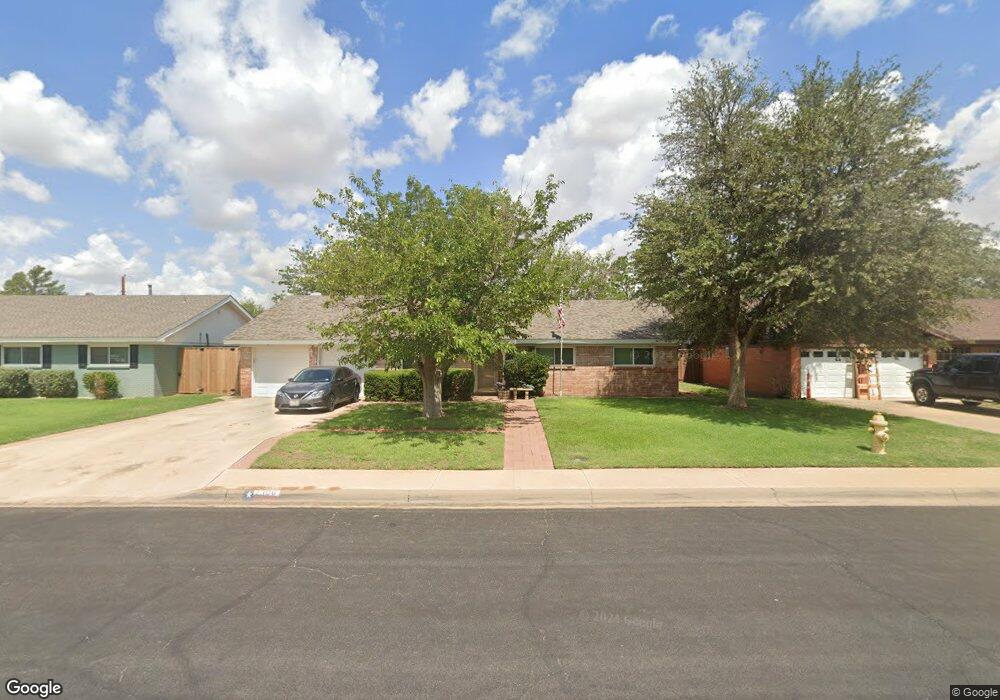
2300 Apperson Dr Midland, TX 79705
Estimated Value: $305,000 - $333,000
--
Bed
2
Baths
1,876
Sq Ft
$170/Sq Ft
Est. Value
About This Home
This home is located at 2300 Apperson Dr, Midland, TX 79705 and is currently estimated at $318,765, approximately $169 per square foot. 2300 Apperson Dr is a home located in Midland County with nearby schools including Midland High School, Robert H. Goddard Junior High School, and The Hillander School.
Ownership History
Date
Name
Owned For
Owner Type
Purchase Details
Closed on
Dec 15, 1993
Bought by
Richardson Bobby Clint
Current Estimated Value
Purchase Details
Closed on
Mar 1, 1991
Bought by
Richardson Bobby Clint
Purchase Details
Closed on
Jan 1, 1991
Bought by
Richardson Bobby Clint
Purchase Details
Closed on
Jul 1, 1990
Bought by
Richardson Bobby Clint
Purchase Details
Closed on
Aug 1, 1984
Bought by
Richardson Bobby Clint
Create a Home Valuation Report for This Property
The Home Valuation Report is an in-depth analysis detailing your home's value as well as a comparison with similar homes in the area
Home Values in the Area
Average Home Value in this Area
Purchase History
| Date | Buyer | Sale Price | Title Company |
|---|---|---|---|
| Richardson Bobby Clint | -- | -- | |
| Richardson Bobby Clint | -- | -- | |
| Richardson Bobby Clint | -- | -- | |
| Richardson Bobby Clint | -- | -- | |
| Richardson Bobby Clint | -- | -- |
Source: Public Records
Tax History Compared to Growth
Tax History
| Year | Tax Paid | Tax Assessment Tax Assessment Total Assessment is a certain percentage of the fair market value that is determined by local assessors to be the total taxable value of land and additions on the property. | Land | Improvement |
|---|---|---|---|---|
| 2025 | $2,754 | $388,520 | $23,340 | $365,180 |
| 2024 | $2,759 | $254,850 | $23,340 | $231,510 |
| 2023 | $2,636 | $249,630 | $23,340 | $226,290 |
| 2022 | $3,778 | $241,830 | $23,340 | $218,490 |
| 2021 | $4,700 | $269,800 | $23,340 | $246,460 |
| 2020 | $3,797 | $253,400 | $23,340 | $230,060 |
| 2019 | $4,779 | $252,420 | $23,340 | $230,060 |
| 2018 | $4,462 | $229,470 | $23,340 | $206,130 |
| 2017 | $4,335 | $222,930 | $23,340 | $199,590 |
| 2016 | $4,339 | $222,770 | $23,340 | $199,430 |
| 2015 | -- | $222,230 | $23,340 | $199,430 |
| 2014 | -- | $205,160 | $23,340 | $181,820 |
Source: Public Records
Map
Nearby Homes
- 19 Winchester Ct
- 2406 Dartmouth Dr
- 2400 W Dengar Ave
- 2409 Stutz Place
- 2305 Auburn Place
- 2406 Stutz Place
- 2505 Maxwell Dr
- 2205 Cimmaron Ave
- 2207 Raleigh Point Dr
- 63 Ironwood Ct Unit 91
- 63 Ironwood Ct
- 5 Chatham Ct
- 2605 Inwood Ct
- 2601 W Dengar Ave
- 2704 N L St
- 2609 Mcclintic St
- 2400 Metz Ct
- 4 Amhurst Ct
- 2603 Hodges St
- 2811 Durant Dr
- 2302 Apperson Dr
- 2301 Apperson Dr
- 2303 Apperson Dr
- 2304 Apperson Dr
- 2305 Apperson Dr
- 1 Winchester Ct
- 2 Winchester Ct
- 2306 Apperson Dr
- 3 Winchester Ct
- 4 Winchester Ct
- 2307 Apperson Dr
- 5 Winchester Ct
- 2308 Apperson Dr
- 6 Winchester Ct
- 7 Winchester Ct
- 2400 Apperson Dr
- 20 Winchester Ct
- 8 Winchester Ct
- 18 Winchester Ct
- 17 Winchester Ct