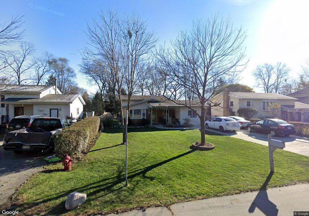
2300 Ashland Ave Rolling Meadows, IL 60008
Estimated Value: $314,000 - $396,000
3
Beds
2
Baths
1,287
Sq Ft
$272/Sq Ft
Est. Value
About This Home
This home is located at 2300 Ashland Ave, Rolling Meadows, IL 60008 and is currently estimated at $350,378, approximately $272 per square foot. 2300 Ashland Ave is a home located in Cook County with nearby schools including Kimball Hill Elementary School, Carl Sandburg Junior High School, and Rolling Meadows High School.
Ownership History
Date
Name
Owned For
Owner Type
Purchase Details
Closed on
Jul 29, 2025
Sold by
Gonzalez Heriberto and Gonzalez Teresa
Bought by
Gonzalez Declaration Of Trust and Gonzalez
Current Estimated Value
Purchase Details
Closed on
Apr 27, 2000
Sold by
Mortensen James and Mortensen Faith
Bought by
Gonzalez Heriberto and Gonzalez Teresa
Home Financials for this Owner
Home Financials are based on the most recent Mortgage that was taken out on this home.
Original Mortgage
$116,000
Interest Rate
8.26%
Create a Home Valuation Report for This Property
The Home Valuation Report is an in-depth analysis detailing your home's value as well as a comparison with similar homes in the area
Home Values in the Area
Average Home Value in this Area
Purchase History
| Date | Buyer | Sale Price | Title Company |
|---|---|---|---|
| Gonzalez Declaration Of Trust | -- | None Listed On Document | |
| Gonzalez Heriberto | $156,000 | -- |
Source: Public Records
Mortgage History
| Date | Status | Borrower | Loan Amount |
|---|---|---|---|
| Previous Owner | Gonzalez Heriberto | $116,000 |
Source: Public Records
Tax History
| Year | Tax Paid | Tax Assessment Tax Assessment Total Assessment is a certain percentage of the fair market value that is determined by local assessors to be the total taxable value of land and additions on the property. | Land | Improvement |
|---|---|---|---|---|
| 2025 | $6,538 | $33,000 | $5,708 | $27,292 |
| 2024 | $6,538 | $27,000 | $4,830 | $22,170 |
| 2023 | $6,271 | $27,000 | $4,830 | $22,170 |
| 2022 | $6,271 | $27,000 | $4,830 | $22,170 |
| 2021 | $5,947 | $23,302 | $2,853 | $20,449 |
| 2020 | $5,940 | $23,302 | $2,853 | $20,449 |
| 2019 | $5,994 | $26,036 | $2,853 | $23,183 |
| 2018 | $6,750 | $23,445 | $2,634 | $20,811 |
| 2017 | $6,633 | $23,445 | $2,634 | $20,811 |
| 2016 | $6,458 | $23,445 | $2,634 | $20,811 |
| 2015 | $6,618 | $22,736 | $2,414 | $20,322 |
| 2014 | $6,495 | $22,736 | $2,414 | $20,322 |
| 2013 | $6,318 | $22,736 | $2,414 | $20,322 |
Source: Public Records
Map
Nearby Homes
- 2401 Rohlwing Rd
- 2302 Flicker Ln
- 2600 Brookwood Way Dr Unit 316
- 2600 Brookwood Way Dr Unit 305
- 2650 Brookwood Way Dr Unit 313
- 2650 Brookwood Way Dr Unit 108
- 304 E Tall Trees Ln
- 2 Croydon on Duxbury
- 4406 Euclid Ave Unit 2C
- 2 Stuart on Oxford
- 3 Holyoke on Auburn
- 4704 Euclid Ave Unit 1B
- 4704 Euclid Ave Unit 47042D
- 3000 California Ave
- 3345 Kirchoff Rd Unit 5C
- 3265 Kirchoff Rd Unit 116
- 3135 Town Square Dr Unit 401
- 3135 Town Square Dr Unit 104
- 3100 Town Square Dr Unit 308
- 3100 Town Square Dr Unit 204
- 2345 Ashland Ave
- 2280 Ashland Ave
- 2350 Ashland Ave
- 2260 Ashland Ave
- 2281 Forest Ave
- 2301 Forest Ave
- 2261 Forest Ave
- 2241 Forest Ave
- 2391 Forest Ave
- 2221 Forest Ave
- 2400 Ashland Ave
- 2300 Forest Ave
- 2280 Forest Ave
- 2431 Forest Ave
- 4010 Emerson Ave
- 2260 Forest Ave
- 2380 Forest Ave
- 2240 Forest Ave
- 2220 Forest Ave
- 2297 Theda Ln
Your Personal Tour Guide
Ask me questions while you tour the home.