M
Seller's Agent in 2021
Mona Winn
Davis Realty of NH and VT, Inc.


Estimated Value: $535,000 - $565,832
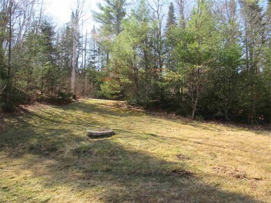
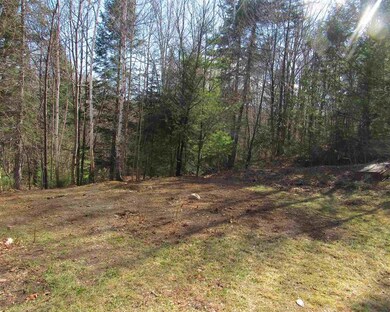
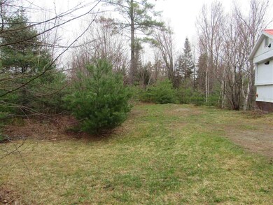
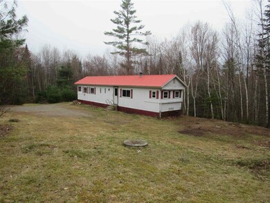
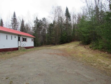
This 4.72 acre property with +\- 867 feet of frontage on beautiful Cow Brook is located approximately 5 miles from Littleton’s award winning downtown. Located approximately 3 miles from exit 43 on I93, this property offers convenient access to snow mobile trails, Moore Reservoir, PRKR mountain biking trails, premier ski areas, picturesque golf courses, and many other recreational activities. This property features a dug well, septic system, Littleton Water and Light electricity, Spectrum cable, and landline phone. There is currently a 1968 Skyline mobile home located on site. This property features a unique opportunity to customize to your own imagination. Whether it be new home construction, a tiny home, or a weekend getaway to park a camper, this property offers amazing opportunities.
Last Agent to Sell the Property
Mona Winn
Davis Realty of NH and VT, Inc. License #011687 Listed on: 04/21/2021
| Date | Buyer | Sale Price | Title Company |
|---|---|---|---|
| Jackson Tim | $10,000 | -- |
| Date | Event | Price | List to Sale | Price per Sq Ft | Prior Sale |
|---|---|---|---|---|---|
| 07/01/2021 07/01/21 | Sold | $88,700 | -10.1% | $132 / Sq Ft | |
| 06/02/2021 06/02/21 | Pending | -- | -- | -- | |
| 04/21/2021 04/21/21 | For Sale | $98,700 | +182.0% | $147 / Sq Ft | |
| 08/28/2020 08/28/20 | Sold | $35,000 | 0.0% | $52 / Sq Ft | View Prior Sale |
| 08/19/2020 08/19/20 | Pending | -- | -- | -- | |
| 08/18/2020 08/18/20 | For Sale | $35,000 | -- | $52 / Sq Ft |
| Year | Tax Paid | Tax Assessment Tax Assessment Total Assessment is a certain percentage of the fair market value that is determined by local assessors to be the total taxable value of land and additions on the property. | Land | Improvement |
|---|---|---|---|---|
| 2024 | $6,200 | $248,600 | $34,700 | $213,900 |
| 2023 | $5,603 | $248,600 | $34,700 | $213,900 |
| 2022 | $800 | $34,700 | $34,700 | $0 |
| 2021 | $800 | $34,700 | $34,700 | $0 |
| 2020 | $933 | $43,100 | $34,700 | $8,400 |
| 2019 | $947 | $41,000 | $31,600 | $9,400 |
| 2018 | $947 | $41,000 | $31,600 | $9,400 |
| 2017 | $1,255 | $48,600 | $28,200 | $20,400 |
| 2016 | $1,275 | $49,200 | $28,200 | $21,000 |
| 2015 | $996 | $42,700 | $23,000 | $19,700 |
| 2014 | $948 | $42,700 | $23,000 | $19,700 |
| 2013 | $973 | $43,300 | $23,000 | $20,300 |
M
Seller's Agent in 2021
Mona Winn
Davis Realty of NH and VT, Inc.

Buyer's Agent in 2021
Cindy Sparks
Coldwell Banker LIFESTYLES- Littleton
(603) 991-3529
32 in this area
81 Total Sales
Source: PrimeMLS
MLS Number: 4856836
APN: LTLN-000014-000025
Disclaimer: Certain information contained herein is derived from information provided by parties other than Homes.com. All information provided is deemed reliable, but is not guaranteed to be accurate and should be independently verified.
![]() Copyright 2025 PrimeMLS, Inc. All rights reserved. This information is deemed reliable, but not guaranteed. The data relating to real estate displayed on this display comes in part from the IDX Program of PrimeMLS. The information being provided is for consumers’ personal, non-commercial use and may not be used for any purpose other than to identify prospective properties consumers may be interested in purchasing.
Copyright 2025 PrimeMLS, Inc. All rights reserved. This information is deemed reliable, but not guaranteed. The data relating to real estate displayed on this display comes in part from the IDX Program of PrimeMLS. The information being provided is for consumers’ personal, non-commercial use and may not be used for any purpose other than to identify prospective properties consumers may be interested in purchasing.