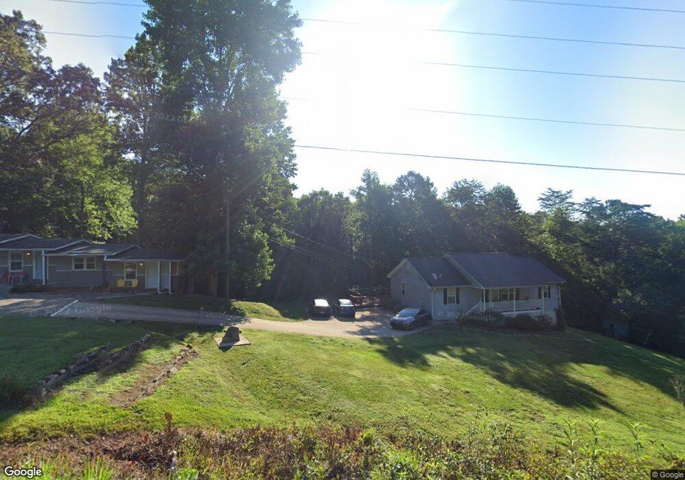
2300 Highway 52 W Unit B Dahlonega, GA 30533
Estimated Value: $585,000 - $731,000
--
Bed
2
Baths
352
Sq Ft
$1,847/Sq Ft
Est. Value
About This Home
This home is located at 2300 Highway 52 W Unit B, Dahlonega, GA 30533 and is currently estimated at $650,097, approximately $1,846 per square foot. 2300 Highway 52 W Unit B is a home located in Lumpkin County with nearby schools including Lumpkin County High School.
Ownership History
Date
Name
Owned For
Owner Type
Purchase Details
Closed on
Mar 31, 2023
Sold by
Geisel Investments Llc
Bought by
A2s Group Llc
Current Estimated Value
Home Financials for this Owner
Home Financials are based on the most recent Mortgage that was taken out on this home.
Original Mortgage
$400,000
Outstanding Balance
$223,159
Interest Rate
6.65%
Mortgage Type
Mortgage Modification
Estimated Equity
$426,938
Purchase Details
Closed on
Jan 21, 2016
Sold by
Spinelli Frank M
Bought by
Geisel Investments Llc
Purchase Details
Closed on
Dec 19, 2013
Sold by
Dunson Doris
Bought by
Spinelli Frank M
Create a Home Valuation Report for This Property
The Home Valuation Report is an in-depth analysis detailing your home's value as well as a comparison with similar homes in the area
Home Values in the Area
Average Home Value in this Area
Purchase History
| Date | Buyer | Sale Price | Title Company |
|---|---|---|---|
| A2s Group Llc | $542,500 | -- | |
| Geisel Investments Llc | $190,000 | -- | |
| Spinelli Frank M | -- | -- |
Source: Public Records
Mortgage History
| Date | Status | Borrower | Loan Amount |
|---|---|---|---|
| Open | A2s Group Llc | $400,000 |
Source: Public Records
Tax History Compared to Growth
Tax History
| Year | Tax Paid | Tax Assessment Tax Assessment Total Assessment is a certain percentage of the fair market value that is determined by local assessors to be the total taxable value of land and additions on the property. | Land | Improvement |
|---|---|---|---|---|
| 2024 | $5,298 | $222,421 | $30,481 | $191,940 |
| 2023 | $4,078 | $173,354 | $27,020 | $146,334 |
| 2022 | $3,685 | $148,845 | $22,515 | $126,330 |
| 2021 | $3,309 | $129,249 | $22,515 | $106,734 |
| 2020 | $3,315 | $125,664 | $21,574 | $104,090 |
| 2019 | $3,345 | $125,664 | $21,574 | $104,090 |
| 2018 | $3,218 | $113,413 | $21,574 | $91,839 |
| 2017 | $2,199 | $109,757 | $21,574 | $88,183 |
| 2016 | $767 | $25,638 | $17,626 | $8,012 |
| 2015 | $676 | $25,639 | $17,626 | $8,012 |
| 2014 | $676 | $25,639 | $17,626 | $8,012 |
| 2013 | -- | $25,638 | $17,626 | $8,012 |
Source: Public Records
Map
Nearby Homes
- 9 W Woods Ct
- 245 W Woods Dr
- 235 W Woods Dr
- 436 Applewood Ln
- 78 Etowah West Dr
- 115 W Woods Dr
- 155 Braeburn Ln
- 5.31 Tom Bell Odom Rd
- 604 Sheep Wallow Rd
- 20 Angels Way
- 543 Rider Mill Rd
- 108 Chariots Dr
- 3A Patriot View Dr
- 10 Strada Del Vino
- 0 Strada Del Vino Unit 10
- 33 Tj Mote Rd
- 33 T J Mote Rd
- 50 Loyal Dr
- 2300 Highway 52 W Unit 2302A
- 2300 Highway 52 W
- 2300B Highway 52 W
- 2300 Highway 52 W Unit A
- 2300 Georgia 52
- 2302 Georgia 52 Unit B
- 2302B Hwy 52
- 2302 Georgia 52 Unit A
- 2302 Highway 52 W Unit A
- 2302 Highway 52 W
- 2302 Highway 52 W Unit B
- 2302 Highway 52 W
- 2302 Highway 52 W
- 3171 E 52 Hwy
- 2331 Georgia 52
- 2331 Highway 52 W Unit Suite E
- 2331 Highway 52 W Unit Suite G
- 2331 Highway 52 W
- 0 Frank Christian Rd Unit 1AC 8312735
- 0 Frank Christian Rd Unit 1AC