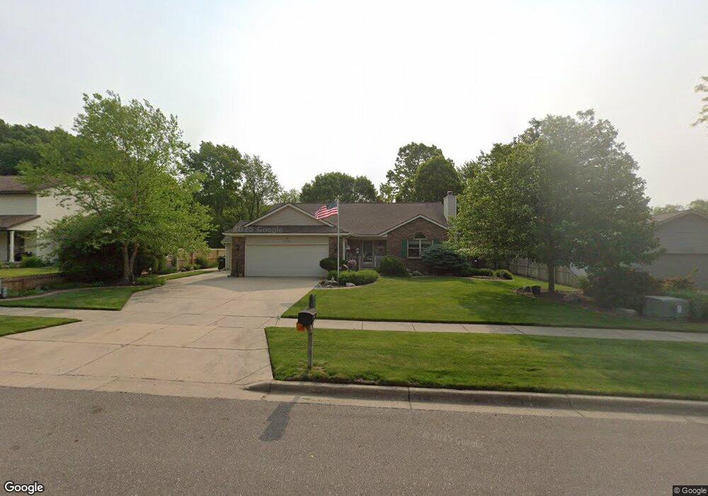
2300 Pheasant Ave NW Grand Rapids, MI 49534
Estimated Value: $399,000 - $466,000
3
Beds
3
Baths
2,059
Sq Ft
$208/Sq Ft
Est. Value
About This Home
This home is located at 2300 Pheasant Ave NW, Grand Rapids, MI 49534 and is currently estimated at $427,857, approximately $207 per square foot. 2300 Pheasant Ave NW is a home located in Kent County with nearby schools including Kenowa Hills Central Elementary School, Kenowa Hills Middle School, and Kenowa Hills High School.
Ownership History
Date
Name
Owned For
Owner Type
Purchase Details
Closed on
Sep 26, 2014
Sold by
Thompson Lucian P
Bought by
Thompson Joann M
Current Estimated Value
Purchase Details
Closed on
Feb 18, 2003
Sold by
Thompson Lucian P and Thompson Joann M
Bought by
Thompson Lucian P and Thompson Joann M
Home Financials for this Owner
Home Financials are based on the most recent Mortgage that was taken out on this home.
Original Mortgage
$70,000
Interest Rate
5.45%
Purchase Details
Closed on
Nov 24, 1992
Bought by
Thompson Lucian P and Thompson Lucian P
Purchase Details
Closed on
Jul 15, 1991
Bought by
Tompson Lucian P and Thompson Lucian P
Create a Home Valuation Report for This Property
The Home Valuation Report is an in-depth analysis detailing your home's value as well as a comparison with similar homes in the area
Home Values in the Area
Average Home Value in this Area
Purchase History
| Date | Buyer | Sale Price | Title Company |
|---|---|---|---|
| Thompson Joann M | -- | None Available | |
| Thompson Lucian P | -- | -- | |
| Thompson Lucian P | $134,000 | -- | |
| Tompson Lucian P | $26,000 | -- |
Source: Public Records
Mortgage History
| Date | Status | Borrower | Loan Amount |
|---|---|---|---|
| Closed | Thompson Lucian P | $70,000 |
Source: Public Records
Tax History Compared to Growth
Tax History
| Year | Tax Paid | Tax Assessment Tax Assessment Total Assessment is a certain percentage of the fair market value that is determined by local assessors to be the total taxable value of land and additions on the property. | Land | Improvement |
|---|---|---|---|---|
| 2025 | $2,905 | $199,000 | $0 | $0 |
| 2024 | $2,905 | $182,100 | $0 | $0 |
| 2023 | $2,717 | $156,400 | $0 | $0 |
| 2022 | $2,923 | $139,700 | $0 | $0 |
| 2021 | $2,849 | $131,500 | $0 | $0 |
| 2020 | $2,500 | $127,100 | $0 | $0 |
| 2019 | $4,700 | $117,200 | $0 | $0 |
| 2018 | $2,703 | $111,400 | $0 | $0 |
| 2017 | $2,628 | $105,000 | $0 | $0 |
| 2016 | $2,525 | $98,500 | $0 | $0 |
| 2015 | $2,385 | $98,500 | $0 | $0 |
| 2013 | -- | $89,000 | $0 | $0 |
Source: Public Records
Map
Nearby Homes
- 2220 Elmridge Dr NW
- 2716 Elmridge Dr NW
- 2530 Westbrook Dr NW
- 1733 Whitmore Ave NW
- 3405 3 Mile Rd NW
- 2505 Longmeadow St NW
- 3560 Richmond St NW
- 1781 Mullins Ave NW
- 2343 Westwinde Dr NW
- 1907 Oakridge Ct NW
- 1596 Geddes Ave NW
- 1460 Benning Ave NW
- 1474 Marlin Ave NW
- 1421 Benning Ave NW
- 1853 Trillium Cir NW Unit 71
- 2558 Meadow Ridge Dr
- 1300 Lancaster Ave NW
- 3511 3 Mile Rd NW
- 1289 Lancaster Ave NW
- 3547 Megan Ct NW Unit 47
- 2314 Pheasant Ave NW
- 2286 Pheasant Ave NW
- 2328 Pheasant Ave NW
- 2272 Pheasant Ave NW
- 2303 Pheasant Ave NW
- 2289 Pheasant Ave NW
- 2317 Pheasant Ave NW
- 2342 Pheasant Ave NW
- 2258 Pheasant Ave NW
- 2275 Pheasant Ave NW
- 2331 Pheasant Ave NW
- 2261 Pheasant Ave NW
- 2244 Pheasant Ave NW
- 2356 Pheasant Ave NW
- 2345 Pheasant Ave NW
- 2230 Pheasant Ave NW
- 2370 Pheasant Ave NW
- 2235 Pheasant Ave NW
- 2373 Pheasant Ave NW
- 2359 Pheasant Ave NW