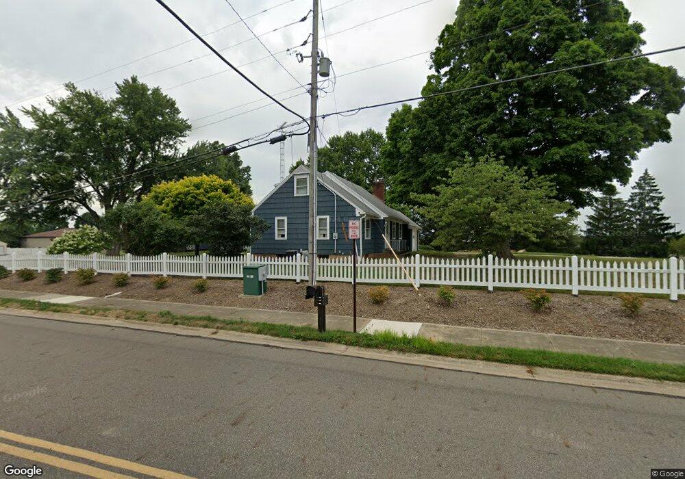
2300 W State St Alliance, OH 44601
Estimated Value: $165,000 - $282,000
4
Beds
2
Baths
1,918
Sq Ft
$121/Sq Ft
Est. Value
About This Home
This home is located at 2300 W State St, Alliance, OH 44601 and is currently estimated at $231,755, approximately $120 per square foot. 2300 W State St is a home located in Stark County with nearby schools including Marlington High School and Regina Coeli/St Joseph School.
Ownership History
Date
Name
Owned For
Owner Type
Purchase Details
Closed on
Apr 18, 2017
Sold by
Reifsnyder Mark E
Bought by
Reifsnyder Mark E and Mark E Reifsnyder Trust
Current Estimated Value
Purchase Details
Closed on
May 4, 2001
Sold by
Reifsnyder Georgia L
Bought by
Reifsnyder Georgia L and The Georgia L Reifsnyder Trust
Purchase Details
Closed on
Jan 25, 2001
Sold by
Estate Of Paulus E Reifsnyder
Bought by
Reifsnyder Georgia
Purchase Details
Closed on
Nov 1, 2000
Sold by
Estate Of Paulus E Reifsnyder
Bought by
Reifsnyder Georgia
Create a Home Valuation Report for This Property
The Home Valuation Report is an in-depth analysis detailing your home's value as well as a comparison with similar homes in the area
Home Values in the Area
Average Home Value in this Area
Purchase History
| Date | Buyer | Sale Price | Title Company |
|---|---|---|---|
| Reifsnyder Mark E | -- | None Available | |
| Reifsnyder Georgia L | -- | -- | |
| Reifsnyder Georgia | -- | -- | |
| Reifsnyder Georgia | -- | -- |
Source: Public Records
Tax History Compared to Growth
Tax History
| Year | Tax Paid | Tax Assessment Tax Assessment Total Assessment is a certain percentage of the fair market value that is determined by local assessors to be the total taxable value of land and additions on the property. | Land | Improvement |
|---|---|---|---|---|
| 2025 | -- | $48,410 | $16,560 | $31,850 |
| 2024 | -- | $48,410 | $16,560 | $31,850 |
| 2023 | $1,160 | $46,410 | $15,120 | $31,290 |
| 2022 | $1,178 | $46,410 | $15,120 | $31,290 |
| 2021 | $1,182 | $46,410 | $15,120 | $31,290 |
| 2020 | $1,454 | $41,480 | $13,130 | $28,350 |
| 2019 | $1,442 | $41,480 | $13,130 | $28,350 |
| 2018 | $1,443 | $41,480 | $13,130 | $28,350 |
| 2017 | $1,338 | $37,860 | $11,000 | $26,860 |
| 2016 | $928 | $37,860 | $11,000 | $26,860 |
| 2015 | $930 | $37,860 | $11,000 | $26,860 |
| 2014 | $936 | $34,840 | $10,120 | $24,720 |
| 2013 | $468 | $34,840 | $10,120 | $24,720 |
Source: Public Records
Map
Nearby Homes
- 2851 Patriots Path Unit 3D
- 0 Easton St NE
- 1870 Northview Ave
- 0 Valewood Cir Unit 5006281
- 0 Winchester St
- 0 Winchester St Unit 5162877
- 2195 Blenheim Ave
- 1201 Overlook Dr
- 3030 Center Ave
- 0 W Main St Unit 5090123
- 1042 Hartshorn St
- 1059 Oakwood Dr
- 1030 Sunset Dr
- 1039 Glamorgan St
- 970 Kingsway St
- 856 Birchwood Dr
- 1136 Parkway Blvd
- 1050 Parkway Blvd
- 2245 Ridgewood Ave
- 549 Linwood Dr
- 2012 Tanglewood Ave
- 2307 Ansley St
- 2305 Ansley St
- 2301 Ansley St Unit B2301
- 2303 Ansley St
- 2250 W State St
- 2310 Ansley St
- 2302 Ansley St Unit 2302
- 2340 W State St
- 2308 Ansley St Unit A2308
- 2304 Ansley St
- 2306 Ansley St
- 2112 Tanglewood Ave
- 2110 Tanglewood Ave
- 2110 Tanglewood Ave
- 2341 Ansley St Unit 2341F
- 2341 Ansley St Unit 2341E
- 2341 Ansley St Unit 2341D
- 2341 Ansley St Unit 2341C
- 2341 Ansley St Unit 2341B