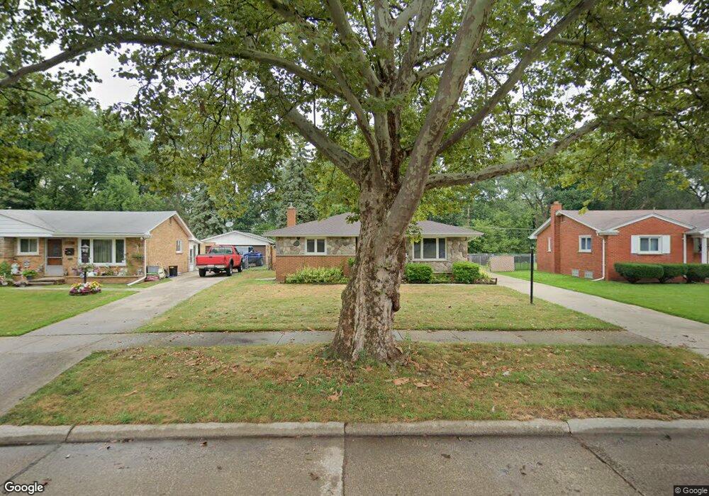
23000 N Brookside Dr Dearborn Heights, MI 48125
Estimated Value: $174,318 - $202,000
--
Bed
1
Bath
1,029
Sq Ft
$188/Sq Ft
Est. Value
About This Home
This home is located at 23000 N Brookside Dr, Dearborn Heights, MI 48125 and is currently estimated at $193,830, approximately $188 per square foot. 23000 N Brookside Dr is a home located in Wayne County with nearby schools including Polk Elementary School, Bedford School, and Pardee School.
Ownership History
Date
Name
Owned For
Owner Type
Purchase Details
Closed on
Mar 14, 2020
Sold by
Przybylski David G
Bought by
Przybylski David G and Przybylski Jill
Current Estimated Value
Home Financials for this Owner
Home Financials are based on the most recent Mortgage that was taken out on this home.
Original Mortgage
$70,000
Outstanding Balance
$48,245
Interest Rate
3.3%
Mortgage Type
New Conventional
Estimated Equity
$145,585
Purchase Details
Closed on
Feb 9, 2007
Sold by
Przybylski Denise
Bought by
Przybylski David
Purchase Details
Closed on
Dec 1, 2005
Sold by
Przybylski Denise
Bought by
Przybylski David
Home Financials for this Owner
Home Financials are based on the most recent Mortgage that was taken out on this home.
Original Mortgage
$111,845
Interest Rate
6.12%
Mortgage Type
Seller Take Back
Create a Home Valuation Report for This Property
The Home Valuation Report is an in-depth analysis detailing your home's value as well as a comparison with similar homes in the area
Home Values in the Area
Average Home Value in this Area
Purchase History
| Date | Buyer | Sale Price | Title Company |
|---|---|---|---|
| Przybylski David G | -- | None Available | |
| Przybylski David | $134,500 | First American Title | |
| Przybylski David | $134,500 | Chicago Title Insurance Co |
Source: Public Records
Mortgage History
| Date | Status | Borrower | Loan Amount |
|---|---|---|---|
| Open | Przybylski David G | $70,000 | |
| Previous Owner | Przybylski David | $111,845 |
Source: Public Records
Tax History Compared to Growth
Tax History
| Year | Tax Paid | Tax Assessment Tax Assessment Total Assessment is a certain percentage of the fair market value that is determined by local assessors to be the total taxable value of land and additions on the property. | Land | Improvement |
|---|---|---|---|---|
| 2025 | $1,678 | $89,200 | $0 | $0 |
| 2024 | $1,678 | $83,700 | $0 | $0 |
| 2023 | $1,586 | $73,700 | $0 | $0 |
| 2022 | $2,205 | $66,500 | $0 | $0 |
| 2021 | $2,204 | $62,600 | $0 | $0 |
| 2019 | $2,139 | $49,100 | $0 | $0 |
| 2018 | $1,437 | $43,000 | $0 | $0 |
| 2017 | $1,296 | $40,900 | $0 | $0 |
| 2016 | $2,036 | $39,100 | $0 | $0 |
| 2015 | $3,640 | $36,400 | $0 | $0 |
| 2013 | $3,870 | $39,300 | $0 | $0 |
| 2010 | -- | $48,000 | $0 | $0 |
Source: Public Records
Map
Nearby Homes
- 22453 Pardee Ct
- 23214 S Brookside Dr
- 4943 Pardee Ave
- 000 Hanover St
- 5015 Lincoln Blvd
- 4459 Parker St
- 4665 Lincoln Blvd
- 4449 Academy St
- 4209 Vassar St
- 4665 Syracuse St
- 4442 Mckinley St
- 4901 Cornell St
- 5671 Syracuse St
- 4506 Syracuse St
- 5689 Cornell St
- 5656 Monroe St
- 4474 Syracuse St
- 4456 Monroe St
- 4454 Monroe St
- 5908 Pine St
- 22988 N Brookside Dr
- 23012 N Brookside Dr
- 23024 N Brookside Dr
- 22522 Pardee Ct
- 22964 N Brookside Dr Unit Bldg-Unit
- 22964 N Brookside Dr
- 0 N Brookside Dr
- 23036 N Brookside Dr
- 22952 N Brookside Dr
- 23043 N Brookside Dr
- 5422 Eden Dr
- 22508 Pardee Ct
- 23048 N Brookside Dr
- 22940 N Brookside Dr
- 23019 N Brookside Dr
- 22509 Pardee Ct
- 5434 Eden Dr
- 22955 N Brookside Dr
- 23060 N Brookside Dr
- 5425 Heather Ln