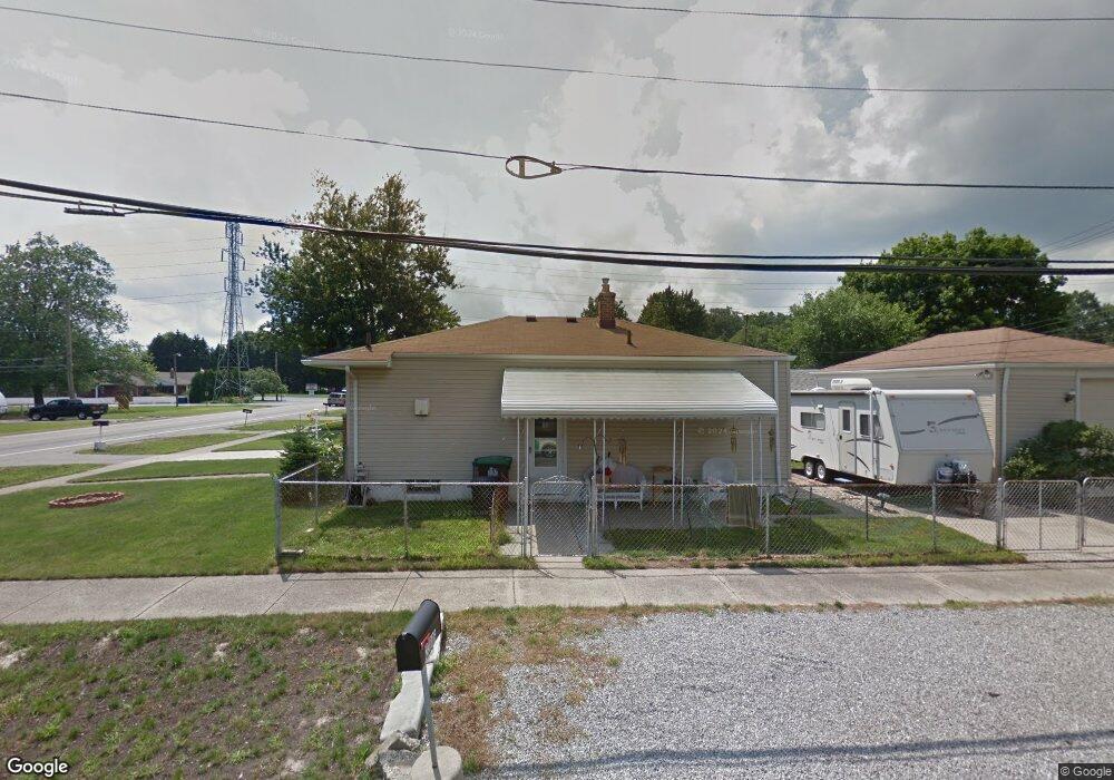
23006 Wick Rd Taylor, MI 48180
Estimated Value: $152,222 - $178,000
3
Beds
1
Bath
858
Sq Ft
$198/Sq Ft
Est. Value
About This Home
This home is located at 23006 Wick Rd, Taylor, MI 48180 and is currently estimated at $170,306, approximately $198 per square foot. 23006 Wick Rd is a home located in Wayne County with nearby schools including Clarence Randall Elementary School, Robert J. West Middle School, and Taylor High School.
Ownership History
Date
Name
Owned For
Owner Type
Purchase Details
Closed on
Oct 2, 2024
Sold by
Lipphard Ashley H
Bought by
Ashley Lipphard Revocable Trust and Lipphard
Current Estimated Value
Purchase Details
Closed on
Aug 2, 2017
Sold by
Lipphard Lipphard Ashley Ashley and Lipphard Mary E
Bought by
Lipphard Ashley
Purchase Details
Closed on
Aug 11, 2001
Sold by
Lipphard William C
Bought by
Lipphard Mary E
Create a Home Valuation Report for This Property
The Home Valuation Report is an in-depth analysis detailing your home's value as well as a comparison with similar homes in the area
Home Values in the Area
Average Home Value in this Area
Purchase History
| Date | Buyer | Sale Price | Title Company |
|---|---|---|---|
| Ashley Lipphard Revocable Trust | -- | None Listed On Document | |
| Lipphard Ashley | -- | None Available | |
| Lipphard Mary E | -- | -- |
Source: Public Records
Tax History
| Year | Tax Paid | Tax Assessment Tax Assessment Total Assessment is a certain percentage of the fair market value that is determined by local assessors to be the total taxable value of land and additions on the property. | Land | Improvement |
|---|---|---|---|---|
| 2025 | $1,432 | $74,200 | $0 | $0 |
| 2024 | $1,328 | $61,800 | $0 | $0 |
| 2023 | $1,578 | $54,700 | $0 | $0 |
| 2022 | $1,267 | $48,000 | $0 | $0 |
| 2021 | $1,389 | $43,000 | $0 | $0 |
| 2020 | $1,375 | $35,800 | $0 | $0 |
| 2019 | $137,471 | $36,200 | $0 | $0 |
| 2018 | $1,088 | $28,000 | $0 | $0 |
| 2017 | $573 | $28,600 | $0 | $0 |
| 2016 | $1,334 | $27,800 | $0 | $0 |
| 2015 | $2,459 | $25,400 | $0 | $0 |
| 2013 | $2,440 | $25,500 | $0 | $0 |
| 2012 | $1,091 | $24,600 | $5,600 | $19,000 |
Source: Public Records
Map
Nearby Homes
- 22327 Wick Rd
- 22726 Haskell St
- 22311 Wick Rd
- 23319 Haig St
- 9255 Syracuse St
- 9560 Sylvester St
- 8935 Lincoln St
- 9360 Pine St
- 9651 Blaty St
- 22185 Wick Rd
- 22134 Wick Rd
- 8279 Elm St
- 23665 Haig St
- 9814 Cass Ave
- 22137 Haskell St
- 22931 Champaign St
- 9223 Roosevelt St
- 0000 Wick Rd
- 22150 Haig St
- 9602 Cornell St
- 23014 Wick Rd
- 23022 Wick Rd
- 9188 Groschner St
- 22950 Wick Rd
- 9180 Groschner St
- 23036 Wick Rd
- 9164 Groschner St
- 9181 Groschner St
- 23044 Wick Rd
- 9093 Robert St
- 9205 Mueller St
- 9204 Mueller St
- 9150 Groschner St
- 9085 Robert St Unit Bldg-Unit
- 9167 Groschner St
- 9151 Groschner St
- 9073 Robert St
- 9073 Robert St
- 9073 Robert St
- 9073 Robert St
Your Personal Tour Guide
Ask me questions while you tour the home.