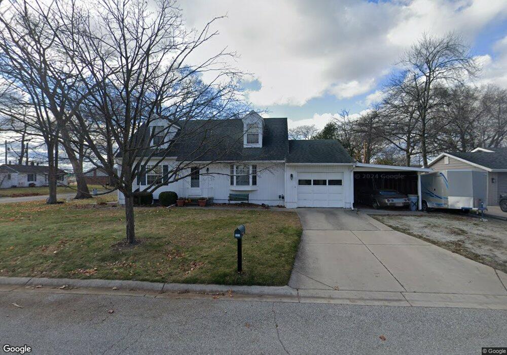
2301 17th Ave Port Huron, MI 48060
Estimated Value: $208,000 - $228,000
4
Beds
2
Baths
1,368
Sq Ft
$157/Sq Ft
Est. Value
About This Home
This home is located at 2301 17th Ave, Port Huron, MI 48060 and is currently estimated at $215,351, approximately $157 per square foot. 2301 17th Ave is a home located in St. Clair County with nearby schools including H.D. Crull Elementary School, Holland Woods Middle School, and Port Huron Northern High School.
Ownership History
Date
Name
Owned For
Owner Type
Purchase Details
Closed on
Oct 22, 2010
Sold by
Barthel Daniel P and Barthel Paula T
Bought by
Barthel Daniel P
Current Estimated Value
Home Financials for this Owner
Home Financials are based on the most recent Mortgage that was taken out on this home.
Original Mortgage
$99,780
Interest Rate
4.23%
Mortgage Type
New Conventional
Create a Home Valuation Report for This Property
The Home Valuation Report is an in-depth analysis detailing your home's value as well as a comparison with similar homes in the area
Home Values in the Area
Average Home Value in this Area
Purchase History
| Date | Buyer | Sale Price | Title Company |
|---|---|---|---|
| Barthel Daniel P | -- | Lsi |
Source: Public Records
Mortgage History
| Date | Status | Borrower | Loan Amount |
|---|---|---|---|
| Closed | Barthel Daniel P | $99,780 |
Source: Public Records
Tax History
| Year | Tax Paid | Tax Assessment Tax Assessment Total Assessment is a certain percentage of the fair market value that is determined by local assessors to be the total taxable value of land and additions on the property. | Land | Improvement |
|---|---|---|---|---|
| 2025 | $2,316 | $97,600 | $0 | $0 |
| 2024 | $2,259 | $90,200 | $0 | $0 |
| 2023 | $2,134 | $81,900 | $0 | $0 |
| 2022 | $2,268 | $73,000 | $0 | $0 |
| 2020 | $2,177 | $67,300 | $67,300 | $0 |
| 2019 | $2,138 | $52,700 | $0 | $0 |
| 2018 | $2,090 | $52,700 | $0 | $0 |
| 2017 | $1,866 | $47,200 | $0 | $0 |
| 2016 | $1,600 | $47,200 | $0 | $0 |
| 2015 | $1,570 | $45,400 | $45,400 | $0 |
| 2014 | $1,570 | $45,500 | $45,500 | $0 |
| 2013 | -- | $44,400 | $0 | $0 |
Source: Public Records
Map
Nearby Homes
- 2008 Elmwood St
- 1907 Riverside Dr
- 2525 19th Ave
- 2215 Hancock St
- 2515 Woodstock Dr
- 2224 Garfield St
- 2838 Elmwood St
- 2835 17th Ave
- 2400 Stone St Unit 2414
- 2335 Water St
- 2857 Riverside Dr
- 1523 Elk St
- 1433 Poplar St
- 2915 Linda Ct
- 1507 Elk St
- 1828 Kennelworth Dr
- 910 Church St
- 2915 10th Ave
- 0000 Campau Ave Campau Ave
- 00 Campau Ave
- 1802 Mansfield St
- 1806 Mansfield St
- 1793 Mansfield St
- 2303 17th Ave
- 1811 Mansfield St
- 2302 17th Ave
- 1796 Mansfield St
- 2302 17th Ave 17th Ave
- 1792 Mansfield St
- 1819 Mansfield St
- 2302 18th Ave
- 2304 17th Ave
- 2305 17th Ave
- 1818 Mansfield St
- 1787 Mansfield St
- 1810 Mansfield St
- 1776 Mansfield St
- 2309 17th Ave
- 2306 18th Ave
- 2310 17th Ave
Your Personal Tour Guide
Ask me questions while you tour the home.