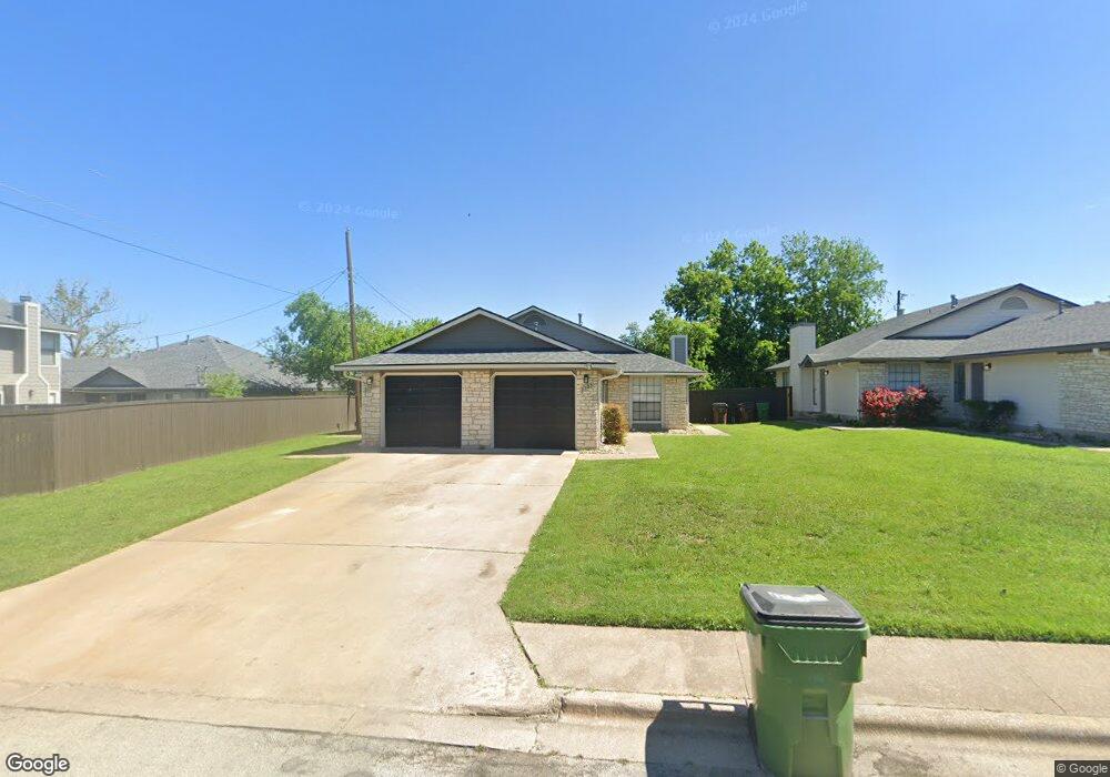
2301 Westwind Ave Unit 2303 Round Rock, TX 78681
Round Rock West NeighborhoodEstimated Value: $421,576 - $468,000
1936
Beds
2
Baths
1,936
Sq Ft
$230/Sq Ft
Est. Value
About This Home
This home is located at 2301 Westwind Ave Unit 2303, Round Rock, TX 78681 and is currently estimated at $444,894, approximately $229 per square foot. 2301 Westwind Ave Unit 2303 is a home located in Williamson County with nearby schools including Bluebonnet Elementary School, Chisholm Trail Middle School, and Round Rock High School.
Ownership History
Date
Name
Owned For
Owner Type
Purchase Details
Closed on
Aug 31, 2016
Sold by
Chisholm Partnership Ltd
Bought by
Round Rock Evergreen Spe Llc and Virtu Round Rock Associates Lp
Current Estimated Value
Home Financials for this Owner
Home Financials are based on the most recent Mortgage that was taken out on this home.
Original Mortgage
$16,100,000
Outstanding Balance
$1,870,808
Interest Rate
3.45%
Mortgage Type
Purchase Money Mortgage
Estimated Equity
-$1,425,914
Create a Home Valuation Report for This Property
The Home Valuation Report is an in-depth analysis detailing your home's value as well as a comparison with similar homes in the area
Home Values in the Area
Average Home Value in this Area
Purchase History
| Date | Buyer | Sale Price | Title Company |
|---|---|---|---|
| Round Rock Evergreen Spe Llc | -- | Heritage Title |
Source: Public Records
Mortgage History
| Date | Status | Borrower | Loan Amount |
|---|---|---|---|
| Open | Round Rock Evergreen Spe Llc | $16,100,000 |
Source: Public Records
Tax History Compared to Growth
Tax History
| Year | Tax Paid | Tax Assessment Tax Assessment Total Assessment is a certain percentage of the fair market value that is determined by local assessors to be the total taxable value of land and additions on the property. | Land | Improvement |
|---|---|---|---|---|
| 2025 | $7,246 | $379,964 | $69,644 | $310,320 |
| 2024 | $7,246 | $409,032 | $71,000 | $338,032 |
| 2023 | $6,968 | $397,260 | $77,000 | $320,260 |
| 2022 | $7,759 | $409,151 | $68,000 | $341,151 |
| 2021 | $7,110 | $316,760 | $55,000 | $261,760 |
| 2020 | $5,989 | $265,299 | $52,327 | $212,972 |
| 2019 | $6,488 | $281,051 | $48,150 | $232,901 |
| 2018 | $5,901 | $255,619 | $48,150 | $207,469 |
| 2017 | $5,382 | $228,448 | $45,000 | $183,448 |
| 2016 | $3,851 | $163,465 | $45,000 | $118,465 |
| 2015 | $3,382 | $155,131 | $35,000 | $120,131 |
| 2014 | $3,382 | $143,722 | $0 | $0 |
Source: Public Records
Map
Nearby Homes
- 1108 Christopher Ave
- 1800 Tamra Ct
- 901 Pack Saddle Pass
- 913 Bellview Ave
- 2210 Lasso Dr
- 1325 Old Austin Rock Rd
- 2100 Oakridge Dr
- 1508 Woodhill Dr
- 1602 Wildwood Dr
- 2002 Frontier Trail
- 812 Christopher Ave
- 1702 Wagon Gap Dr
- 1000 Abbey Rd
- 1602 Rock Creek Dr
- 2104 Dry Creek Dr
- 1004 Lime Rock Dr
- 1105 Deep Wood Dr
- 513 Purple Sage Dr
- 1908 Creekview Dr
- 1904 Creekview Dr
- 2305 Westwind Ave Unit 2307
- 1209 Christopher Ave
- 1205 Christopher Ave Unit A
- 2300 Leslie Ct Unit A
- 2309 Westwind Ave Unit 2311
- 2304 Leslie Ct Unit A
- 1201 Christopher Ave Unit A
- 2308 Leslie Ct Unit A
- 1213 Christopher Ave Unit 1215
- 2300 Westwind Ave Unit 2302
- 1125 Christopher Ave Unit A
- 2304 Westwind Ave Unit 2306
- 2313 Westwind Ave Unit 2315
- 2312 Leslie Ct Unit A
- 1217 Christopher Ave Unit 1219
- 2308 Westwind Ave Unit 2310
- 2317 Westwind Ave Unit 2319
- 1200 Christopher Ave
- 1140 Christopher Ave Unit A
- 1204 Christopher Ave