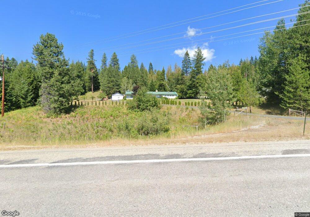
23011 Highway 2 Sandpoint, ID 83864
Estimated Value: $828,969 - $1,050,000
3
Beds
2
Baths
3,300
Sq Ft
$286/Sq Ft
Est. Value
About This Home
This home is located at 23011 Highway 2, Sandpoint, ID 83864 and is currently estimated at $943,492, approximately $285 per square foot. 23011 Highway 2 is a home located in Bonner County with nearby schools including Washington Elementary School, Sandpoint Middle School, and Sandpoint High School.
Ownership History
Date
Name
Owned For
Owner Type
Purchase Details
Closed on
Aug 29, 2017
Sold by
Freeman Thomas C
Bought by
Gibbs Manrod and Gibbs Linda
Current Estimated Value
Home Financials for this Owner
Home Financials are based on the most recent Mortgage that was taken out on this home.
Original Mortgage
$195,000
Outstanding Balance
$105,021
Interest Rate
3.86%
Mortgage Type
New Conventional
Estimated Equity
$838,471
Create a Home Valuation Report for This Property
The Home Valuation Report is an in-depth analysis detailing your home's value as well as a comparison with similar homes in the area
Home Values in the Area
Average Home Value in this Area
Purchase History
| Date | Buyer | Sale Price | Title Company |
|---|---|---|---|
| Gibbs Manrod | -- | Alliance Title |
Source: Public Records
Mortgage History
| Date | Status | Borrower | Loan Amount |
|---|---|---|---|
| Open | Gibbs Manrod | $195,000 |
Source: Public Records
Tax History Compared to Growth
Tax History
| Year | Tax Paid | Tax Assessment Tax Assessment Total Assessment is a certain percentage of the fair market value that is determined by local assessors to be the total taxable value of land and additions on the property. | Land | Improvement |
|---|---|---|---|---|
| 2025 | $2,097 | $738,931 | $139,221 | $599,710 |
| 2024 | $2,116 | $586,776 | $130,112 | $456,664 |
| 2023 | $1,804 | $566,624 | $130,112 | $436,512 |
| 2022 | $2,157 | $540,624 | $104,112 | $436,512 |
| 2021 | $2,178 | $407,298 | $95,829 | $311,469 |
| 2020 | $2,375 | $389,439 | $82,024 | $307,415 |
| 2019 | $1,360 | $385,554 | $82,024 | $303,530 |
| 2018 | $1,284 | $256,227 | $82,024 | $174,203 |
| 2017 | $1,284 | $240,298 | $0 | $0 |
| 2016 | $1,283 | $230,851 | $0 | $0 |
| 2015 | -- | $230,851 | $0 | $0 |
| 2014 | -- | $230,851 | $0 | $0 |
Source: Public Records
Map
Nearby Homes
- 22592 Highway 2
- 346 Brookfield Rd
- 494 Snug Harbor Rd
- 142 Maria Pia Ln
- 1671 Wooded Acres Dr
- NNA Cheyenne Dr
- 347 Homestead Loop
- 451 Westwood Heights Rd
- Lot 1 Eagle View Ln
- 117 Muskrat Place
- 1205 Wooded Acres Dr
- NNA Lot 8 Luna Ridge
- Lot 16 Swan Shores
- 172 Elk Hills Rd
- 176 Swan Shores Dr
- 1279 Gypsy Bay Rd
- 13 Swan Shores Dr
- 289 Swan Shores Dr
- 23011 Highway 2
- 78 Ladyhawk Dr
- 55 Winterhawk Dr
- 39 Winterhawk Dr
- 171 Ladyhawk Dr
- 19 Winterhawk Dr
- 63 Ladyhawk Dr
- 19 Fernwood Dr
- 172 Ladyhawk Dr
- 3 Soaring Eagle Dr
- 21 Rosewood East
- 37 Rosewood East
- 59 Rosewood East
- 22979 Highway 2
- 59 Soaring Eagle Dr
- 45 Soaring Eagle Dr
- 23204 Highway 2
- 92 Wild Turkey Rd
- NKA Wild Turkey
- 368 Wild Turkey Rd