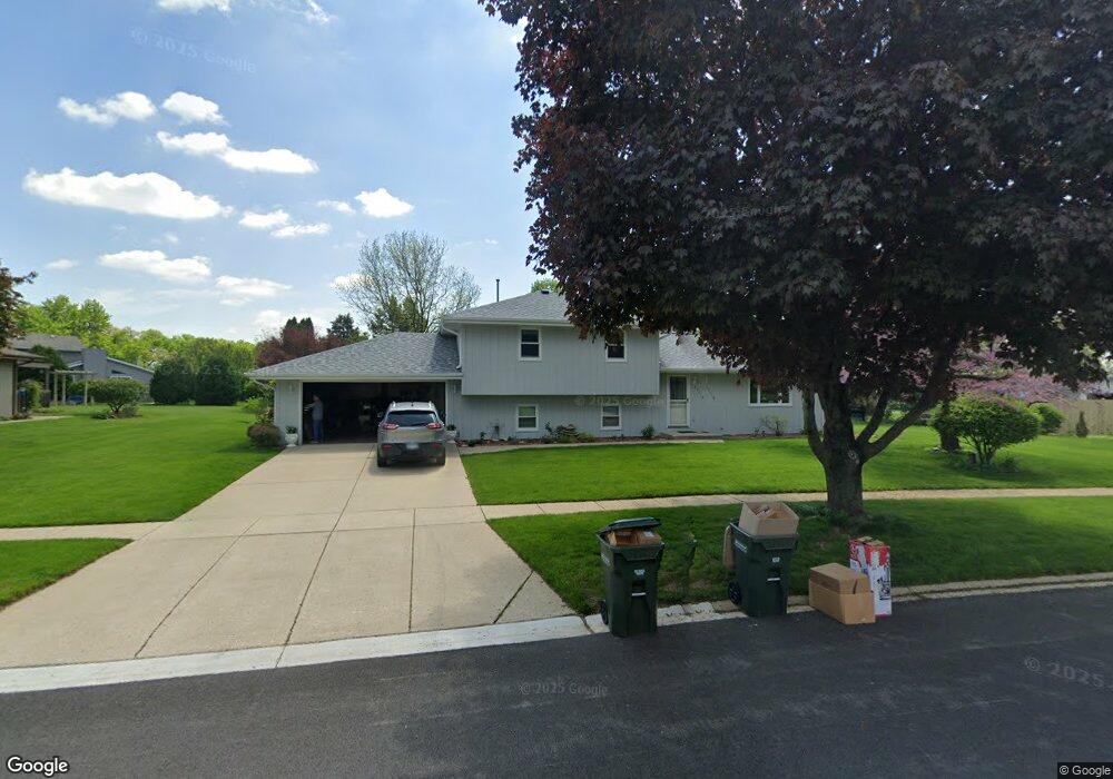
23019 S Michael Dr Unit 2 Channahon, IL 60410
Southwest Joliet NeighborhoodEstimated Value: $277,668 - $354,000
Studio
--
Bath
1,824
Sq Ft
$174/Sq Ft
Est. Value
About This Home
This home is located at 23019 S Michael Dr Unit 2, Channahon, IL 60410 and is currently estimated at $317,417, approximately $174 per square foot. 23019 S Michael Dr Unit 2 is a home located in Will County with nearby schools including Heritage Trail Elementary School, Troy Middle School, and Orenic Intermediate School.
Ownership History
Date
Name
Owned For
Owner Type
Purchase Details
Closed on
Aug 15, 1997
Sold by
Deno Earl and Deno Vicky
Bought by
Maticic Steven J and Maticic Rebecca S
Current Estimated Value
Home Financials for this Owner
Home Financials are based on the most recent Mortgage that was taken out on this home.
Original Mortgage
$35,000
Outstanding Balance
$5,246
Interest Rate
7.54%
Estimated Equity
$312,171
Create a Home Valuation Report for This Property
The Home Valuation Report is an in-depth analysis detailing your home's value as well as a comparison with similar homes in the area
Home Values in the Area
Average Home Value in this Area
Purchase History
| Date | Buyer | Sale Price | Title Company |
|---|---|---|---|
| Maticic Steven J | $136,000 | -- |
Source: Public Records
Mortgage History
| Date | Status | Borrower | Loan Amount |
|---|---|---|---|
| Open | Maticic Steven J | $35,000 |
Source: Public Records
Tax History
| Year | Tax Paid | Tax Assessment Tax Assessment Total Assessment is a certain percentage of the fair market value that is determined by local assessors to be the total taxable value of land and additions on the property. | Land | Improvement |
|---|---|---|---|---|
| 2024 | $7,310 | $88,758 | $18,704 | $70,054 |
| 2023 | $7,310 | $79,747 | $16,805 | $62,942 |
| 2022 | $6,394 | $73,308 | $15,902 | $57,406 |
| 2021 | $5,983 | $68,964 | $14,960 | $54,004 |
| 2020 | $5,692 | $65,521 | $14,960 | $50,561 |
| 2019 | $5,517 | $62,850 | $14,350 | $48,500 |
| 2018 | $5,115 | $57,300 | $14,350 | $42,950 |
| 2017 | $4,897 | $54,100 | $14,350 | $39,750 |
| 2016 | $4,699 | $51,000 | $14,350 | $36,650 |
| 2015 | $4,003 | $47,168 | $12,968 | $34,200 |
| 2014 | $4,003 | $45,791 | $12,968 | $32,823 |
| 2013 | $4,003 | $45,791 | $12,968 | $32,823 |
Source: Public Records
Map
Nearby Homes
- 22550 Woodside Dr
- 22511 S Deal Ave
- 23058 W Mcclintock Rd
- 23906 S Frontage Rd
- 24304 S Frontage Rd W
- 24240 S Burr Rd
- 23550 S Vetter Rd
- 24317 Schubert Ln
- 24031 S Cardinal Dr
- 24646 W Eames St
- 24415 W Quail Dr
- Sec8 W Eames St
- 25032 W Mcmillin Dr
- 2780 Channahon Rd
- 3406 Karen Dr
- Lot7 and Lot8 Us Rte 6 Rd
- Lot 122 W Cache Isle Cir
- Lot 120 W Cache Isle Cir
- Lot 123 W Cache Isle Cir
- Lot 134 Blue Heron Ct
- 23011 S Michael Dr
- 23041 S Patricia Ln
- 23051 S Patricia Ln
- 23025 S Patricia Ln
- 23020 S Frances Way
- 23020 S Michael Dr
- 23001 S Michael Dr
- 23010 S Michael Dr
- 23057 S Patricia Ln Unit 2
- 23000 S Michael Dr
- 23030 S Michael Dr
- 23513 W Frances Ct
- 23044 S Patricia Ln
- 23050 S Patricia Ln
- 23034 S Patricia Ln
- 23507 W Frances Ct
- 23028 S Patricia Ln
- 23058 S Patricia Ln
- 23523 W Frances Ct
- 23009 S Patricia Ln