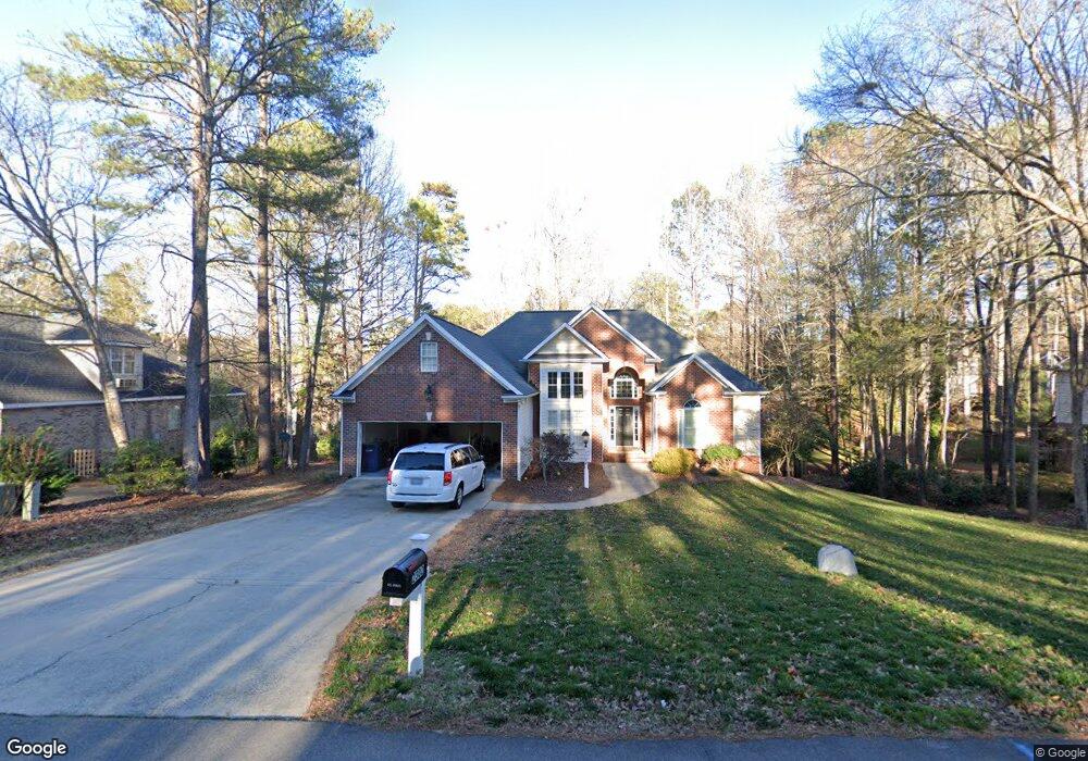
2302 Brownstone Rd Sanford, NC 27330
Estimated Value: $491,000 - $557,000
5
Beds
3
Baths
3,550
Sq Ft
$147/Sq Ft
Est. Value
About This Home
This home is located at 2302 Brownstone Rd, Sanford, NC 27330 and is currently estimated at $521,206, approximately $146 per square foot. 2302 Brownstone Rd is a home located in Lee County with nearby schools including Benjamin T. Bullock Elementary School, West Lee Middle School, and Lee County High School.
Ownership History
Date
Name
Owned For
Owner Type
Purchase Details
Closed on
May 21, 2021
Sold by
Hall Michael Kent and Hall Kay Brantley
Bought by
Secor Richard and Secor Harriett A
Current Estimated Value
Home Financials for this Owner
Home Financials are based on the most recent Mortgage that was taken out on this home.
Original Mortgage
$296,250
Outstanding Balance
$269,383
Interest Rate
2.9%
Mortgage Type
New Conventional
Estimated Equity
$251,823
Purchase Details
Closed on
Jul 9, 2004
Sold by
Be-For Corporation
Bought by
Hall Michael Kent
Purchase Details
Closed on
Jan 13, 1995
Bought by
Be-For Corporation
Create a Home Valuation Report for This Property
The Home Valuation Report is an in-depth analysis detailing your home's value as well as a comparison with similar homes in the area
Home Values in the Area
Average Home Value in this Area
Purchase History
| Date | Buyer | Sale Price | Title Company |
|---|---|---|---|
| Secor Richard | $395,000 | None Available | |
| Hall Michael Kent | $294,000 | -- | |
| Be-For Corporation | $51,000 | -- |
Source: Public Records
Mortgage History
| Date | Status | Borrower | Loan Amount |
|---|---|---|---|
| Open | Secor Richard | $296,250 | |
| Previous Owner | Hall Michael K | $85,592 |
Source: Public Records
Tax History Compared to Growth
Tax History
| Year | Tax Paid | Tax Assessment Tax Assessment Total Assessment is a certain percentage of the fair market value that is determined by local assessors to be the total taxable value of land and additions on the property. | Land | Improvement |
|---|---|---|---|---|
| 2025 | $5,545 | $436,700 | $50,000 | $386,700 |
| 2024 | $5,525 | $436,700 | $50,000 | $386,700 |
| 2023 | $5,515 | $436,700 | $50,000 | $386,700 |
| 2022 | $4,330 | $297,000 | $37,500 | $259,500 |
| 2021 | $4,312 | $290,000 | $37,500 | $252,500 |
| 2020 | $4,298 | $290,000 | $37,500 | $252,500 |
| 2019 | $4,258 | $290,000 | $37,500 | $252,500 |
| 2018 | $4,529 | $304,200 | $45,000 | $259,200 |
| 2017 | $4,469 | $304,200 | $45,000 | $259,200 |
| 2016 | $4,444 | $304,200 | $45,000 | $259,200 |
| 2014 | $4,215 | $304,200 | $45,000 | $259,200 |
Source: Public Records
Map
Nearby Homes
- 2648 Buckingham Dr
- 618 Contento Ct
- 631 Contento Ct
- 2839 Bristol Way
- 2600 Buckingham Dr
- 2215 Southern Rd
- 308 Brookfield Cir
- 110 Hickory Grove Dr
- Wayland Plan at Hickory Grove
- Ashford Plan at Hickory Grove
- Hamilton Plan at Hickory Grove
- Andrews Plan at Hickory Grove
- Bedford Plan at Hickory Grove
- Sheridan Plan at Hickory Grove
- 2523 Victory Dr
- 0 Cool Springs Rd Unit 744558
- 401 Bridgewater Dr
- 0 Lot B Carbonton Rd
- 2302 Brownstone Dr
- 2216 Brownstone Rd
- 2306 Brownstone Rd
- 2653 Buckingham Dr
- 2655 Buckingham Dr
- 2305 Brownstone Dr
- 2301 Brownstone Rd
- 2212 Brownstone Rd
- 2305 Brownstone Rd
- 2649 Buckingham Dr
- 2310 Brownstone Dr
- 2212 Brownstone Dr
- 2310 Brownstone Rd
- 2657 Buckingham Dr
- 1001 Fieldstone Dr
- 2208 Brownstone Rd
- 2656 Buckingham Dr
- 2314 Brownstone Dr
- 2314 Brownstone Rd
- 2645 Buckingham Dr
