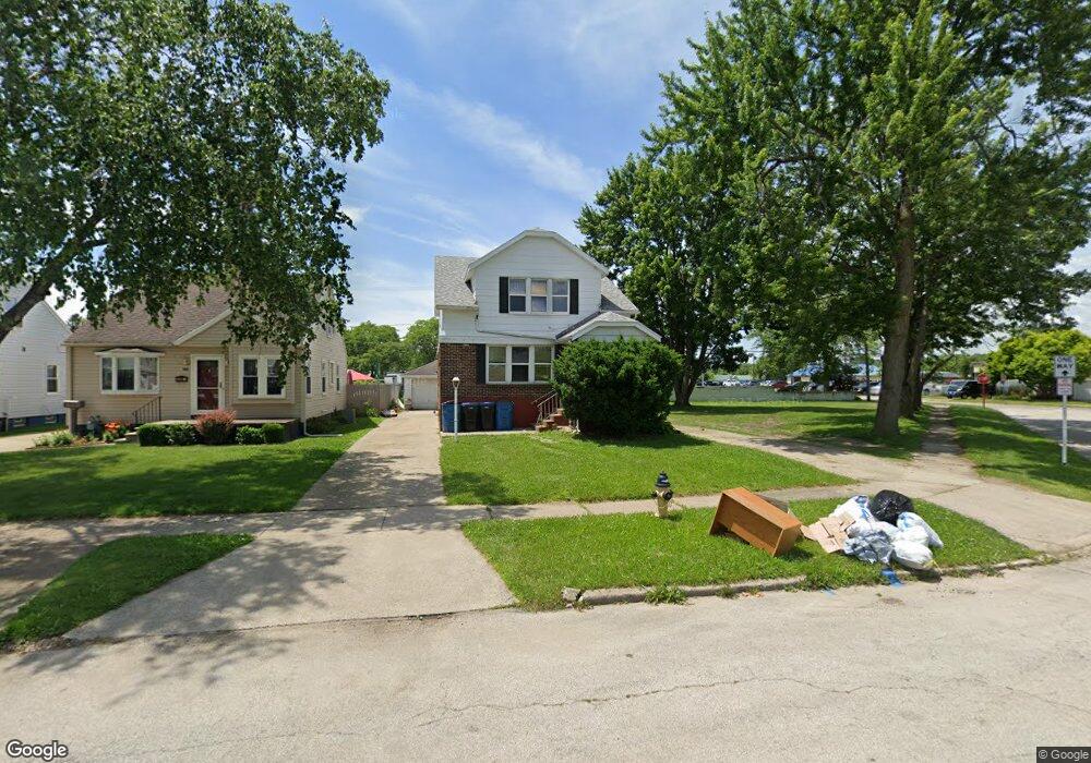
2302 Taft Ave Oregon, OH 43616
Estimated Value: $92,812 - $109,000
Studio
--
Bath
--
Sq Ft
4,574
Sq Ft Lot
About This Home
This home is located at 2302 Taft Ave, Oregon, OH 43616 and is currently estimated at $100,906. 2302 Taft Ave is a home located in Lucas County with nearby schools including Kateri Catholic Academy and St. Kateri Catholic Schools.
Ownership History
Date
Name
Owned For
Owner Type
Purchase Details
Closed on
Feb 2, 2005
Sold by
Torda Kathleen A
Bought by
Schwierking Keith and Demaria Jess J
Current Estimated Value
Home Financials for this Owner
Home Financials are based on the most recent Mortgage that was taken out on this home.
Original Mortgage
$74,400
Outstanding Balance
$37,252
Interest Rate
5.83%
Mortgage Type
Purchase Money Mortgage
Estimated Equity
$63,654
Purchase Details
Closed on
Mar 22, 1996
Sold by
Est Elsie M Kelly
Bought by
Torda Joseph R and Torda Kathleen A
Home Financials for this Owner
Home Financials are based on the most recent Mortgage that was taken out on this home.
Original Mortgage
$7,125
Interest Rate
7.06%
Mortgage Type
New Conventional
Create a Home Valuation Report for This Property
The Home Valuation Report is an in-depth analysis detailing your home's value as well as a comparison with similar homes in the area
Home Values in the Area
Average Home Value in this Area
Purchase History
| Date | Buyer | Sale Price | Title Company |
|---|---|---|---|
| Schwierking Keith | $93,000 | -- | |
| Torda Joseph R | $71,500 | -- |
Source: Public Records
Mortgage History
| Date | Status | Borrower | Loan Amount |
|---|---|---|---|
| Open | Schwierking Keith | $74,400 | |
| Closed | Torda Joseph R | $7,125 |
Source: Public Records
Tax History
| Year | Tax Paid | Tax Assessment Tax Assessment Total Assessment is a certain percentage of the fair market value that is determined by local assessors to be the total taxable value of land and additions on the property. | Land | Improvement |
|---|---|---|---|---|
| 2025 | -- | $4,795 | $4,410 | $385 |
| 2024 | $131 | $4,795 | $4,410 | $385 |
| 2023 | $262 | $4,095 | $3,675 | $420 |
| 2022 | $263 | $4,095 | $3,675 | $420 |
| 2021 | $265 | $4,095 | $3,675 | $420 |
| 2020 | $244 | $3,325 | $2,975 | $350 |
| 2019 | $238 | $3,325 | $2,975 | $350 |
| 2018 | $235 | $3,325 | $2,975 | $350 |
| 2017 | $236 | $3,080 | $2,940 | $140 |
| 2016 | $234 | $8,800 | $8,400 | $400 |
| 2015 | $233 | $8,800 | $8,400 | $400 |
| 2014 | $188 | $3,010 | $2,870 | $140 |
| 2013 | $188 | $3,010 | $2,870 | $140 |
Source: Public Records
Map
Nearby Homes
- 1703 Glenross Blvd
- 2011 Oakdale Ave
- 2432 Rochester Place
- 2249 Pickle Rd
- 230 Ritter Ave
- 208 Gardner Ave
- 1462 Holmes St
- 932 Cresceus Rd
- 1512 Vinal St
- 1531 Freedom St
- 3517 Goodrich Ave
- 1532 Liberty St
- 1413 Ironwood Ave
- 29 Lemoyne Rd
- 1219 Crystal St
- 1401 Liberty St
- 674 Sylvandale Ave
- Integrity 1880 Plan at Oregon Town Center
- Integrity 2060 Plan at Oregon Town Center
- Integrity 2000 Plan at Oregon Town Center
- 2302 Taft Ave
- 2306 Taft Ave
- 2310 Taft Ave
- 2314 Taft Ave
- 2318 Taft Ave
- 2322 Taft Ave
- 2332 Burnside Ave
- 2313 Burnside Ave
- 2317 Burnside Ave
- 2309 Burnside Ave
- 2326 Taft Ave
- 2305 Burnside Ave
- 2325 Burnside Ave
- 2301 Burnside Ave
- 2329 Burnside Ave
- 2334 Taft Ave
- 1624 Reswick Dr
- 2333 Burnside Ave
- 1656 Groll Dr
- 2337 Burnside Ave