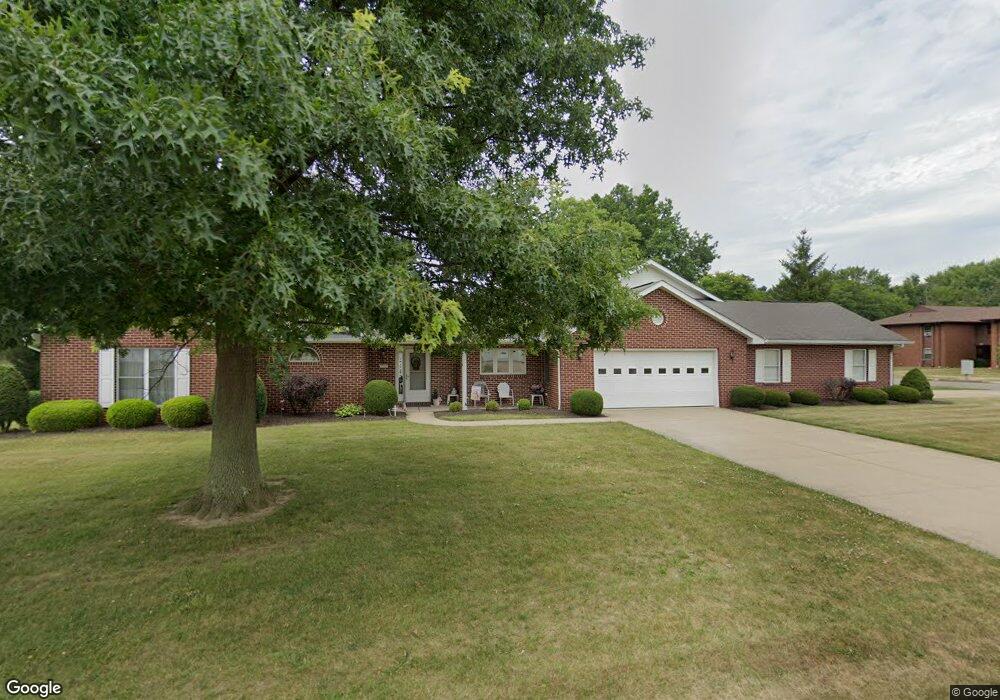
2303 Camalak Ln Alliance, OH 44601
Estimated Value: $213,000 - $320,388
4
Beds
4
Baths
3,192
Sq Ft
$90/Sq Ft
Est. Value
About This Home
This home is located at 2303 Camalak Ln, Alliance, OH 44601 and is currently estimated at $288,097, approximately $90 per square foot. 2303 Camalak Ln is a home located in Stark County with nearby schools including Marlington High School and Regina Coeli/St Joseph School.
Ownership History
Date
Name
Owned For
Owner Type
Purchase Details
Closed on
Feb 28, 2017
Sold by
Camalak Properties Inc
Bought by
Franklin B Riley Trust Llc
Current Estimated Value
Home Financials for this Owner
Home Financials are based on the most recent Mortgage that was taken out on this home.
Original Mortgage
$1,950,000
Interest Rate
4.12%
Mortgage Type
Commercial
Create a Home Valuation Report for This Property
The Home Valuation Report is an in-depth analysis detailing your home's value as well as a comparison with similar homes in the area
Home Values in the Area
Average Home Value in this Area
Purchase History
| Date | Buyer | Sale Price | Title Company |
|---|---|---|---|
| Franklin B Riley Trust Llc | $26,000 | Heritage Union Title Co Ltd |
Source: Public Records
Mortgage History
| Date | Status | Borrower | Loan Amount |
|---|---|---|---|
| Closed | Franklin B Riley Trust Llc | $1,950,000 |
Source: Public Records
Tax History Compared to Growth
Tax History
| Year | Tax Paid | Tax Assessment Tax Assessment Total Assessment is a certain percentage of the fair market value that is determined by local assessors to be the total taxable value of land and additions on the property. | Land | Improvement |
|---|---|---|---|---|
| 2025 | -- | $96,220 | $25,970 | $70,250 |
| 2024 | -- | $96,220 | $25,970 | $70,250 |
| 2023 | $2,371 | $74,730 | $16,870 | $57,860 |
| 2022 | $1,190 | $74,730 | $16,870 | $57,860 |
| 2021 | $2,388 | $74,730 | $16,870 | $57,860 |
| 2020 | $1,641 | $45,890 | $12,290 | $33,600 |
| 2019 | $1,628 | $45,890 | $12,290 | $33,600 |
| 2018 | $1,630 | $45,890 | $12,290 | $33,600 |
| 2017 | $1,622 | $45,890 | $12,290 | $33,600 |
| 2016 | $2,149 | $60,770 | $12,290 | $48,480 |
| 2015 | $2,153 | $60,770 | $12,290 | $48,480 |
| 2014 | $164 | $55,940 | $11,310 | $44,630 |
| 2013 | $1,082 | $55,940 | $11,310 | $44,630 |
Source: Public Records
Map
Nearby Homes
- 2851 Patriots Path Unit 3D
- 0 Easton St NE
- 1870 Northview Ave
- 0 Valewood Cir Unit 5006281
- 0 Winchester St
- 0 Winchester St Unit 5162877
- 2195 Blenheim Ave
- 1201 Overlook Dr
- 3030 Center Ave
- 1059 Oakwood Dr
- 1042 Hartshorn St
- 0 W Main St Unit 5090123
- 1030 Sunset Dr
- 856 Birchwood Dr
- 1039 Glamorgan St
- 970 Kingsway St
- 2245 Ridgewood Ave
- 1136 Parkway Blvd
- 1050 Parkway Blvd
- 549 Linwood Dr
- 2307 Camalak Ln
- 2306 Ansley St
- 2304 Ansley St
- 2308 Ansley St Unit A2308
- 2302 Camalak Ln
- 2144 Tanglewood Ave
- 2146 Tanglewood Ave Unit C
- 2146 Tanglewood Ave
- 2302 Ansley St Unit 2302
- 2310 Ansley St
- 2112 Tanglewood Ave
- 2110 Tanglewood Ave
- 2110 Tanglewood Ave
- 2301 Cambury St
- 2329 Cambury St
- 2303 Ansley St
- 2301 Ansley St Unit B2301
- 2305 Ansley St
- 2307 Ansley St
- 2332 Ansley St