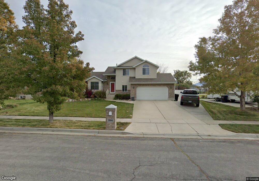
2303 S 1520 W Syracuse, UT 84075
Estimated Value: $539,612 - $643,000
5
Beds
3
Baths
2,647
Sq Ft
$224/Sq Ft
Est. Value
About This Home
This home is located at 2303 S 1520 W, Syracuse, UT 84075 and is currently estimated at $592,153, approximately $223 per square foot. 2303 S 1520 W is a home located in Davis County with nearby schools including Cook School, Legacy Junior High School, and Clearfield High School.
Ownership History
Date
Name
Owned For
Owner Type
Purchase Details
Closed on
Sep 14, 2021
Sold by
Daniels William B
Bought by
Daniels William B and William B Daniels Living Trust
Current Estimated Value
Purchase Details
Closed on
Jan 10, 2019
Sold by
Hairston David R
Bought by
Daniels William B
Home Financials for this Owner
Home Financials are based on the most recent Mortgage that was taken out on this home.
Original Mortgage
$318,250
Outstanding Balance
$279,837
Interest Rate
4.8%
Mortgage Type
New Conventional
Estimated Equity
$312,316
Purchase Details
Closed on
Oct 25, 2016
Sold by
Comesario Noel U and Comesario Yvonne M
Bought by
Hairston David R
Purchase Details
Closed on
Oct 1, 2014
Sold by
Ramsden Scott R
Bought by
Comesario Noel U and Comesario Yvonne M
Home Financials for this Owner
Home Financials are based on the most recent Mortgage that was taken out on this home.
Original Mortgage
$227,283
Interest Rate
4.08%
Mortgage Type
VA
Purchase Details
Closed on
Sep 25, 2007
Sold by
Thorne Craig and Thorne Stephanie
Bought by
Ramsden Scott R
Home Financials for this Owner
Home Financials are based on the most recent Mortgage that was taken out on this home.
Original Mortgage
$58,700
Interest Rate
6.4%
Mortgage Type
Stand Alone Second
Purchase Details
Closed on
May 27, 2003
Sold by
Frazier Michael T
Bought by
Thorne Craig and Thorne Stephanie
Purchase Details
Closed on
Mar 3, 1999
Sold by
Frazier Michael T and Frazier Jennifer A
Bought by
Frazier Michael T
Home Financials for this Owner
Home Financials are based on the most recent Mortgage that was taken out on this home.
Original Mortgage
$160,000
Interest Rate
6.76%
Purchase Details
Closed on
Sep 12, 1997
Sold by
Lamano Debra L
Bought by
Frazier Michael T and Frazier Jennifer A
Home Financials for this Owner
Home Financials are based on the most recent Mortgage that was taken out on this home.
Original Mortgage
$132,900
Interest Rate
7.34%
Purchase Details
Closed on
Oct 2, 1996
Sold by
Bretwood Co Inc
Bought by
Lamano Debra L
Create a Home Valuation Report for This Property
The Home Valuation Report is an in-depth analysis detailing your home's value as well as a comparison with similar homes in the area
Home Values in the Area
Average Home Value in this Area
Purchase History
| Date | Buyer | Sale Price | Title Company |
|---|---|---|---|
| Daniels William B | -- | None Available | |
| Daniels William B | -- | Us Title Company Of | |
| Hairston David R | -- | First American Title | |
| Comesario Noel U | -- | Us Title Co | |
| Ramsden Scott R | -- | First American Title | |
| Thorne Craig | -- | Heritage West Title Insuranc | |
| Frazier Michael T | -- | Security Title Company | |
| Frazier Michael T | -- | Security Title Company | |
| Lamano Debra L | -- | Security Title Co |
Source: Public Records
Mortgage History
| Date | Status | Borrower | Loan Amount |
|---|---|---|---|
| Open | Daniels William B | $318,250 | |
| Previous Owner | Comesario Noel U | $227,283 | |
| Previous Owner | Ramsden Scott R | $58,700 | |
| Previous Owner | Ramsden Scott R | $176,150 | |
| Previous Owner | Frazier Michael T | $160,000 | |
| Previous Owner | Frazier Michael T | $132,900 |
Source: Public Records
Tax History Compared to Growth
Tax History
| Year | Tax Paid | Tax Assessment Tax Assessment Total Assessment is a certain percentage of the fair market value that is determined by local assessors to be the total taxable value of land and additions on the property. | Land | Improvement |
|---|---|---|---|---|
| 2025 | $2,685 | $259,050 | $127,680 | $131,370 |
| 2024 | $2,576 | $250,250 | $108,239 | $142,011 |
| 2023 | $2,469 | $437,000 | $150,665 | $286,335 |
| 2022 | $2,760 | $267,850 | $86,363 | $181,487 |
| 2021 | $2,395 | $368,000 | $127,928 | $240,072 |
| 2020 | $2,180 | $317,000 | $110,109 | $206,891 |
| 2019 | $2,090 | $300,000 | $109,255 | $190,745 |
| 2018 | $1,804 | $257,000 | $104,639 | $152,361 |
| 2016 | $1,701 | $127,105 | $40,103 | $87,002 |
| 2015 | $1,651 | $117,480 | $40,103 | $77,377 |
| 2014 | $1,725 | $125,143 | $40,103 | $85,040 |
| 2013 | -- | $108,058 | $33,416 | $74,642 |
Source: Public Records
Map
Nearby Homes
- 1315 W 2325 S
- 1306 W 2325 S
- 1295 W 2325 S
- 1286 W 2325 S
- 2355 S 1230 W
- 2194 S 1800 W
- 1196 W 2325 S
- 1156 W 2325 S
- 1137 W 2275 S
- 1116 W 2325 S
- 1137 2275 S
- 2742 S Allison Way Unit 212
- 1137 W 2500 S
- 1148 W 2050 S
- 1142 W 2050 S
- 1667 W 2770 S Unit 206
- 2232 S 1000 W
- 1079 W 2050 S
- 2306 S 2000 W
- 2208 W 2615 S Unit 141