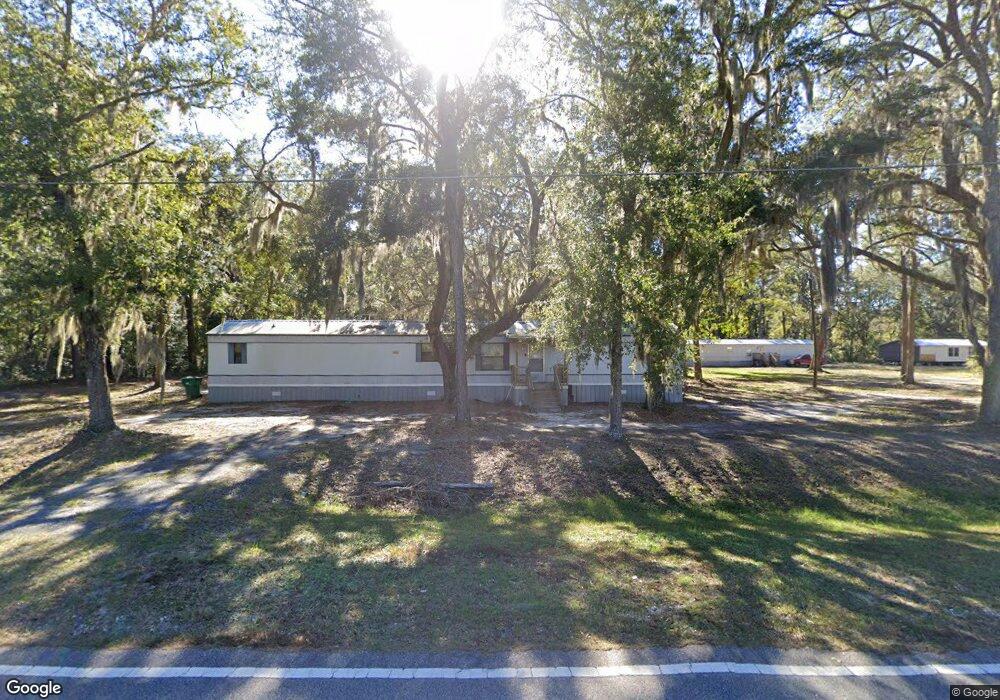
2304 Swamp Rd SE Townsend, GA 31331
Estimated Value: $339,000 - $433,000
4
Beds
2
Baths
2,676
Sq Ft
$137/Sq Ft
Est. Value
About This Home
This home is located at 2304 Swamp Rd SE, Townsend, GA 31331 and is currently estimated at $365,864, approximately $136 per square foot. 2304 Swamp Rd SE is a home with nearby schools including Todd Grant Elementary School, McIntosh County Middle School, and McIntosh County Academy.
Ownership History
Date
Name
Owned For
Owner Type
Purchase Details
Closed on
Aug 14, 2024
Sold by
Everson Brooks Jeanette
Bought by
Altman Safra and Walker John Charles
Current Estimated Value
Home Financials for this Owner
Home Financials are based on the most recent Mortgage that was taken out on this home.
Original Mortgage
$236,000
Outstanding Balance
$233,278
Interest Rate
6.77%
Mortgage Type
New Conventional
Estimated Equity
$132,586
Purchase Details
Closed on
Feb 2, 2001
Sold by
Brooks Alphonso and Brooks Je
Bought by
Brooks Alphonso and Brooks Je
Purchase Details
Closed on
Feb 1, 1995
Bought by
Brooks Alphonso
Create a Home Valuation Report for This Property
The Home Valuation Report is an in-depth analysis detailing your home's value as well as a comparison with similar homes in the area
Home Values in the Area
Average Home Value in this Area
Purchase History
| Date | Buyer | Sale Price | Title Company |
|---|---|---|---|
| Altman Safra | $295,000 | -- | |
| Brooks Alphonso | -- | -- | |
| Brooks Alphonso | -- | -- |
Source: Public Records
Mortgage History
| Date | Status | Borrower | Loan Amount |
|---|---|---|---|
| Open | Altman Safra | $236,000 |
Source: Public Records
Tax History Compared to Growth
Tax History
| Year | Tax Paid | Tax Assessment Tax Assessment Total Assessment is a certain percentage of the fair market value that is determined by local assessors to be the total taxable value of land and additions on the property. | Land | Improvement |
|---|---|---|---|---|
| 2024 | $3,740 | $129,324 | $14,440 | $114,884 |
| 2023 | $1,481 | $124,244 | $13,120 | $111,124 |
| 2022 | $1,481 | $98,884 | $6,680 | $92,204 |
| 2021 | $1,980 | $74,524 | $6,680 | $67,844 |
| 2020 | $1,423 | $72,668 | $6,680 | $65,988 |
| 2019 | $1,843 | $69,356 | $6,680 | $62,676 |
| 2018 | $1,843 | $69,356 | $6,680 | $62,676 |
| 2017 | $1,423 | $63,796 | $6,680 | $57,116 |
| 2016 | $1,423 | $63,796 | $6,680 | $57,116 |
| 2015 | $1,381 | $58,758 | $5,936 | $52,822 |
| 2014 | $1,525 | $63,851 | $11,029 | $52,822 |
Source: Public Records
Map
Nearby Homes
- 18 Doboy Ct
- 3261 Smith Rd SE
- 0 Highway 99 Unit 22514247
- 13 Seabreeze Dr
- $20,000 PRICE REDUCT Smith Rd SE
- 2296 Vic Waters Dr SE
- Lot 8 Hudson Creek Dr SE
- 0 Mission Dr SE Unit 1655895
- 0 Rice Planter
- LOT A Ga Highway 99
- 1066 Baywood Ave SE
- 2486 Mission Dr SE
- 11.73 Acres On Smith Rd SE
- 1334 Emma Ln SE
- 5554 Ga Highway 99
- 1165 Durant Dr SE
- Lot 4 Mission Dr SE
- 1441 Halyard Way SE
- 85 ACRES Catfish Farm Rd SE
- 1474 Mcintosh Trail SE
- 2304 Swamp Rd
- 1 Acre Swamp Rd
- 2286 Swamp Rd SE
- 2363 Swamp Rd SE
- 2323 Swamp Rd SE
- 2389 Swamp Rd SE
- 2504 Swamp Rd SE
- 1175 Christopher Padgett Rd SE
- 1068 Christopher Padgett Rd SE
- 2638 Swamp Rd SE
- 1111 Christoper Padgett Rd
- 2481 Swamp Rd SE
- 1111 Christopher Padgett Rd SE
- 0 Swamp Rd Unit 163980
- 0 Swamp Rd Unit 133505
- 0 Swamp Rd Unit 382310
- 2641 Swamp Rd
- 2661 Swamp Rd
- 1307 Christopher Padgett Rd SE
- 2026 Swamp Rd SE