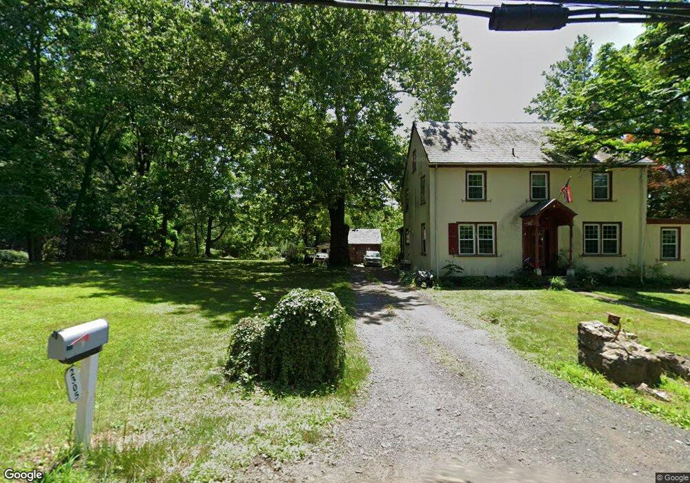
2305 Lower State Rd Doylestown, PA 18901
Estimated Value: $556,000 - $1,392,000
3
Beds
2
Baths
2,774
Sq Ft
$311/Sq Ft
Est. Value
About This Home
This home is located at 2305 Lower State Rd, Doylestown, PA 18901 and is currently estimated at $863,612, approximately $311 per square foot. 2305 Lower State Rd is a home located in Bucks County with nearby schools including Doyle El School, Lenape Middle School, and Central Bucks High School-West.
Ownership History
Date
Name
Owned For
Owner Type
Purchase Details
Closed on
Mar 28, 2008
Sold by
Grochowski Francis M and Grochowski Dolores M
Bought by
Showalter Robert L and Showalter Maryanne P
Current Estimated Value
Home Financials for this Owner
Home Financials are based on the most recent Mortgage that was taken out on this home.
Original Mortgage
$270,400
Outstanding Balance
$168,136
Interest Rate
5.62%
Mortgage Type
Purchase Money Mortgage
Estimated Equity
$695,476
Purchase Details
Closed on
Feb 13, 1981
Bought by
Grochowski Francis M and Grochowski Dolores M
Create a Home Valuation Report for This Property
The Home Valuation Report is an in-depth analysis detailing your home's value as well as a comparison with similar homes in the area
Home Values in the Area
Average Home Value in this Area
Purchase History
| Date | Buyer | Sale Price | Title Company |
|---|---|---|---|
| Showalter Robert L | $338,000 | None Available | |
| Grochowski Francis M | $96,000 | -- |
Source: Public Records
Mortgage History
| Date | Status | Borrower | Loan Amount |
|---|---|---|---|
| Open | Showalter Robert L | $270,400 |
Source: Public Records
Tax History Compared to Growth
Tax History
| Year | Tax Paid | Tax Assessment Tax Assessment Total Assessment is a certain percentage of the fair market value that is determined by local assessors to be the total taxable value of land and additions on the property. | Land | Improvement |
|---|---|---|---|---|
| 2025 | $6,081 | $34,360 | $4,760 | $29,600 |
| 2024 | $6,081 | $34,360 | $4,760 | $29,600 |
| 2023 | $5,798 | $34,360 | $4,760 | $29,600 |
| 2022 | $5,733 | $34,360 | $4,760 | $29,600 |
| 2021 | $5,615 | $34,360 | $4,760 | $29,600 |
| 2020 | $5,590 | $34,360 | $4,760 | $29,600 |
| 2019 | $5,529 | $34,360 | $4,760 | $29,600 |
| 2018 | $5,512 | $34,360 | $4,760 | $29,600 |
| 2017 | $5,469 | $34,360 | $4,760 | $29,600 |
| 2016 | $5,435 | $34,360 | $4,760 | $29,600 |
| 2015 | -- | $34,360 | $4,760 | $29,600 |
| 2014 | -- | $34,360 | $4,760 | $29,600 |
Source: Public Records
Map
Nearby Homes
- 9 Mill Creek Dr
- 422 Fordhook Rd
- 450 Ford Hook Rd
- 432 Ford Hook Rd
- 137 Wells Rd
- 259 W Ashland St
- 197 Spring Ln
- 195 Lafayette St
- 250 Wooded Dr
- 121 Conestoga Dr
- 218 Vaux Dr
- 84 Iron Hill Rd
- 403 S Main St Unit S201
- 200 N Shady Retreat Rd
- 215 N Franklin St
- 37 N Clinton St
- 82 Avalon Ct Unit 2005
- 333 Dorset Ct Unit 333
- 78 Tower Hill Rd
- 89 Homestead Dr
- 2321 Lower State Rd
- 2332 Lower State Rd
- 20 Berkeley Ct Unit 20
- 2335 Lower State Rd Unit 1
- 19 Berkeley Ct Unit 19
- 21 Berkeley Ct
- 7 Aurora Ct Unit 7
- 9 Aurora Ct
- 18 Berkeley Ct Unit 18
- 22 Berkeley Ct Unit 22
- 10 Aurora Ct Unit 10
- 17 Berkeley Ct
- 8 Oxford Ln
- 6 Aster Ct Unit 6
- 5 Aster Ct Unit 5
- 1 Aster Ct Unit 1
- 6 Oxford Ln
- 2371 Lower State Rd
- 4 Aster Ct Unit 4
- 2 Aster Ct Unit 2