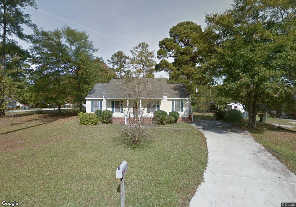
2305 Ramsgate Dr Columbia, SC 29210
Saint Andrews NeighborhoodEstimated Value: $161,000 - $192,000
3
Beds
2
Baths
1,280
Sq Ft
$136/Sq Ft
Est. Value
About This Home
This home is located at 2305 Ramsgate Dr, Columbia, SC 29210 and is currently estimated at $174,548, approximately $136 per square foot. 2305 Ramsgate Dr is a home located in Richland County with nearby schools including Sandel Elementary School, St. Andrews Middle School, and Columbia High School.
Ownership History
Date
Name
Owned For
Owner Type
Purchase Details
Closed on
Dec 18, 2020
Sold by
Banks Edwin
Bought by
Westry James L
Current Estimated Value
Home Financials for this Owner
Home Financials are based on the most recent Mortgage that was taken out on this home.
Original Mortgage
$93,279
Outstanding Balance
$83,046
Interest Rate
2.7%
Mortgage Type
FHA
Estimated Equity
$91,502
Purchase Details
Closed on
Apr 25, 2002
Sold by
Diamond Ray E
Bought by
Thompson Michael John
Home Financials for this Owner
Home Financials are based on the most recent Mortgage that was taken out on this home.
Original Mortgage
$60,800
Interest Rate
7.07%
Create a Home Valuation Report for This Property
The Home Valuation Report is an in-depth analysis detailing your home's value as well as a comparison with similar homes in the area
Home Values in the Area
Average Home Value in this Area
Purchase History
| Date | Buyer | Sale Price | Title Company |
|---|---|---|---|
| Westry James L | $95,000 | None Available | |
| Westry James L | $95,000 | None Listed On Document | |
| Thompson Michael John | $76,000 | -- |
Source: Public Records
Mortgage History
| Date | Status | Borrower | Loan Amount |
|---|---|---|---|
| Open | Westry James L | $93,279 | |
| Closed | Westry James L | $93,279 | |
| Previous Owner | Thompson Michael John | $60,800 |
Source: Public Records
Tax History Compared to Growth
Tax History
| Year | Tax Paid | Tax Assessment Tax Assessment Total Assessment is a certain percentage of the fair market value that is determined by local assessors to be the total taxable value of land and additions on the property. | Land | Improvement |
|---|---|---|---|---|
| 2024 | $1,074 | $109,300 | $0 | $0 |
| 2023 | $1,074 | $3,800 | $0 | $0 |
| 2022 | $975 | $95,000 | $9,200 | $85,800 |
| 2021 | $967 | $3,800 | $0 | $0 |
| 2020 | $2,355 | $4,500 | $0 | $0 |
| 2019 | $2,329 | $4,500 | $0 | $0 |
| 2018 | $2,285 | $4,440 | $0 | $0 |
| 2017 | $2,223 | $4,440 | $0 | $0 |
| 2016 | $2,186 | $4,440 | $0 | $0 |
| 2015 | $2,058 | $4,210 | $0 | $0 |
| 2014 | $2,019 | $70,200 | $0 | $0 |
| 2013 | -- | $4,210 | $0 | $0 |
Source: Public Records
Map
Nearby Homes
- 2332 New Lake Dr
- 1917 Kathleen Dr
- 1932 Greenwyche Ave
- 2225 Hertford Dr
- 2116 Chandler Ave
- 1917 Chandler Ave
- 2126 Rolling Hills Rd
- 1904 Elise Dr
- 1830 Saint Michaels Rd
- 1604 Nunamaker Dr
- 1605 Kathleen Dr
- 1810 Saint Michaels Rd
- 1900 Rolling Hills Rd
- 0 Marley Dr Unit 598776
- 2305 Apple Valley Rd
- 529 Cambout St
- 1533 Westchester Dr
- 1720 Grays Inn Rd
- 1908 Grays Inn Rd
- 321 Cambout St
- 2312 Hertford Dr
- 2309 Ramsgate Dr
- 2316 Hertford Dr
- 2308 Ramsgate Dr
- 2306 Ramsgate Dr
- 2308 Hertford Dr
- 2313 Ramsgate Dr
- 2302 Ramsgate Dr
- 2304 Ramsgate Dr
- 2310 Ramsgate Dr
- 2320 Hertford Dr
- 2313 Hertford Dr
- 2317 Ramsgate Dr
- 2309 Hertford Dr
- 2312 Ramsgate Dr
- 2304 Hertford Dr
- 2317 Hertford Dr
- 2009 Greenwyche Ave
- 2324 Hertford Dr
- 2013 Greenwyche Ave