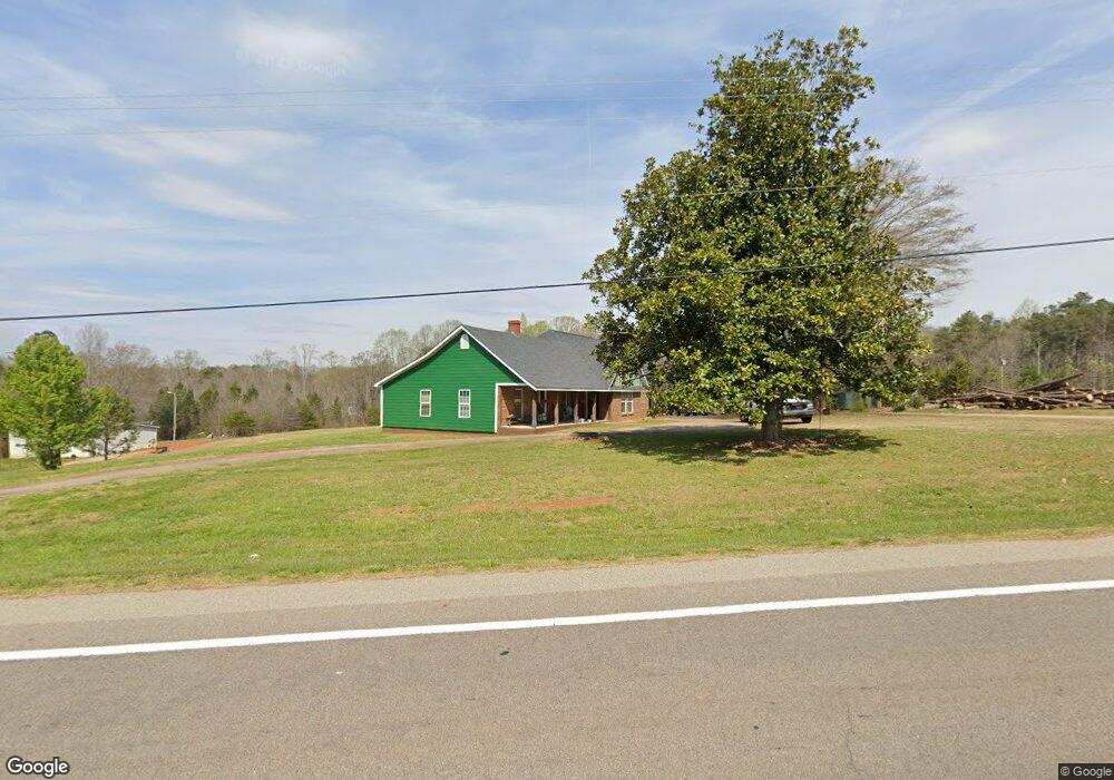
2306 Highway 11 W Chesnee, SC 29323
Estimated Value: $236,000 - $289,332
3
Beds
1
Bath
2,447
Sq Ft
$107/Sq Ft
Est. Value
About This Home
This home is located at 2306 Highway 11 W, Chesnee, SC 29323 and is currently estimated at $261,083, approximately $106 per square foot. 2306 Highway 11 W is a home located in Spartanburg County with nearby schools including Chesnee Middle School and Chesnee High School.
Ownership History
Date
Name
Owned For
Owner Type
Purchase Details
Closed on
Jul 25, 2018
Sold by
Wix Joshua Taylor
Bought by
Wix James S
Current Estimated Value
Home Financials for this Owner
Home Financials are based on the most recent Mortgage that was taken out on this home.
Original Mortgage
$80,000
Outstanding Balance
$69,332
Interest Rate
4.5%
Mortgage Type
Adjustable Rate Mortgage/ARM
Estimated Equity
$191,751
Purchase Details
Closed on
Jul 8, 2013
Sold by
Cobb Ann L
Bought by
Wix Joshua Taylor
Create a Home Valuation Report for This Property
The Home Valuation Report is an in-depth analysis detailing your home's value as well as a comparison with similar homes in the area
Home Values in the Area
Average Home Value in this Area
Purchase History
| Date | Buyer | Sale Price | Title Company |
|---|---|---|---|
| Wix James S | $100,000 | None Available | |
| Wix Joshua Taylor | $62,000 | -- | |
| Cobb Ann L | -- | -- |
Source: Public Records
Mortgage History
| Date | Status | Borrower | Loan Amount |
|---|---|---|---|
| Open | Wix James S | $80,000 |
Source: Public Records
Tax History Compared to Growth
Tax History
| Year | Tax Paid | Tax Assessment Tax Assessment Total Assessment is a certain percentage of the fair market value that is determined by local assessors to be the total taxable value of land and additions on the property. | Land | Improvement |
|---|---|---|---|---|
| 2025 | $1,128 | $6,900 | $265 | $6,635 |
| 2024 | $1,128 | $6,900 | $265 | $6,635 |
| 2023 | $1,128 | $6,900 | $265 | $6,635 |
| 2022 | $1,022 | $6,000 | $256 | $5,744 |
| 2021 | $1,022 | $6,000 | $256 | $5,744 |
| 2020 | $1,569 | $9,592 | $556 | $9,036 |
| 2019 | $688 | $2,723 | $551 | $2,172 |
| 2018 | $475 | $2,723 | $551 | $2,172 |
| 2017 | $426 | $2,368 | $532 | $1,836 |
| 2016 | $426 | $2,368 | $532 | $1,836 |
| 2015 | $1,307 | $3,552 | $798 | $2,754 |
| 2014 | $1,302 | $3,552 | $798 | $2,754 |
Source: Public Records
Map
Nearby Homes
- 0 Cantrell Dr
- 291 Robbins Rd
- 107 Brooklyn Church Rd
- 202 Arrowood Branch Rd
- 351 Smith Wall Rd
- 216 Sweetgrass Dr
- 140 Manor House Ln
- 523 State Road S-42-1879
- 537 State Road S-42-1879
- 545 State Road S-42-1879
- 561 State Road S-42-1879
- 565 State Road S-42-1879
- 569 State Road S-42-1879
- 0 State Road S-42-1879
- 1543 Highway 11 W
- 402 Dodger Ave
- 407 Dodger Ave
- 190 Clement Rd
- 411 Dodger Ave
- 410 Dodger Ave
- 2288 Hwy 11 W
- 2307 S Carolina 11
- 2259 Highway 11 W
- 2338 Highway 11 W
- 2338 Highway 11 W
- 2307 Highway 11 W
- 2364 Hwy 11 W
- 2374 W 11 Hwy
- 2245 Highway 11 W
- 2358 Hwy 11 W
- 2358 Highway 11 W
- 2358 Highway 11 W
- 2240 Highway 11 W
- 2368 Highway 11 W
- 191 Cantrell Dr
- 2370 Highway 11 W
- 2370 Highway 11 W
- 2374 S Carolina 11
- 2374 Highway 11 W
- 139 Cantrell Dr