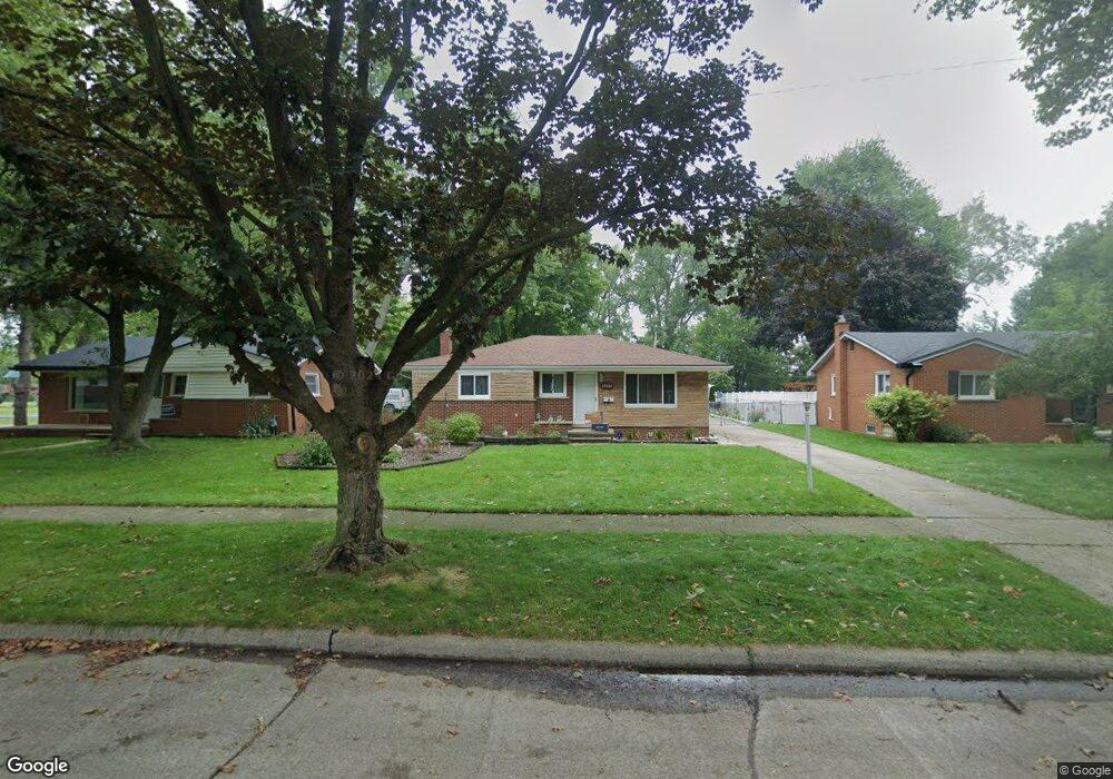
23060 N Brookside Dr Dearborn Heights, MI 48125
Estimated Value: $196,000 - $220,000
--
Bed
1
Bath
1,276
Sq Ft
$163/Sq Ft
Est. Value
About This Home
This home is located at 23060 N Brookside Dr, Dearborn Heights, MI 48125 and is currently estimated at $208,536, approximately $163 per square foot. 23060 N Brookside Dr is a home located in Wayne County with nearby schools including Polk Elementary School, Bedford School, and Pardee School.
Ownership History
Date
Name
Owned For
Owner Type
Purchase Details
Closed on
May 3, 2013
Sold by
Hirt Gregory A
Bought by
Hirt Laura K
Current Estimated Value
Purchase Details
Closed on
Apr 6, 2006
Sold by
Slim Hadie
Bought by
Mortgage Electronic Registration Systems and Accredited Home Lenders Inc
Purchase Details
Closed on
Aug 22, 2005
Sold by
Attard Craig S and Attard Ginger M
Bought by
Slim Hadie
Purchase Details
Closed on
Apr 1, 1995
Sold by
Tricoff Christ A
Bought by
Attard Craig S and Attard Ginger
Create a Home Valuation Report for This Property
The Home Valuation Report is an in-depth analysis detailing your home's value as well as a comparison with similar homes in the area
Home Values in the Area
Average Home Value in this Area
Purchase History
| Date | Buyer | Sale Price | Title Company |
|---|---|---|---|
| Hirt Laura K | -- | None Available | |
| Mortgage Electronic Registration Systems | $140,923 | None Available | |
| Slim Hadie | $170,000 | Multiple | |
| Attard Craig S | $91,500 | -- |
Source: Public Records
Tax History Compared to Growth
Tax History
| Year | Tax Paid | Tax Assessment Tax Assessment Total Assessment is a certain percentage of the fair market value that is determined by local assessors to be the total taxable value of land and additions on the property. | Land | Improvement |
|---|---|---|---|---|
| 2025 | $1,886 | $106,100 | $0 | $0 |
| 2024 | $1,886 | $101,500 | $0 | $0 |
| 2023 | $1,782 | $89,600 | $0 | $0 |
| 2022 | $2,477 | $80,600 | $0 | $0 |
| 2021 | $2,476 | $75,300 | $0 | $0 |
| 2019 | $2,404 | $59,100 | $0 | $0 |
| 2018 | $1,615 | $48,600 | $0 | $0 |
| 2017 | $1,456 | $46,100 | $0 | $0 |
| 2016 | $2,288 | $44,000 | $0 | $0 |
| 2015 | $4,090 | $40,900 | $0 | $0 |
| 2013 | $4,310 | $44,600 | $0 | $0 |
| 2010 | -- | $54,100 | $0 | $0 |
Source: Public Records
Map
Nearby Homes
- 22453 Pardee Ct
- 23214 S Brookside Dr
- 4943 Pardee Ave
- 4459 Parker St
- 000 Hanover St
- 4449 Academy St
- 5015 Lincoln Blvd
- 4665 Syracuse St
- 4665 Lincoln Blvd
- 4901 Cornell St
- 4209 Vassar St
- 5671 Syracuse St
- 4506 Syracuse St
- 4474 Syracuse St
- 5689 Cornell St
- 4442 Mckinley St
- 4489 Westpoint St
- 4155 Syracuse St
- 5908 Pine St
- 4193 Cornell St
- 23048 N Brookside Dr
- 23072 N Brookside Dr
- 23036 N Brookside Dr
- 23024 N Brookside Dr
- 23228 N Brookside Dr
- 5425 Heather Ln
- 23211 N Brookside Dr
- 23012 N Brookside Dr
- 23043 N Brookside Dr
- 23242 N Brookside Dr
- 23225 N Brookside Dr
- 23019 N Brookside Dr
- 5432 Heather Ln
- 23000 N Brookside Dr
- 5443 Heather Ln
- 23237 N Brookside Dr
- 23300 N Brookside Dr
- 5422 Eden Dr
- 5444 Heather Ln
- 22988 N Brookside Dr