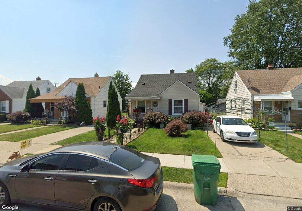
23067 Normandy Ave Eastpointe, MI 48021
Estimated Value: $125,013 - $138,000
3
Beds
1
Bath
940
Sq Ft
$142/Sq Ft
Est. Value
About This Home
This home is located at 23067 Normandy Ave, Eastpointe, MI 48021 and is currently estimated at $133,753, approximately $142 per square foot. 23067 Normandy Ave is a home located in Macomb County with nearby schools including Forest Park Elementary School, Eastpointe Middle School, and Chandler Park Academy - Elementary School.
Ownership History
Date
Name
Owned For
Owner Type
Purchase Details
Closed on
Aug 7, 2009
Sold by
Sobczyk Christopher
Bought by
Emc Mortgage Corporation
Current Estimated Value
Purchase Details
Closed on
Apr 26, 2002
Sold by
Bendert Joseph A
Bought by
Sobczyk Christopher
Home Financials for this Owner
Home Financials are based on the most recent Mortgage that was taken out on this home.
Original Mortgage
$109,620
Interest Rate
7.07%
Purchase Details
Closed on
Apr 17, 2000
Sold by
Polomski Anna H
Bought by
Benderty Joseph A
Create a Home Valuation Report for This Property
The Home Valuation Report is an in-depth analysis detailing your home's value as well as a comparison with similar homes in the area
Home Values in the Area
Average Home Value in this Area
Purchase History
We collect this data history from publicly available records. To have your information removed, we recommend requesting removal directly through your county’s website.
| Date | Buyer | Sale Price | Title Company |
|---|---|---|---|
| Emc Mortgage Corporation | $27,375 | None Available | |
| Sobczyk Christopher | $113,000 | -- | |
| Benderty Joseph A | $94,900 | -- |
Source: Public Records
Mortgage History
We collect this data history from publicly available records. To have your information removed, we recommend requesting removal directly through your county’s website.
| Date | Status | Borrower | Loan Amount |
|---|---|---|---|
| Previous Owner | Sobczyk Christopher | $109,620 |
Source: Public Records
Tax History
| Year | Tax Paid | Tax Assessment Tax Assessment Total Assessment is a certain percentage of the fair market value that is determined by local assessors to be the total taxable value of land and additions on the property. | Land | Improvement |
|---|---|---|---|---|
| 2025 | $2,025 | $63,800 | $0 | $0 |
| 2024 | $14 | $51,400 | $0 | $0 |
| 2023 | $1,316 | $45,900 | $0 | $0 |
| 2022 | $1,882 | $39,300 | $0 | $0 |
| 2021 | $1,354 | $34,900 | $0 | $0 |
| 2020 | $1,294 | $31,900 | $0 | $0 |
| 2019 | $1,375 | $28,000 | $0 | $0 |
| 2018 | $1,686 | $26,120 | $0 | $0 |
| 2017 | $1,897 | $23,370 | $2,930 | $20,440 |
| 2016 | $1,811 | $23,370 | $0 | $0 |
| 2015 | $1,065 | $21,180 | $0 | $0 |
| 2013 | $1,078 | $20,070 | $0 | $0 |
Source: Public Records
Map
Nearby Homes
- 23011 Normandy Ave
- 23027 Tuscany Ave
- 23003 Tuscany Ave
- 23705 Wilmot Ave
- 22773 Brittany Ave
- 23131 Lambrecht Ave
- 23772 Brittany Ave
- 22741 Normandy Ave
- 23754 Lambrecht Ave
- 23833 Normandy Ave
- 23824 Tuscany Ave
- 23708 Lexington Ave
- 22540 Normandy Ave
- 22765 Rosalind Ave
- 18047 Holland Ave
- 22732 Rosalind Ave
- 18004 Holland Ave
- 24268 Brittany Ave
- 17331 Stephens Rd
- 22441 Gascony Ave
- 23059 Normandy Ave
- 23075 Normandy Ave
- 23083 Normandy Ave
- 23051 Normandy Ave
- 23056 Brittany Ave
- 23043 Normandy Ave
- 23068 Brittany Ave
- 23091 Normandy Ave
- 23072 Brittany Ave
- 23052 Brittany Ave
- 23084 Brittany Ave
- 23035 Normandy Ave
- 23099 Normandy Ave
- 23088 Brittany Ave
- 23040 Brittany Ave
- 23066 Normandy Ave
- 23058 Normandy Ave
- 23074 Normandy Ave
- 23100 Brittany Ave
- 23050 Normandy Ave
Your Personal Tour Guide
Ask me questions while you tour the home.