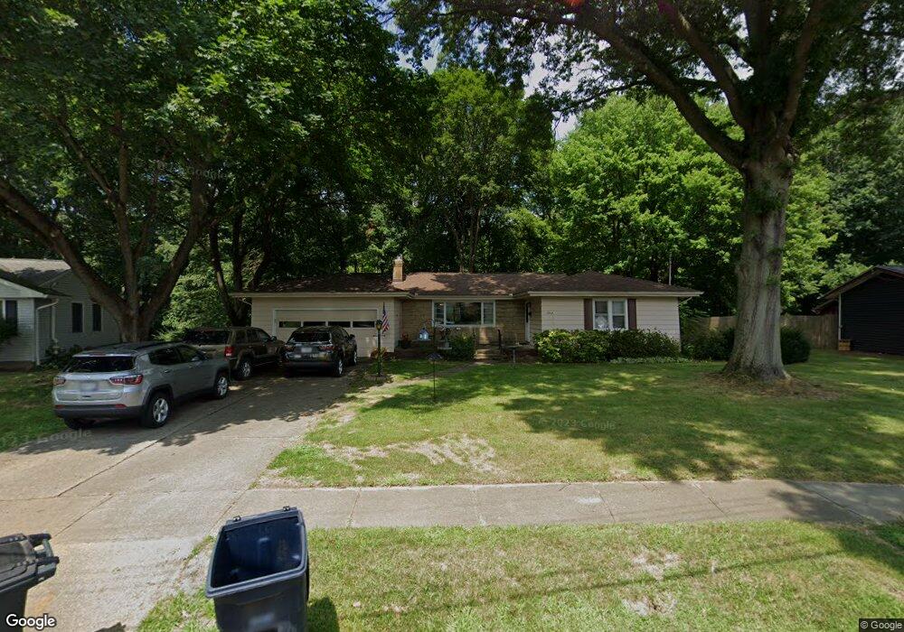
2307 Burnham Rd Fairlawn, OH 44333
Estimated Value: $145,000 - $263,214
3
Beds
1
Bath
1,532
Sq Ft
$139/Sq Ft
Est. Value
About This Home
This home is located at 2307 Burnham Rd, Fairlawn, OH 44333 and is currently estimated at $213,304, approximately $139 per square foot. 2307 Burnham Rd is a home located in Summit County with nearby schools including Fairlawn Lutheran School, Our Lady Of The Elms Elementary School, and St. Hilary Elementary School.
Ownership History
Date
Name
Owned For
Owner Type
Purchase Details
Closed on
Dec 11, 2025
Sold by
Zink Ruth Sharon
Bought by
Hoar Terry E
Current Estimated Value
Home Financials for this Owner
Home Financials are based on the most recent Mortgage that was taken out on this home.
Original Mortgage
$148,934
Outstanding Balance
$148,934
Interest Rate
6.22%
Mortgage Type
VA
Estimated Equity
$64,370
Purchase Details
Closed on
Jun 20, 1995
Sold by
Linden Archie F
Bought by
Zink Ruth S
Create a Home Valuation Report for This Property
The Home Valuation Report is an in-depth analysis detailing your home's value as well as a comparison with similar homes in the area
Home Values in the Area
Average Home Value in this Area
Purchase History
| Date | Buyer | Sale Price | Title Company |
|---|---|---|---|
| Hoar Terry E | $145,800 | American Title Solutions | |
| Zink Ruth S | $107,000 | -- |
Source: Public Records
Mortgage History
| Date | Status | Borrower | Loan Amount |
|---|---|---|---|
| Open | Hoar Terry E | $148,934 |
Source: Public Records
Tax History
| Year | Tax Paid | Tax Assessment Tax Assessment Total Assessment is a certain percentage of the fair market value that is determined by local assessors to be the total taxable value of land and additions on the property. | Land | Improvement |
|---|---|---|---|---|
| 2025 | $4,324 | $76,986 | $15,589 | $61,397 |
| 2024 | $3,621 | $76,986 | $15,589 | $61,397 |
| 2023 | $3,621 | $76,986 | $15,589 | $61,397 |
| 2022 | $2,944 | $51,668 | $10,462 | $41,206 |
| 2021 | $2,947 | $51,668 | $10,462 | $41,206 |
| 2020 | $2,903 | $51,670 | $10,460 | $41,210 |
| 2019 | $2,779 | $45,980 | $10,460 | $35,520 |
| 2018 | $2,742 | $45,980 | $10,460 | $35,520 |
| 2017 | $2,785 | $45,980 | $10,460 | $35,520 |
| 2016 | $2,787 | $45,980 | $10,460 | $35,520 |
| 2015 | $2,785 | $45,980 | $10,460 | $35,520 |
| 2014 | $2,763 | $45,980 | $10,460 | $35,520 |
| 2013 | $2,625 | $44,790 | $10,460 | $34,330 |
Source: Public Records
Map
Nearby Homes
- 2239 Woodpark Rd
- 441 Sandhurst Rd
- 2547 Sand Run Pkwy
- 286 Sand Run Rd
- 2592 Falmouth Rd
- 131 N Wheaton Rd
- 898 Willow Creek Dr
- 2682 Smith Rd
- 762 Hunters Trail Unit 105
- 998 Hampton Ridge Dr
- 215 Grayling Dr
- 970 Hampton Ridge Dr Unit 6D
- 858 Sutton Place Unit 64
- 2330 Thurmont Rd
- 2445 Chatham Rd
- 48 S Wheaton Rd
- 568 Hampshire Rd
- 1061 Wycliff Ln
- 135 Southwood Rd
- 148 Rentham Rd
- 2315 Burnham Rd
- 2299 Burnham Rd
- 2314 Burnham Rd
- 400 Mowbray Rd
- 2300 Burnham Rd
- 2327 Burnham Rd
- 405 Sandhurst Rd
- 412 Mowbray Rd
- 2326 Burnham Rd
- 376 Mowbray Rd
- 369 Sandhurst Rd
- 389 Mowbray Rd
- 379 Mowbray Rd
- 399 Mowbray Rd
- 409 Mowbray Rd
- 410 Sandhurst Rd
- 378 Sandhurst Rd
- 428 Mowbray Rd
- 419 Mowbray Rd
- 2359 Burnham Rd
Your Personal Tour Guide
Ask me questions while you tour the home.