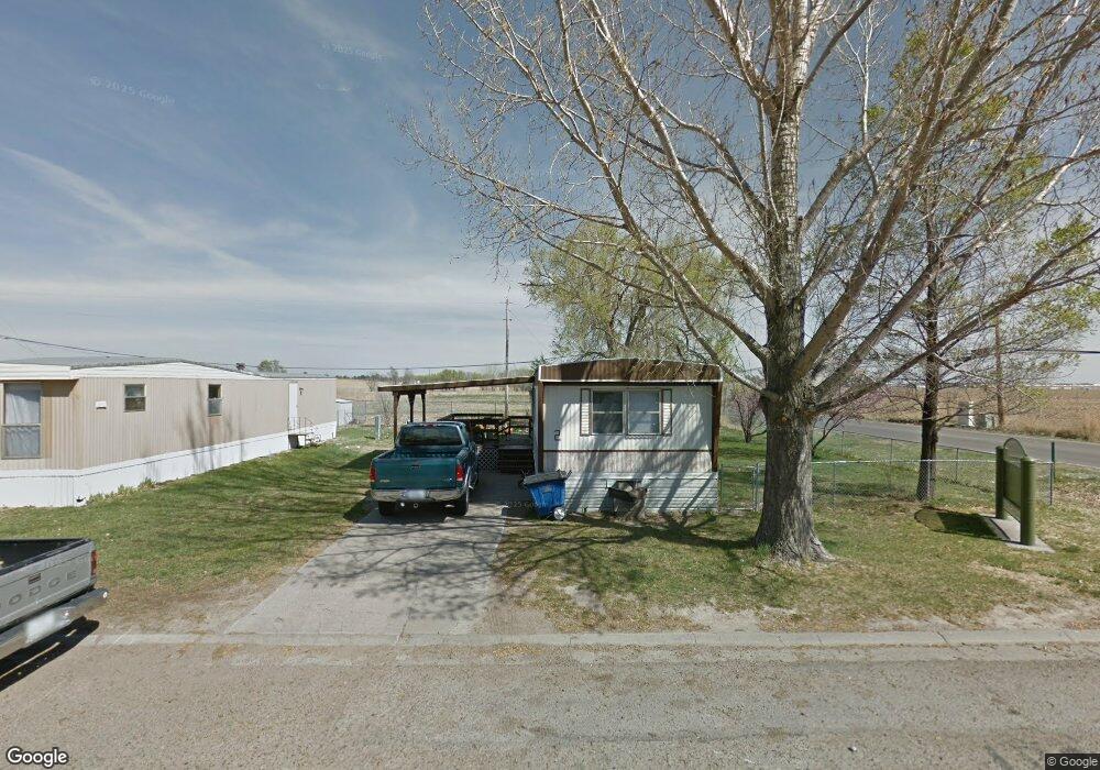
2307 W 42nd St Unit 13 Northside MH Par Scottsbluff, NE 69361
Estimated Value: $261,000 - $770,204
--
Bed
2
Baths
192
Sq Ft
$2,391/Sq Ft
Est. Value
About This Home
This home is located at 2307 W 42nd St Unit 13 Northside MH Par, Scottsbluff, NE 69361 and is currently estimated at $459,068, approximately $2,390 per square foot. 2307 W 42nd St Unit 13 Northside MH Par is a home located in Scotts Bluff County with nearby schools including Lincoln Heights Elementary School, Bluffs Middle School, and Scottsbluff Senior High School.
Ownership History
Date
Name
Owned For
Owner Type
Purchase Details
Closed on
May 18, 2005
Sold by
Lesh Carrie C and Segelke Carrie C
Bought by
Albertz Gerald W and Albertz Susan J
Current Estimated Value
Home Financials for this Owner
Home Financials are based on the most recent Mortgage that was taken out on this home.
Original Mortgage
$62,300
Interest Rate
5.92%
Mortgage Type
Future Advance Clause Open End Mortgage
Create a Home Valuation Report for This Property
The Home Valuation Report is an in-depth analysis detailing your home's value as well as a comparison with similar homes in the area
Home Values in the Area
Average Home Value in this Area
Purchase History
| Date | Buyer | Sale Price | Title Company |
|---|---|---|---|
| Albertz Gerald W | $63,000 | -- |
Source: Public Records
Mortgage History
| Date | Status | Borrower | Loan Amount |
|---|---|---|---|
| Closed | Albertz Gerald W | $62,300 |
Source: Public Records
Tax History Compared to Growth
Tax History
| Year | Tax Paid | Tax Assessment Tax Assessment Total Assessment is a certain percentage of the fair market value that is determined by local assessors to be the total taxable value of land and additions on the property. | Land | Improvement |
|---|---|---|---|---|
| 2025 | $9,204 | $862,985 | $396,930 | $466,055 |
| 2024 | $9,432 | $862,985 | $396,930 | $466,055 |
| 2023 | $14,776 | $799,064 | $367,529 | $431,535 |
| 2022 | $14,776 | $799,064 | $367,529 | $431,535 |
| 2021 | $15,018 | $799,064 | $367,529 | $431,535 |
| 2020 | $15,118 | $799,064 | $367,529 | $431,535 |
| 2019 | $13,665 | $723,321 | $291,786 | $431,535 |
| 2018 | $13,695 | $720,096 | $291,786 | $428,310 |
| 2017 | $13,747 | $720,096 | $291,786 | $428,310 |
| 2016 | $6,030 | $315,497 | $50,603 | $264,894 |
| 2015 | $5,981 | $315,497 | $50,603 | $264,894 |
| 2014 | $5,558 | $315,497 | $50,603 | $264,894 |
| 2012 | -- | $315,497 | $50,603 | $264,894 |
Source: Public Records
Map
Nearby Homes
- 4301 Shady Ln
- 4318 Shady Ln
- 2517 Country Ln
- 2317 Kingsgate Rd
- 2817 W 42nd St
- 1126 Peacock Dr
- 597 Sagebrush Dr
- TBD W 36th St
- 0 W 36th St Unit 20254154
- 501 W 38th St
- 1010 W 29th St
- 1011 W 27th St
- 10 Stoney Creek Dr
- 409 Sandra Ct
- 3021 Avenue E
- 2809 Avenue D
- 3415 Ross Ave
- Lot 1 31st St
- Lot 2 31st St
- TBD U S Highway 26
- 2307 W 42nd St Unit 49
- 2307 W 42nd St Unit 2307 W. 42ND 13
- 2307 W 42nd St Unit 2307 W. 42ND ST.
- 2307 W 42nd St Unit 51
- 2307 W 42nd St Unit 2307 W. 42ND ST., 1
- 2307 W 42nd St Unit 14
- 2307 W 42nd St Unit 2307 W. 42nd Street
- 4401 Pleasant Dr
- 4325 Pleasant Dr
- 4409 Pleasant Dr
- 4402 Pleasant Dr
- 4417 Pleasant Dr
- 4318 Pleasant Dr
- 4309 Pleasant Dr
- 4310 Pleasant Dr
- 4425 Pleasant Dr
- 4301 Pleasant Dr
- 2402 Country Ln
- 4401 Shady Ln
- 4302 Pleasant Dr