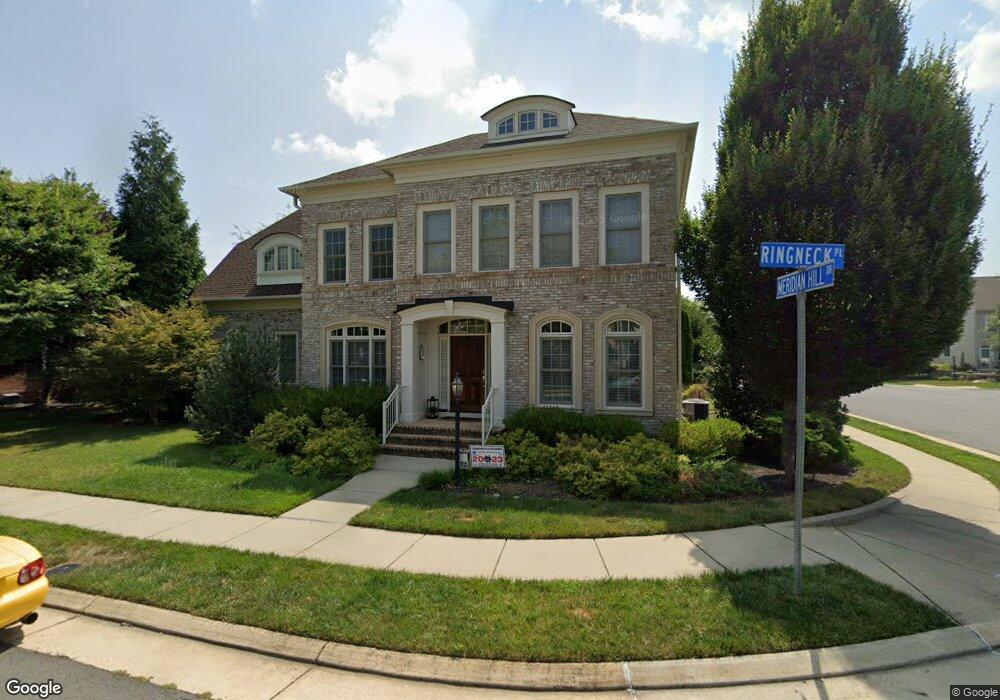
23071 Bronstein Ln Ashburn, VA 20148
Estimated Value: $1,108,000 - $1,334,000
4
Beds
6
Baths
3,676
Sq Ft
$334/Sq Ft
Est. Value
About This Home
This home is located at 23071 Bronstein Ln, Ashburn, VA 20148 and is currently estimated at $1,227,567, approximately $333 per square foot. 23071 Bronstein Ln is a home located in Loudoun County with nearby schools including Legacy Elementary School, Brambleton Middle School, and Independence High School.
Ownership History
Date
Name
Owned For
Owner Type
Purchase Details
Closed on
Jan 13, 2021
Sold by
Ferguson Paul Michael and Ferguson Son Ae
Bought by
Ferguson Paul Michael and Ferguson Son Ae
Current Estimated Value
Purchase Details
Closed on
Feb 10, 2010
Sold by
Gulick Group Inc
Bought by
Ferguson Paul Michael
Home Financials for this Owner
Home Financials are based on the most recent Mortgage that was taken out on this home.
Original Mortgage
$724,053
Outstanding Balance
$482,545
Interest Rate
5.17%
Mortgage Type
VA
Estimated Equity
$745,022
Create a Home Valuation Report for This Property
The Home Valuation Report is an in-depth analysis detailing your home's value as well as a comparison with similar homes in the area
Home Values in the Area
Average Home Value in this Area
Purchase History
| Date | Buyer | Sale Price | Title Company |
|---|---|---|---|
| Ferguson Paul Michael | -- | None Available | |
| Ferguson Paul Michael | $708,814 | -- |
Source: Public Records
Mortgage History
| Date | Status | Borrower | Loan Amount |
|---|---|---|---|
| Open | Ferguson Paul Michael | $724,053 |
Source: Public Records
Tax History
| Year | Tax Paid | Tax Assessment Tax Assessment Total Assessment is a certain percentage of the fair market value that is determined by local assessors to be the total taxable value of land and additions on the property. | Land | Improvement |
|---|---|---|---|---|
| 2025 | $9,717 | $1,207,100 | $335,000 | $872,100 |
| 2024 | $10,187 | $1,177,680 | $310,000 | $867,680 |
| 2023 | $9,956 | $1,137,800 | $310,000 | $827,800 |
| 2022 | $8,724 | $980,250 | $270,000 | $710,250 |
| 2021 | $8,514 | $868,770 | $245,000 | $623,770 |
| 2020 | $8,694 | $839,990 | $225,000 | $614,990 |
| 2019 | $8,398 | $803,630 | $225,000 | $578,630 |
| 2018 | $8,497 | $783,130 | $200,000 | $583,130 |
| 2017 | $8,689 | $772,340 | $200,000 | $572,340 |
| 2016 | $8,780 | $766,820 | $0 | $0 |
| 2015 | $8,771 | $572,760 | $0 | $572,760 |
| 2014 | $9,251 | $620,970 | $0 | $620,970 |
Source: Public Records
Map
Nearby Homes
- 42594 Good Hope Ln
- 23104 Sullivans Cove Square
- 23043 Sullivans Cove Square
- 22966 Cabral Terrace
- 22879 Courtland Park Dr
- 42496 Legacy Park Dr
- 23049 Cottonwillow Square
- 22876 Ashton Woods Dr
- 42298 Impervious Terrace
- 42466 Regal Wood Dr
- 23132 Brooksbank Square
- 22833 Highcrest Cir
- 23248 Hickox Dr
- 42257 Bliss Terrace
- 23197 Tradewind Dr
- 22773 Highcrest Cir
- 42637 Willow Bend Dr
- 42315 Spring Dew Dr
- 22555 Blue Elder Terrace
- 42517 Sandwort Terrace
- 23067 Bronstein Ln
- 42536 Ringneck Place
- 42522 Meridian Hill Dr
- 23070 Bronstein Ln
- 23063 Bronstein Ln
- 23066 Bronstein Ln
- 42540 Ringneck Place
- 42518 Meridian Hill Dr
- 23078 Bronstein Ln
- 42523 Meridian Hill Dr
- 23062 Bronstein Ln
- 42517 Ringneck Place
- 42544 Ringneck Place
- 42514 Meridian Hill Dr
- 23082 Bronstein Ln
- 42515 Meridian Hill Dr
- 23059 Bronstein Ln Unit 1654
- 23059 Bronstein Ln
- 42513 Ringneck Place
- 23058 Bronstein Ln
Your Personal Tour Guide
Ask me questions while you tour the home.