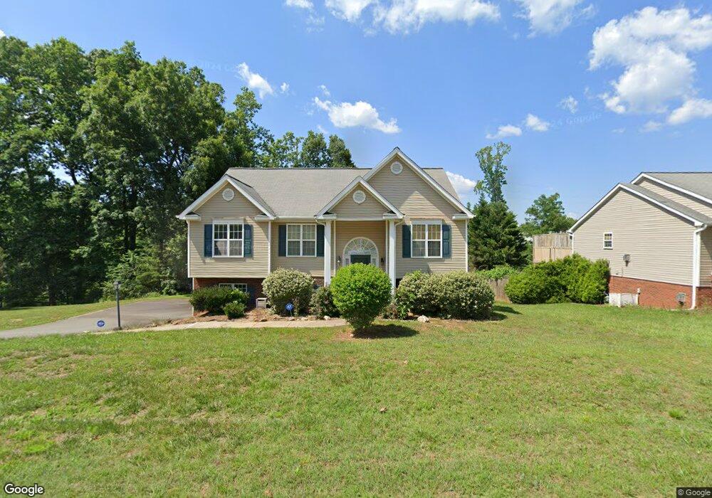
2309 Robbins Perch West Ct Kernersville, NC 27284
Woodbridge NeighborhoodEstimated Value: $276,945 - $323,000
3
Beds
2
Baths
1,404
Sq Ft
$214/Sq Ft
Est. Value
About This Home
This home is located at 2309 Robbins Perch West Ct, Kernersville, NC 27284 and is currently estimated at $300,486, approximately $214 per square foot. 2309 Robbins Perch West Ct is a home located in Forsyth County with nearby schools including Cash Elementary, East Forsyth Middle, and East Forsyth High School.
Ownership History
Date
Name
Owned For
Owner Type
Purchase Details
Closed on
Jan 30, 2008
Sold by
Milch Brian M and Milch Melissa
Bought by
Patrick Regan S and Patrick Theresa
Current Estimated Value
Home Financials for this Owner
Home Financials are based on the most recent Mortgage that was taken out on this home.
Original Mortgage
$128,500
Outstanding Balance
$80,943
Interest Rate
6.12%
Mortgage Type
Purchase Money Mortgage
Estimated Equity
$219,543
Purchase Details
Closed on
May 4, 2006
Sold by
Shugart Enterprises Llc
Bought by
Milch Brian Michael
Home Financials for this Owner
Home Financials are based on the most recent Mortgage that was taken out on this home.
Original Mortgage
$164,124
Interest Rate
6.39%
Mortgage Type
FHA
Create a Home Valuation Report for This Property
The Home Valuation Report is an in-depth analysis detailing your home's value as well as a comparison with similar homes in the area
Home Values in the Area
Average Home Value in this Area
Purchase History
| Date | Buyer | Sale Price | Title Company |
|---|---|---|---|
| Patrick Regan S | $173,000 | None Available | |
| Milch Brian Michael | $167,000 | None Available |
Source: Public Records
Mortgage History
| Date | Status | Borrower | Loan Amount |
|---|---|---|---|
| Open | Patrick Regan S | $128,500 | |
| Previous Owner | Milch Brian Michael | $164,124 |
Source: Public Records
Tax History Compared to Growth
Tax History
| Year | Tax Paid | Tax Assessment Tax Assessment Total Assessment is a certain percentage of the fair market value that is determined by local assessors to be the total taxable value of land and additions on the property. | Land | Improvement |
|---|---|---|---|---|
| 2025 | $1,374 | $281,300 | $20,800 | $260,500 |
| 2024 | $1,374 | $175,800 | $20,800 | $155,000 |
| 2023 | $1,374 | $175,800 | $20,800 | $155,000 |
| 2022 | $1,374 | $175,800 | $20,800 | $155,000 |
| 2021 | $1,374 | $175,800 | $20,800 | $155,000 |
| 2020 | $1,289 | $151,500 | $14,700 | $136,800 |
| 2019 | $1,312 | $151,500 | $14,700 | $136,800 |
| 2018 | $1,261 | $151,500 | $14,700 | $136,800 |
| 2016 | $1,160 | $138,694 | $15,667 | $123,027 |
| 2015 | -- | $0 | $0 | $0 |
Source: Public Records
Map
Nearby Homes
- 2378 Robbins Perch Ct W
- 4721 Weston Brooke Trail
- 2389 Robbins Perch Ct W
- 0 Weston Brooke Trail
- 4761 Weston Brooke Trail
- 2171 Castle Stone Ct
- 924 Star Gate Dr
- 765 Robbins Perch Trail
- 2249 Pisgah Church Rd
- Mayfair Plan at Pisgah Park
- Canton Plan at Pisgah Park
- Ellerbe Plan at Pisgah Park
- Raleigh Plan at Pisgah Park
- Drexel Plan at Pisgah Park
- Davidson Plan at Pisgah Park
- Cypress Plan at Pisgah Park
- Fenwick Plan at Pisgah Park
- Avery Plan at Pisgah Park
- 4791 Weston Brooke Trail
- 2231 Pisgah Church Rd
- 2301 Robbins Perch Ct W
- 2301 Robbins Perch West Ct
- 2317 Robbins Perch West Ct
- 798 Afton Park Dr
- 797 Afton Park Dr
- 783 Afton Park Dr
- 776 Afton Park Dr
- 775 Afton Park Dr
- 756 Afton Park Dr
- 767 Afton Park Dr
- 755 Afton Park Dr
- 742 Afton Park Dr
- 743 Afton Park Dr
- 722 Afton Park Dr
- 731 Afton Park Dr
- 770 Robbins Perch Trail
- 723 Afton Park Dr
- 0 Robbins Perch Ct Unit 12 CAR4123995
- 000 Robbins Perch Ct
- 00 Robbins Perch Ct